Home > Digitized Walters Manuscripts
This document is a tranformation of a TEI P5 XML manuscript description incorporating images. If you have trouble reading special or non-Latin characters on this page, please make sure you have appropriate Unicode fonts installed and an up-to-date web browser.
Walters Ms. W.658, Book on navigation
Browse images (Browse images in a new window) | TEI in XML format
W.658
Book on navigation
Vernacular: كتاب بحريه
Authority name: Pirî Reis, d. 1554?
As-written name: Pīrī Reʾīs bin Ḥājī Muḥammed
Name, in vernacular: پيري رئيس بن حاجي محمد
Note: Author's name given on fol. 376b as Raʾīs al-Baḥr Pīrī ibn Muḥammad; author dates preferred by cataloger: d. 962 AH / 1555 CE
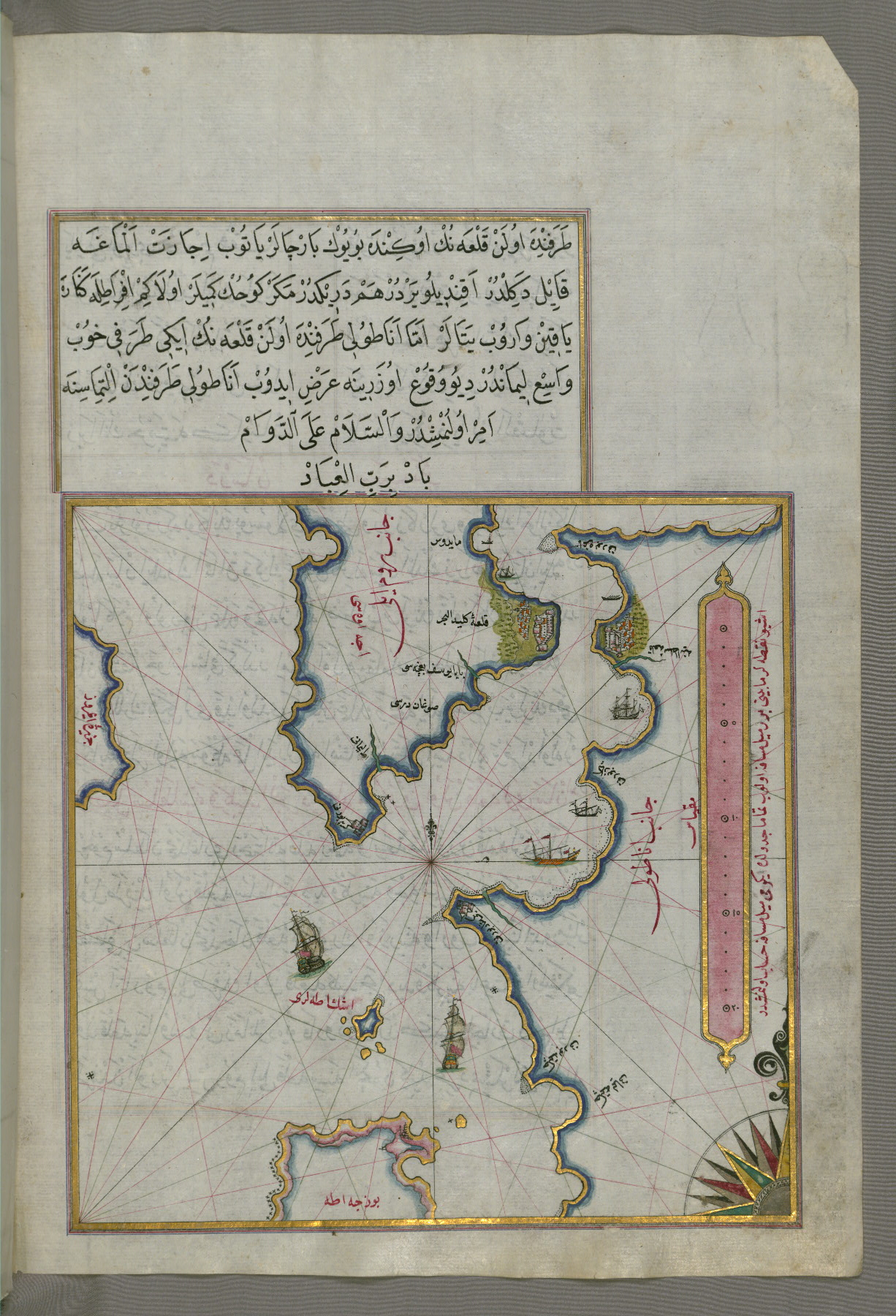
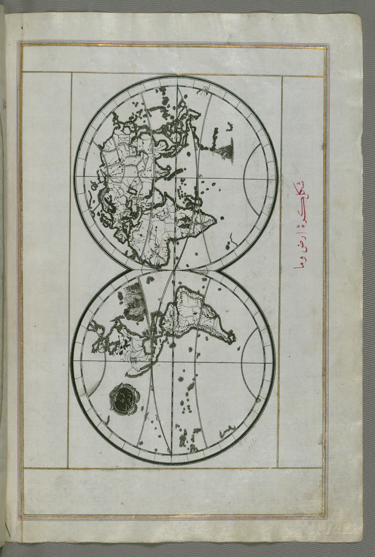
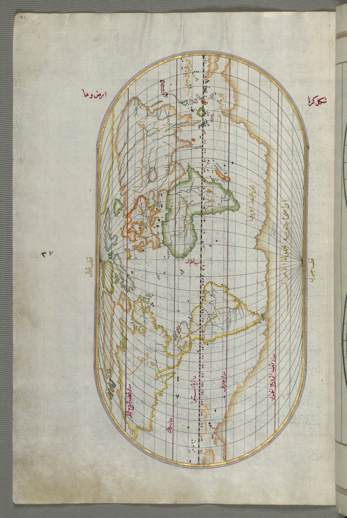
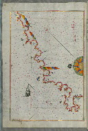
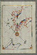
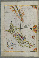
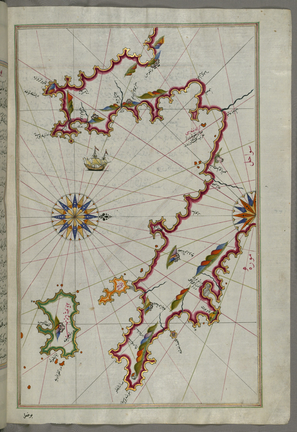
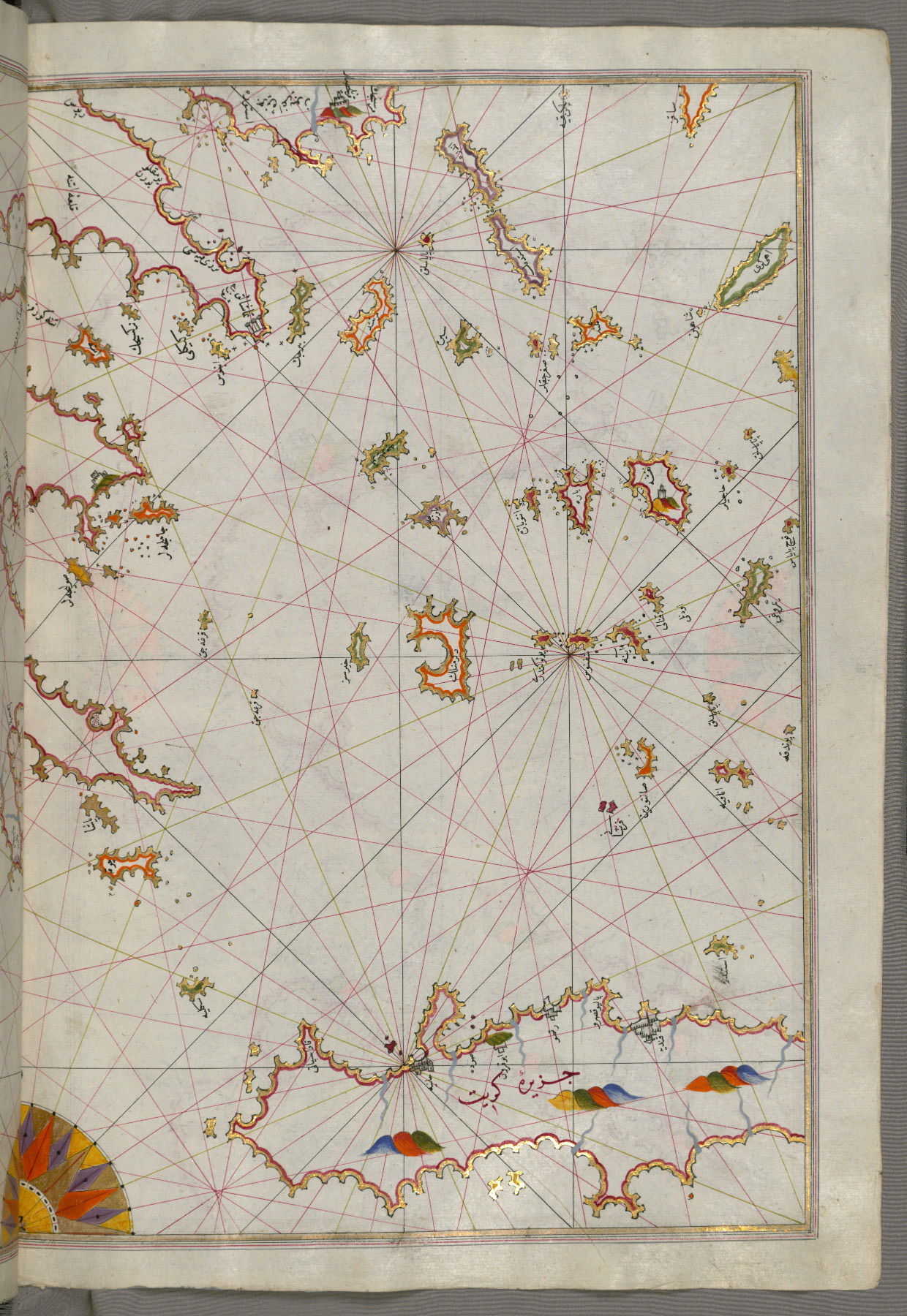
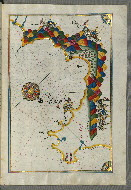
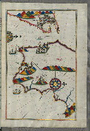
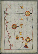
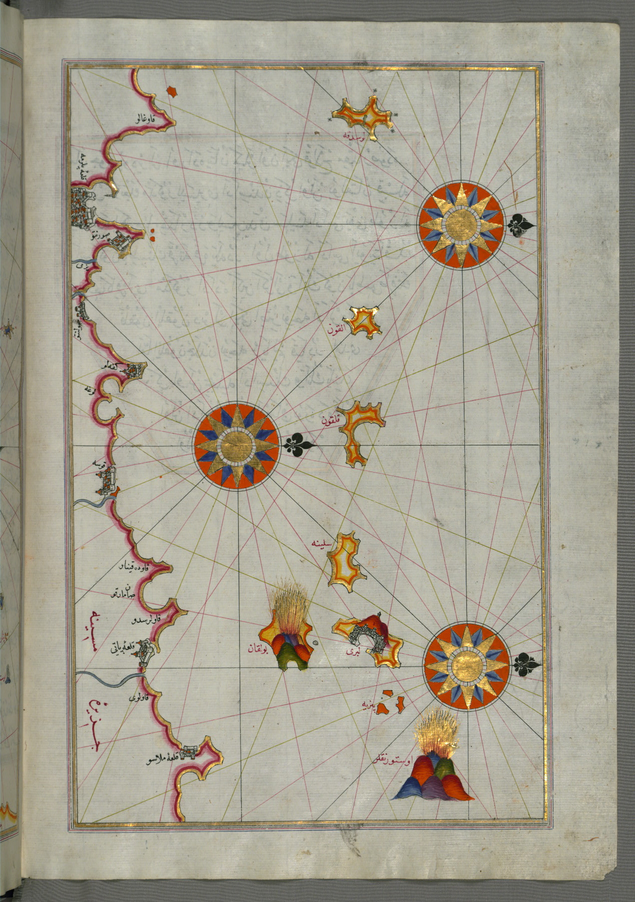
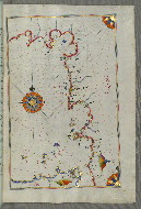
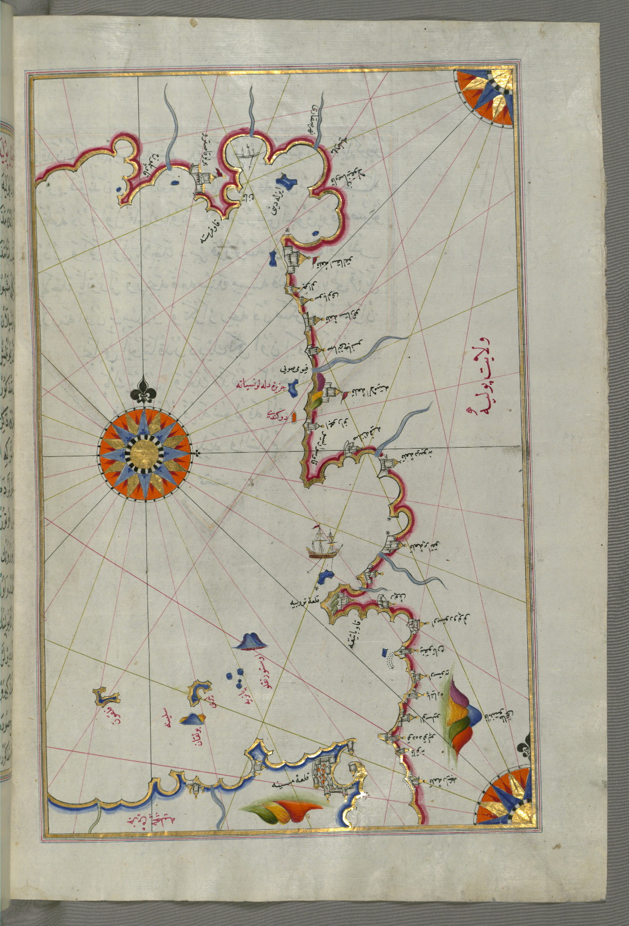
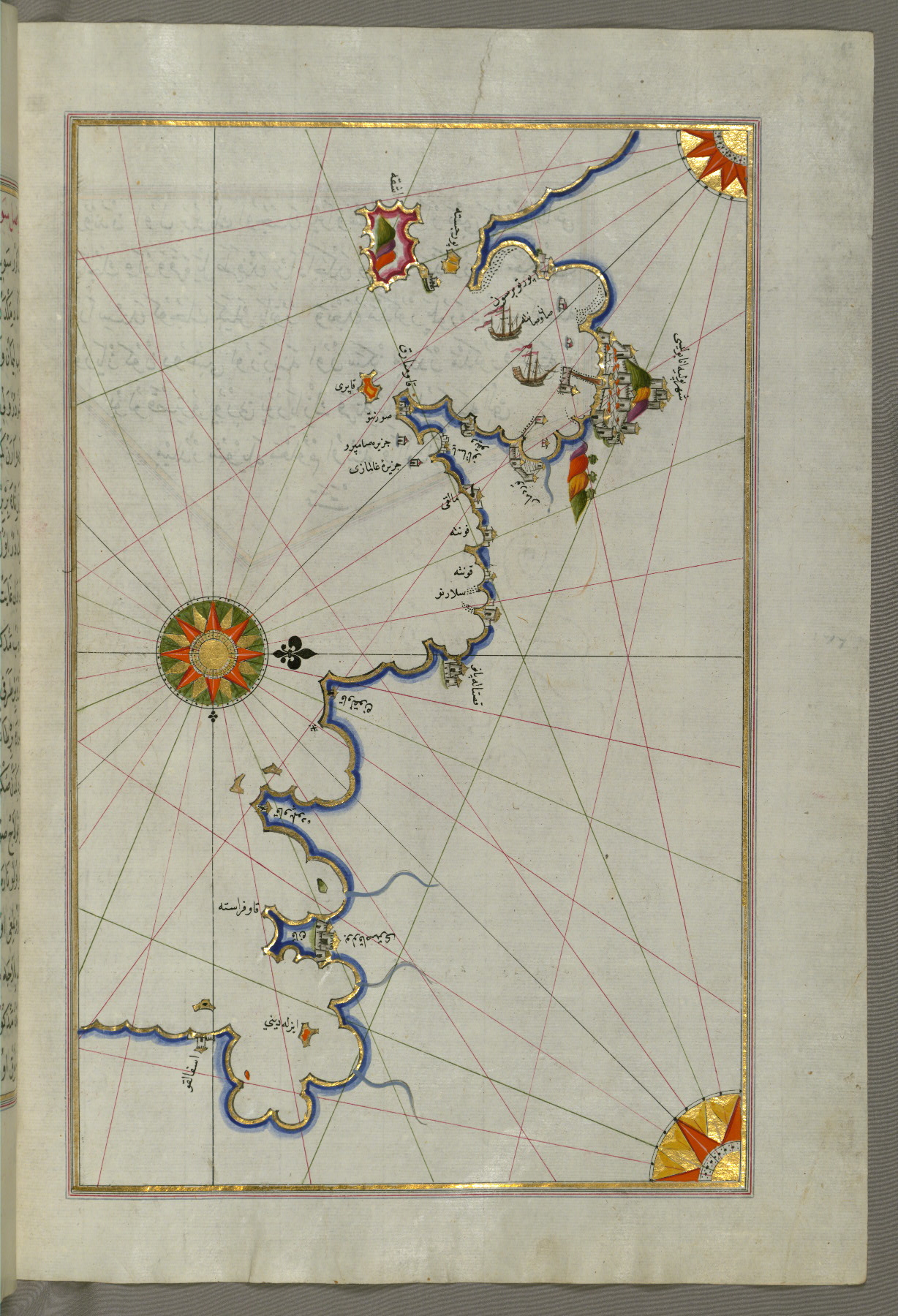
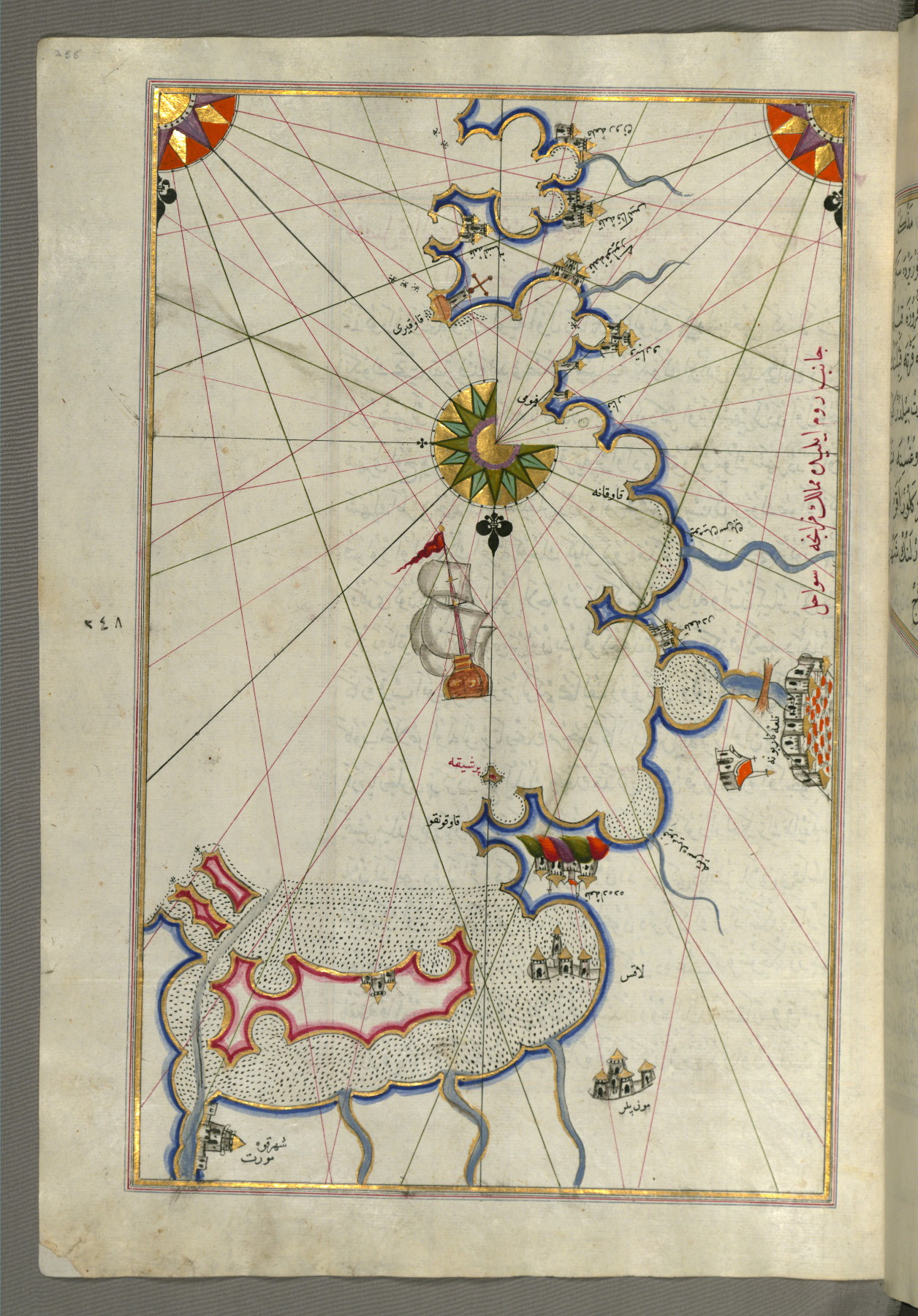
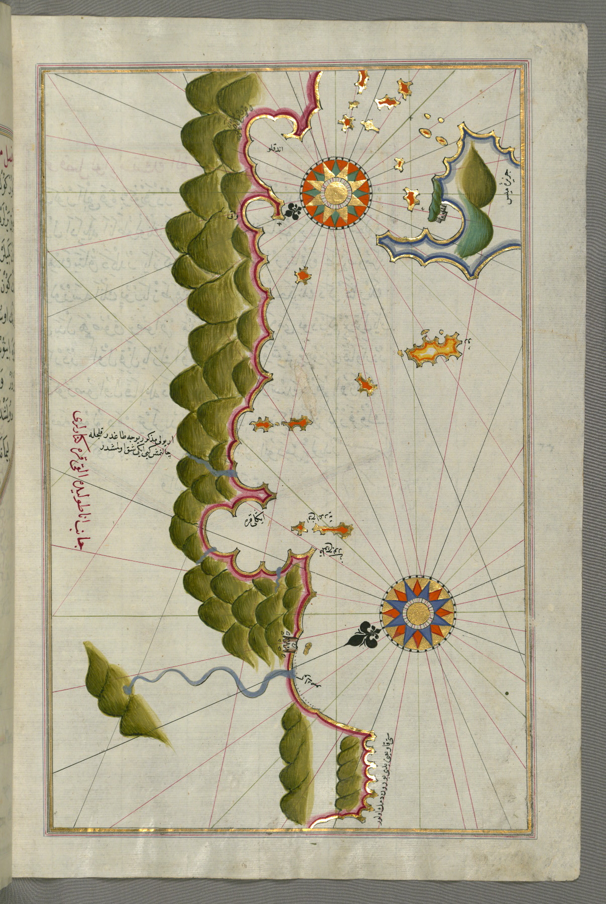
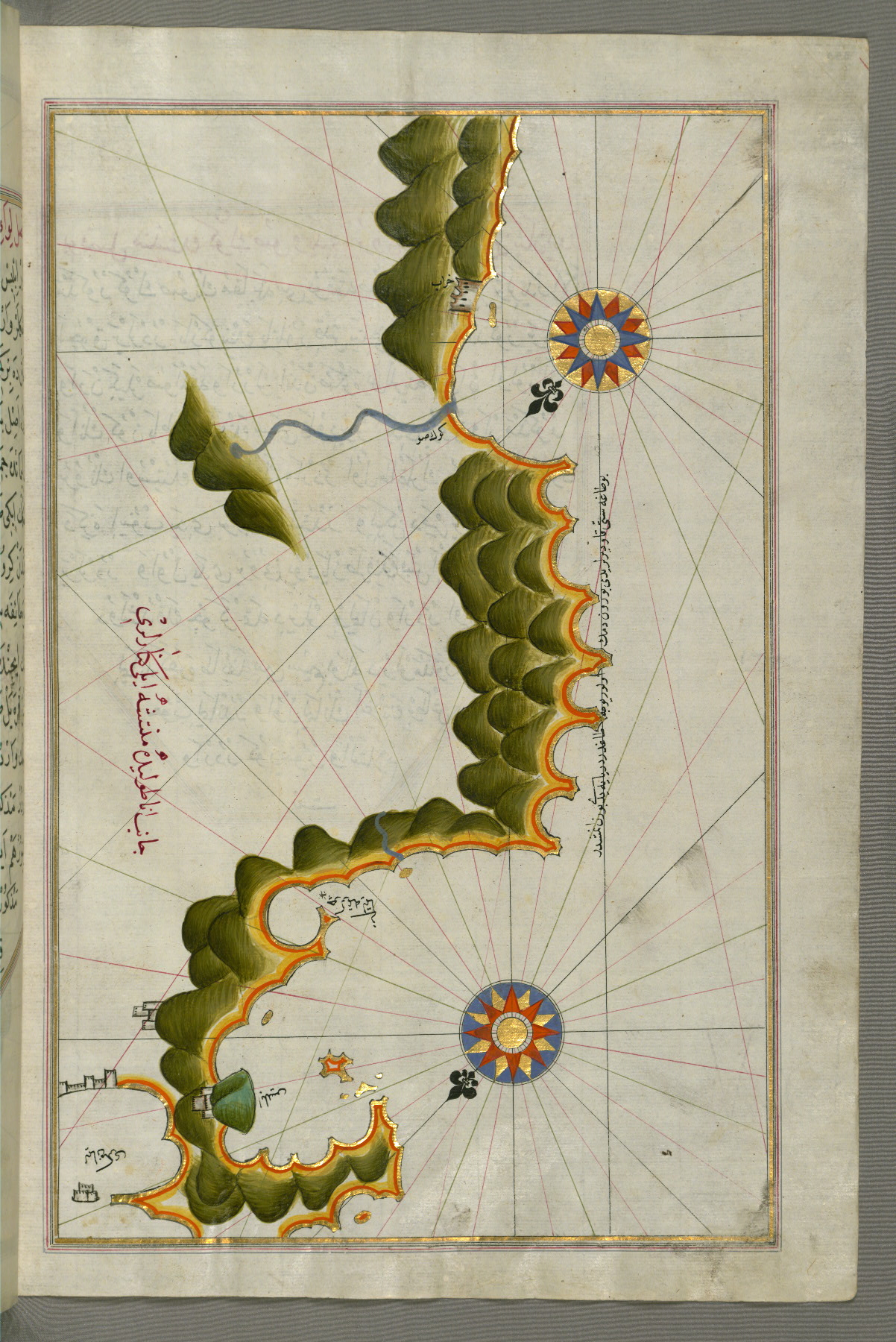
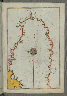
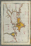
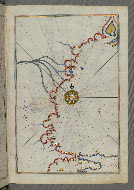
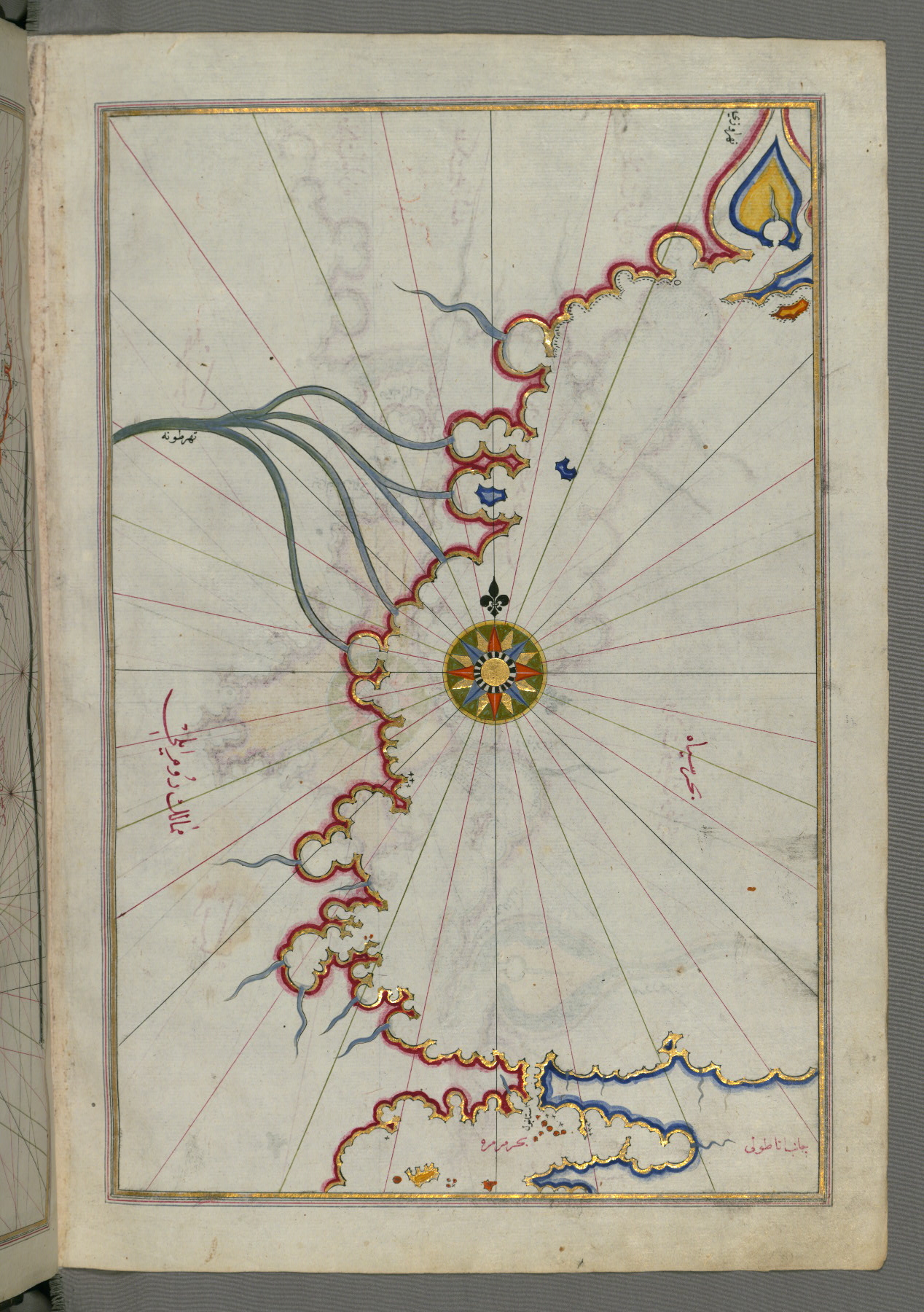
Originally composed in 932 AH / 1525 CE and dedicated to Sultan Süleyman I (the Magnificent), this great work by Piri Reis (d. 962 AH / 1555 CE) on navigation was later revised and expanded. The present manuscript, made mostly in the late eleventh century AH / seventeenth CE, is based on the later expanded version and has some 240 exquisitely executed maps and portolan charts. They include a world map with the outline of the Americas (fol. 41a) and maps of coastlines (bays, capes, peninsulas); islands; mountains; and cities of the Mediterranean basin and the Black Sea. The work starts with a description of the coastline of Anatolia and the islands of the Aegean Sea, the Peloponnese peninsula, and the eastern and western coasts of the Adriatic Sea. It then proceeds to describe the western shores of Italy, southern France, Spain, North Africa, Palestine, Israel, Lebanon, Syria, western Anatolia, various islands north of Crete, the Sea of Marmara, the Bosporus, and the Black Sea. It ends with a map of the shores of the Caspian Sea (fol. 374a).
Late 11th century AH / 17th CE -- early 12th century AH / 18th CE
Turkey
Book
Scientific
The primary language in this manuscript is Turkish, Ottoman (1500-1928).
Paper
European laid paper, watermarked with lion courrant C (fol. 375) and trefoil with the letters P A (fol. 5)
Foliation: ii+378+ii
Original foliation of 361 folios, inscribed in the middle on the left side of the frame, shaved on the final few folios; marbled paper used for the first set of mounted flyleaves; contains a number of blank folios (fols. 24a, 31a, 31b, 40a, 370bisa-b, 373b, 374b, and 375a-b), most likely intended for charts
Catchwords: Written obliquely outside the frame on versos
24.0 cm wide by 34.0 cm high
13.5 cm wide by 23.5 cm high
- Columns: 1
- Ruled lines: 19
- Prose text arranged in one column, verses in two columns
- Title: Kitāb-i baḥriye
- Author: Pirî Reis, d. 1554?
- Incipit: حمد بى حد وثناێ بى عد اول ستار العيوب وغفار الذنوب ...
- Text note: Main text preceded by a table of contents (fihrist) (fols. 1b-3b)
- Hand note: Written in clear, vocalized naskh script, mostly in black, with rubricated chapter headings
- Decoration note: Two hundred thirty-nine color maps and charts; illuminated headpiece; frame decorated in gold and colors
fol. 4b:
- Title: Incipit page with illuminated headpiece
- Form: Incipit; headpiece

fol. 23b:
- Title: Oval map of the world with the Pacific Ocean in the center
- Form: Illustration

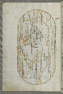
fol. 24b:
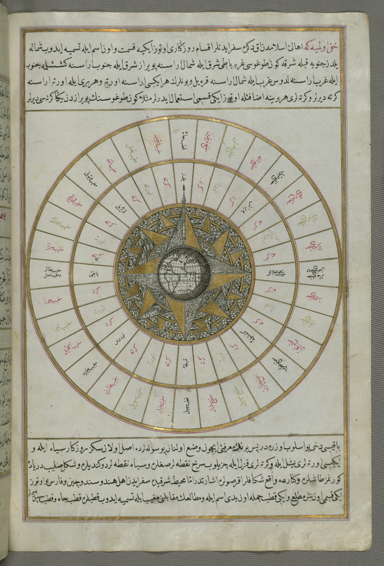
- Title: Western hemisphere within a wind rose with the Atlantic Ocean in the center
- Form: Illustration
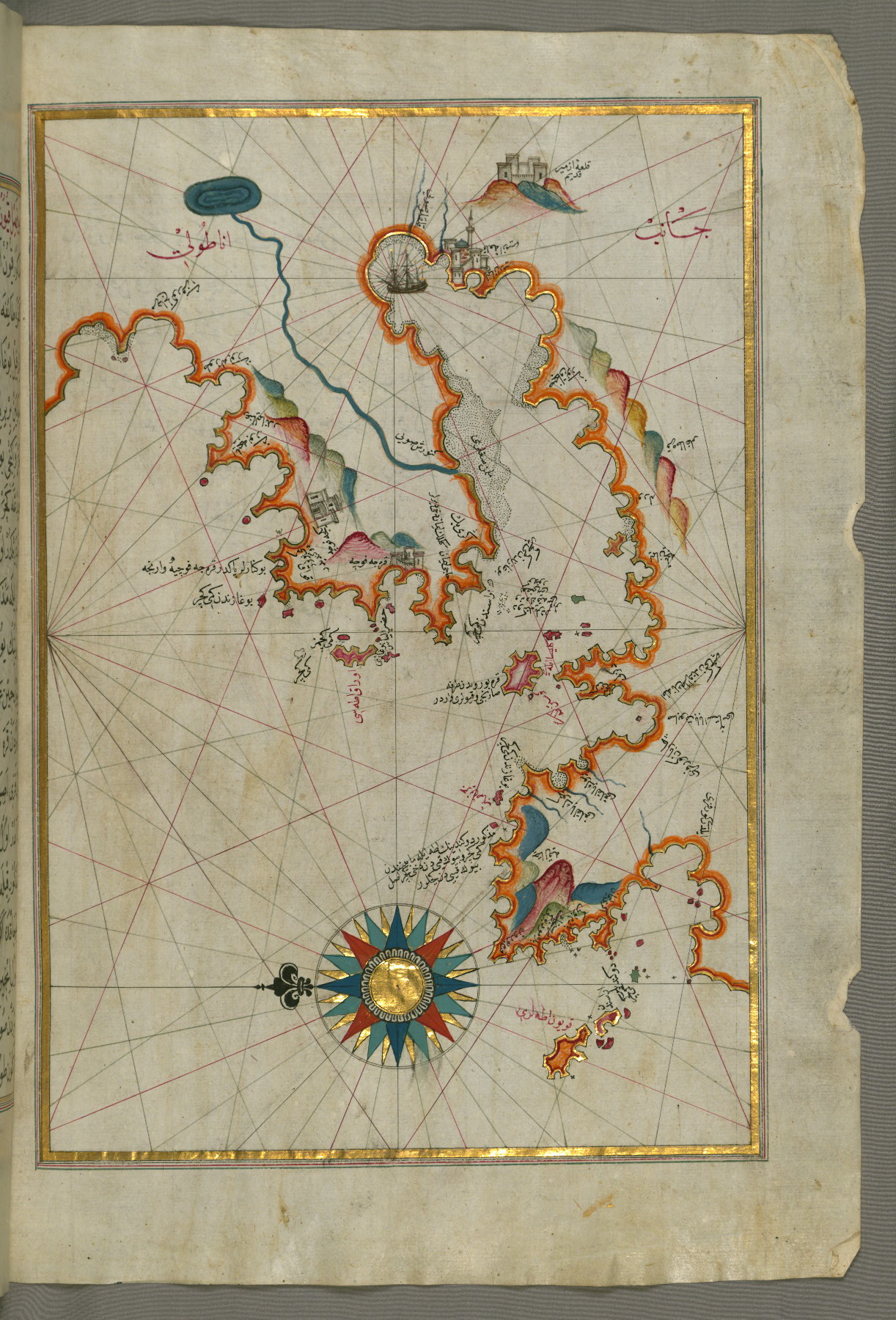
fol. 39b:
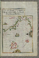
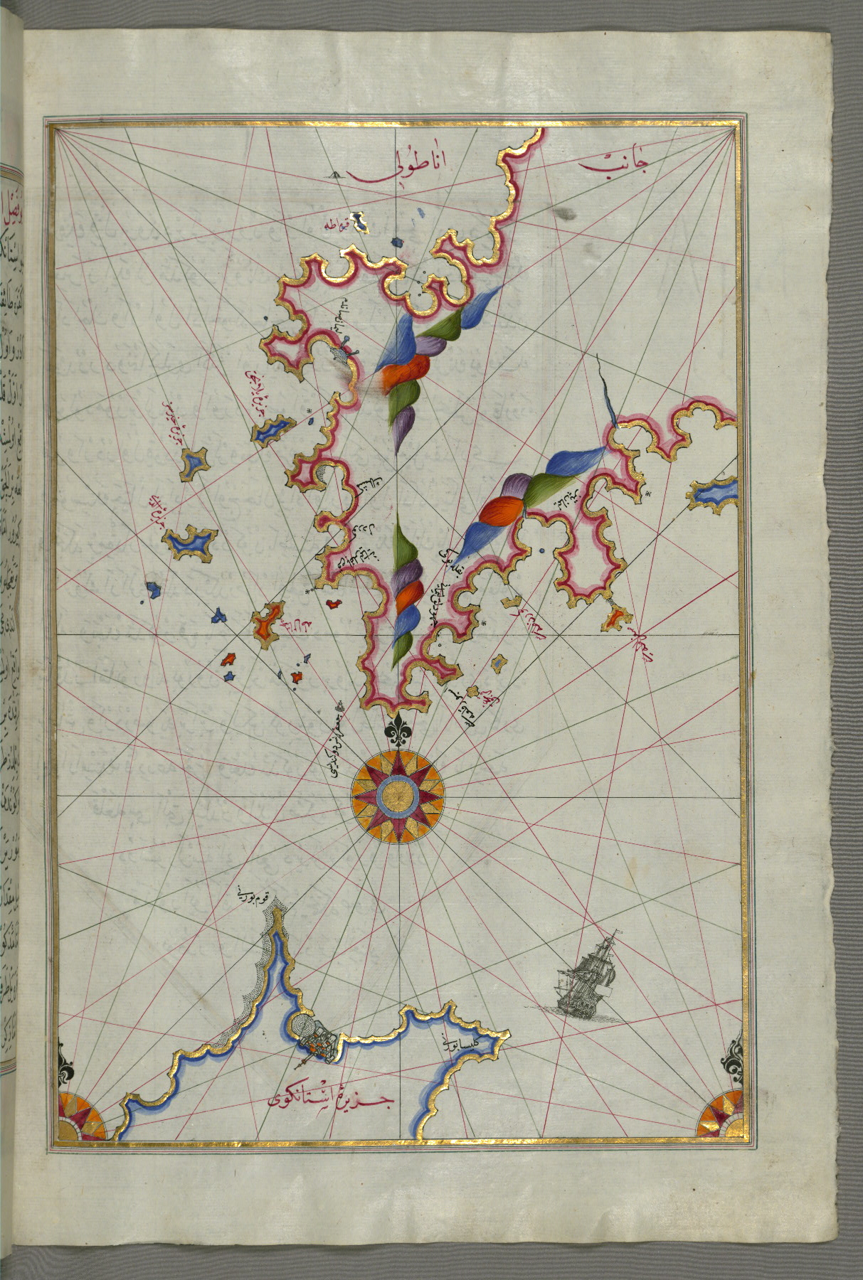
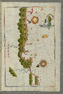
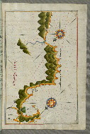
- Title: Upper Aegean Sea with the islands of Imbros and Bozca
- Form: Illustration
- Label: This map shows the upper Aegean Sea with the islands of Imbros (Imroz, Gökçeada) and Bozca (Tenedos).
fol. 40b:
- Title: World map in a double hemisphere
- Form: Illustration
fol. 41a:
- Title: Oval world map with the Atlantic Ocean in the center
- Form: Illustration
fol. 43a:
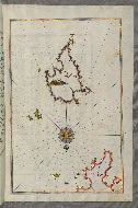
- Title: Island of Bozjah off the coast of Anatolia
- Form: Illustration
- Label: This map shows the island of Bozjah (Tenedos) off the coast of Anatolia.
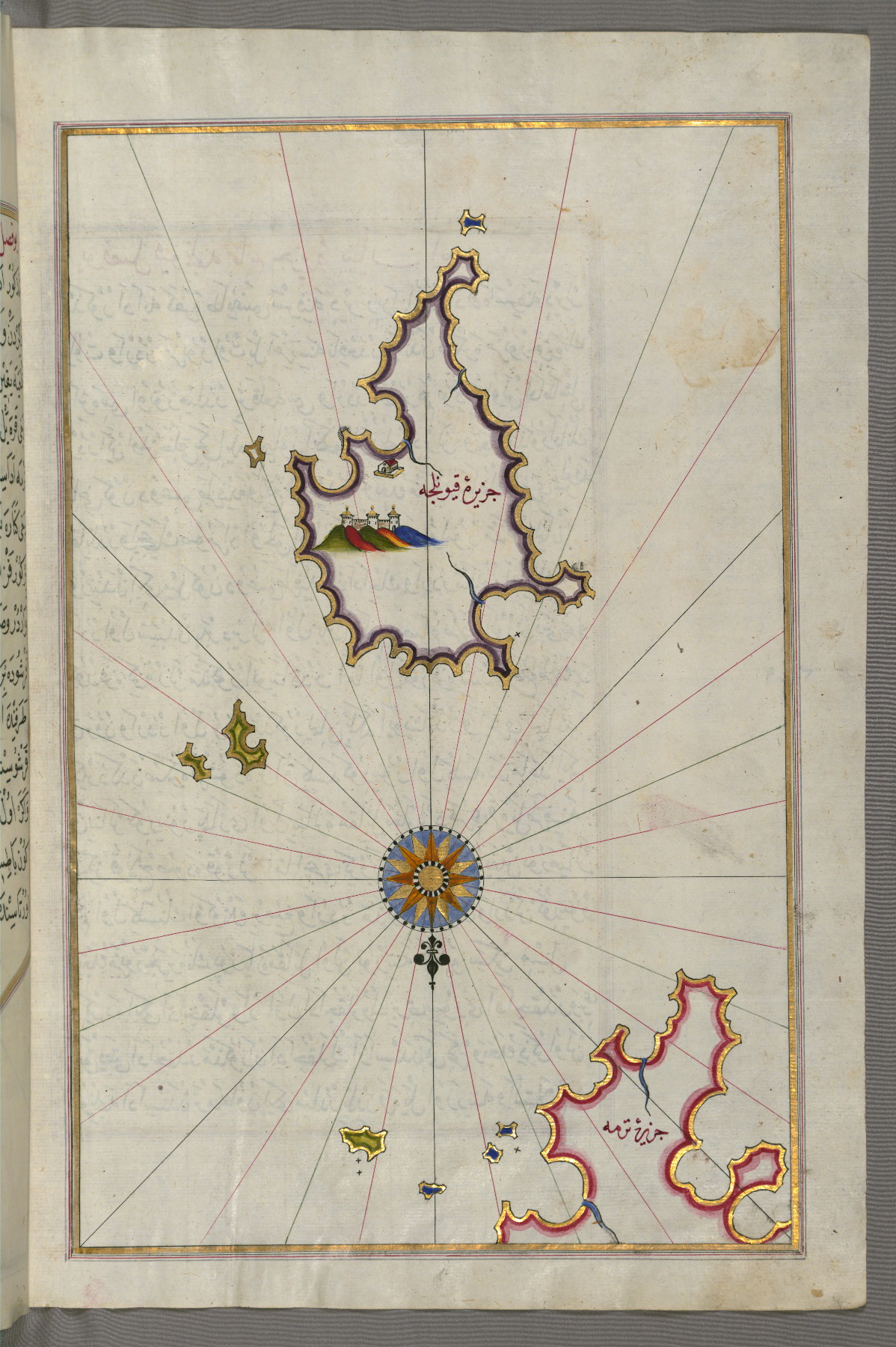
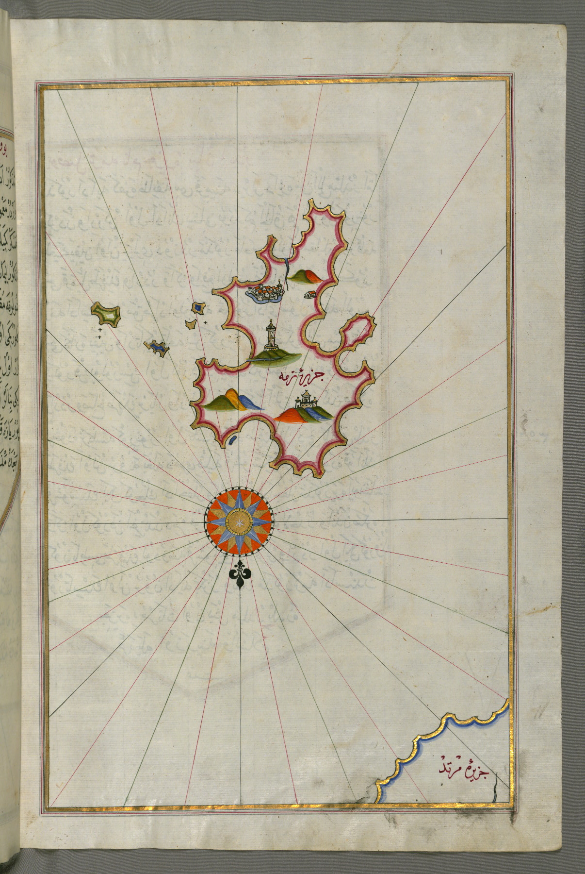
fol. 44b:
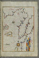
- Title: Islands of Semendrek and Imroz in the Aegean Sea
- Form: Illustration
- Label: This map shows the islands of Semendrek (Samothraki) and Imroz (Imbros) in the Aegean Sea.
fol. 45b:
- Title: Part of the European coastline with the islands of Semendrek and Imroz in the Aegean Sea further south
- Form: Illustration
- Label: This map shows part of the European coastline with the islands of Semendrek (Samothraki) and Imroz (Imbros, Gökçeada) in the Aegean Sea further south.

fol. 47a:
- Title: Island of Lemnos, southwest of Imbroz in the Aegean Sea
- Form: Illustration
- Label: This map shows the island of Lemnos (Limnos, Limni, Īlmelī), southwest of Imbroz in the Aegean Sea.

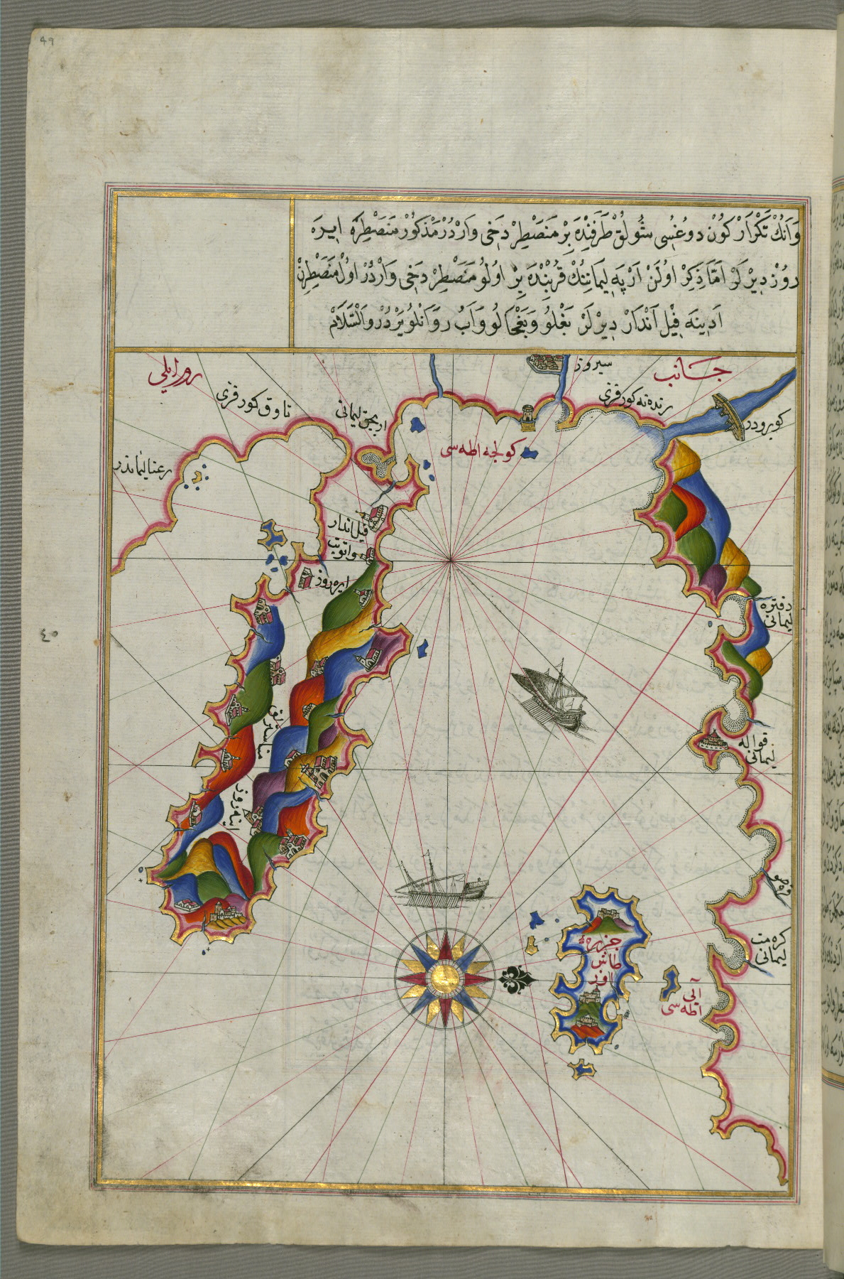
fol. 49a:
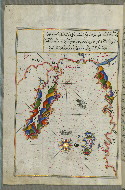
- Title: Area west of the island of Thasos and the Ayion Oros peninsula
- Form: Illustration
- Label: This map shows the area west of the island of Thasos (Taşöz) and the Ayion Oros peninsula.
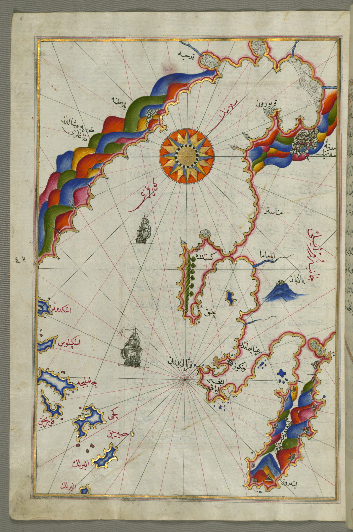
fol. 51a:
- Title: Bay of Salonica
- Form: Illustration
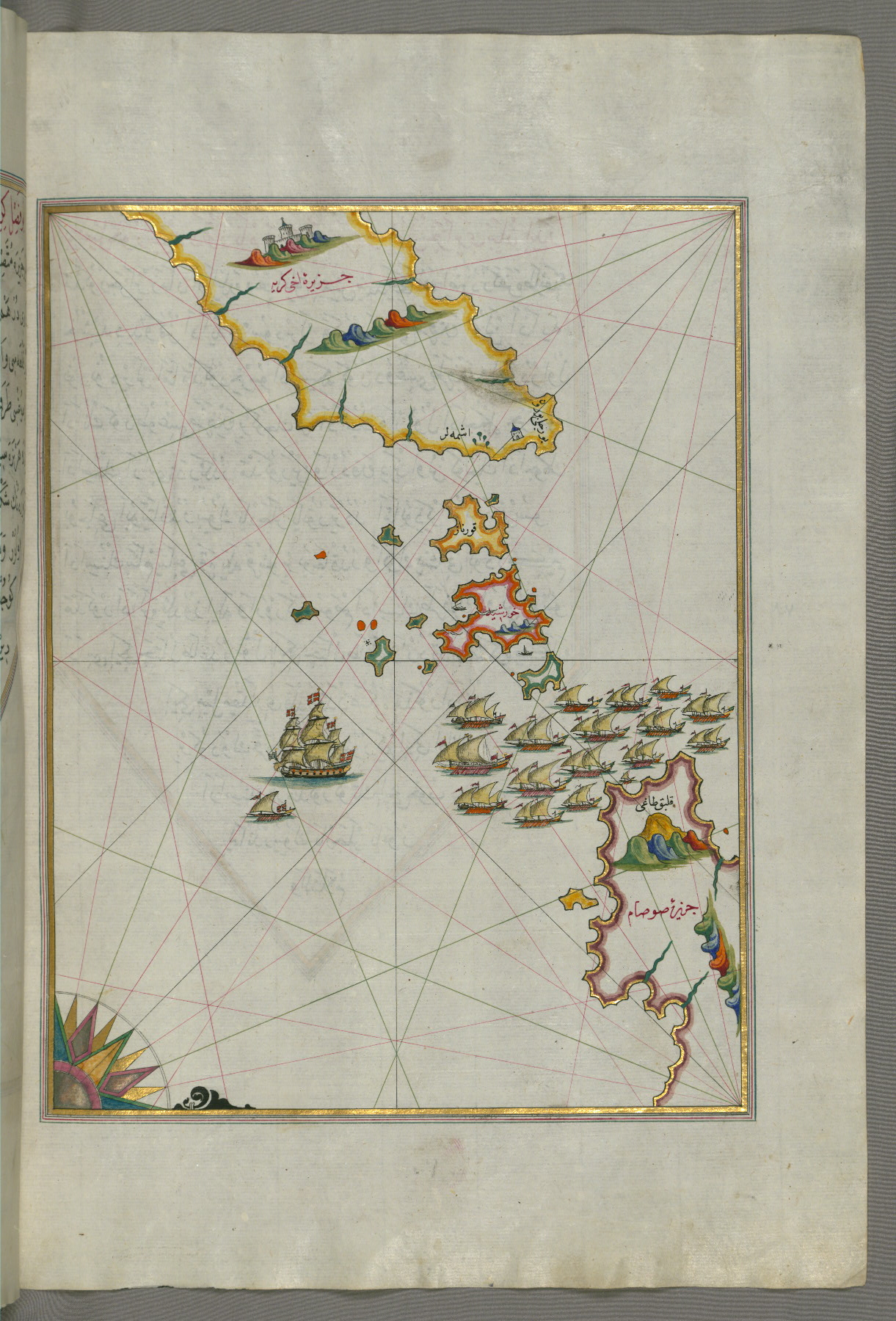
- Label: This map shows the Bay of Salonica (Selānīk, Thessaloniki).
fol. 52b:
- Title: Bay of Salonica and the western coastline
- Form: Illustration
- Label: This map shows the Bay of Salonica (Selānīk, Thessalonici) and the western coastline.
fol. 56a:
- Title: Islands of Skyros and Euboea
- Form: Illustration
- Label: This map shows the islands of Skyros (İskire) and Euboea (Evvoia, Aghrībūz, Eğriboz).
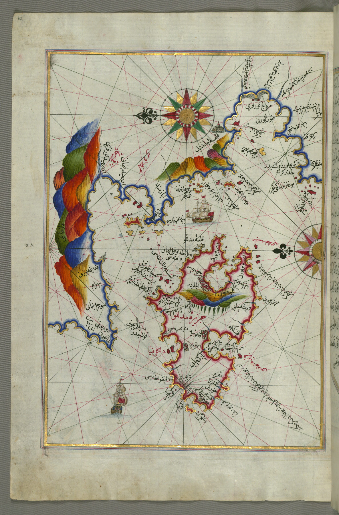
fol. 62a:
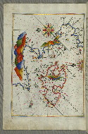
- Title: Island of Midilli in the northeastern Aegean Sea
- Form: Illustration
- Label: This map shows the island of Midilli (Midillü, Mitylene, Lesvos) in the northeastern Aegean Sea.
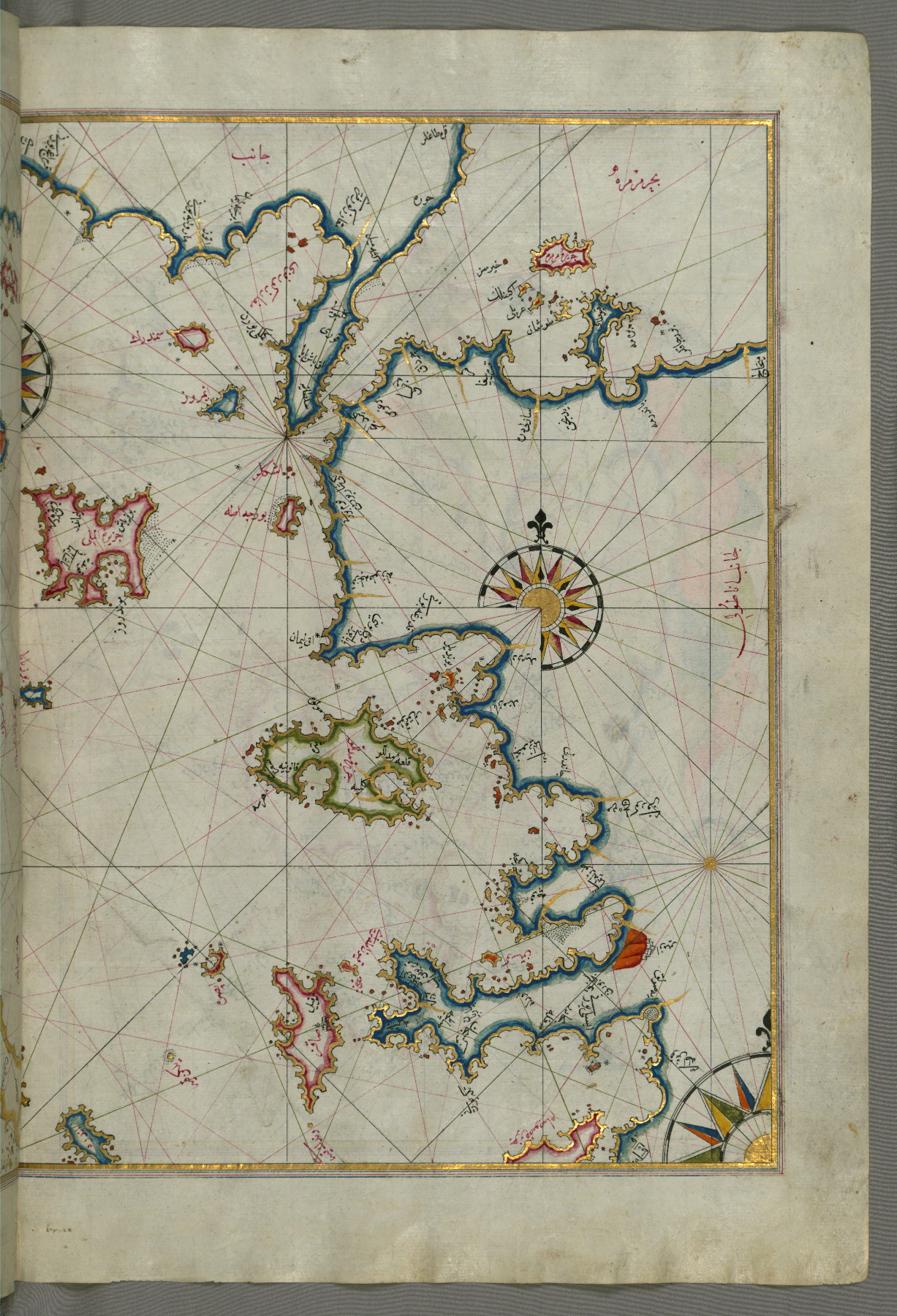
fol. 62b:
- Title: Sea of Marmara and the islands of the eastern Aegean Sea from Semendrek as far as Chios
- Form: Illustration
- Label: This map shows the sea of Marmara and the islands of the eastern Aegean Sea from Semendrek (Samothraki) as far as Chios (Sakiz, Ṣāqiz).
fol. 63a:
- Title: Coastline of the western Aegean Sea as far south as the Island of Euboea
- Form: Illustration
- Label: This map shows the coastline of the western Aegean Sea as far south as the Island of Euboea (Evvoia, Aghrībūz, Eğriboz).
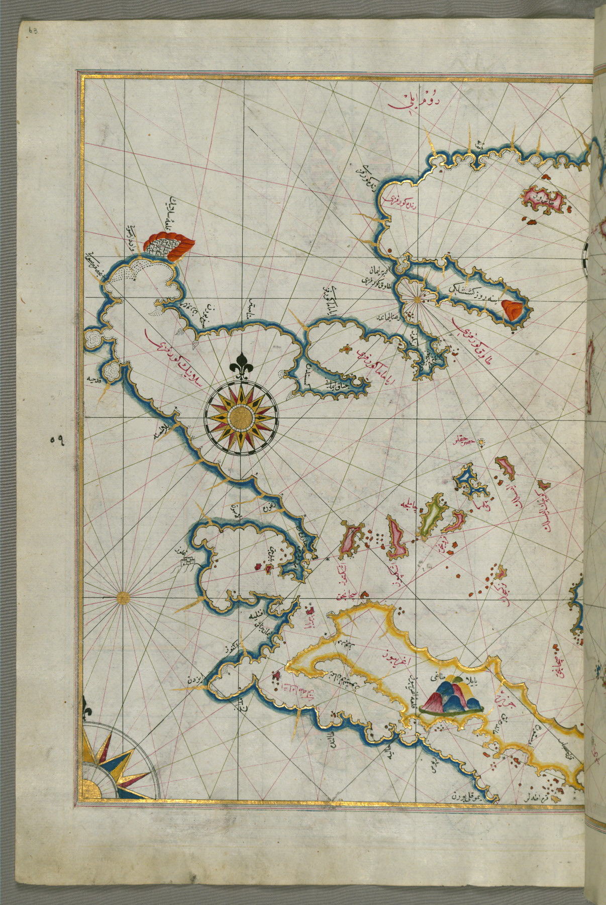
fol. 63b:
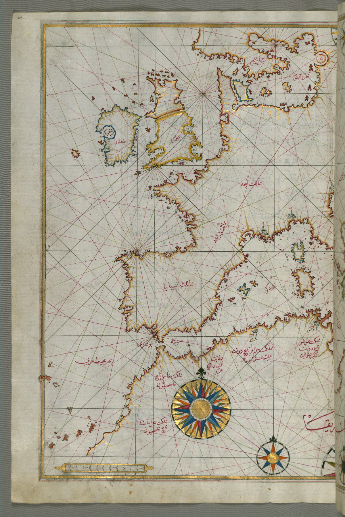
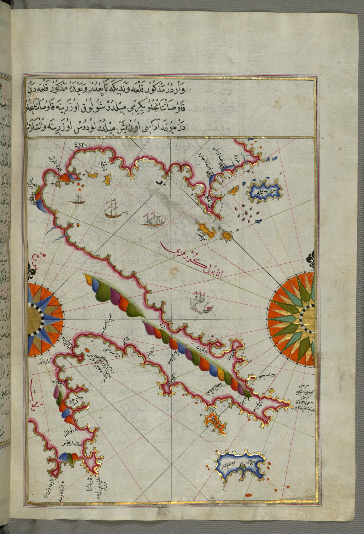
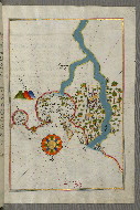
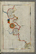
- Title: Eastern Mediterranean, the Aegean, and the Black Sea
- Form: Illustration
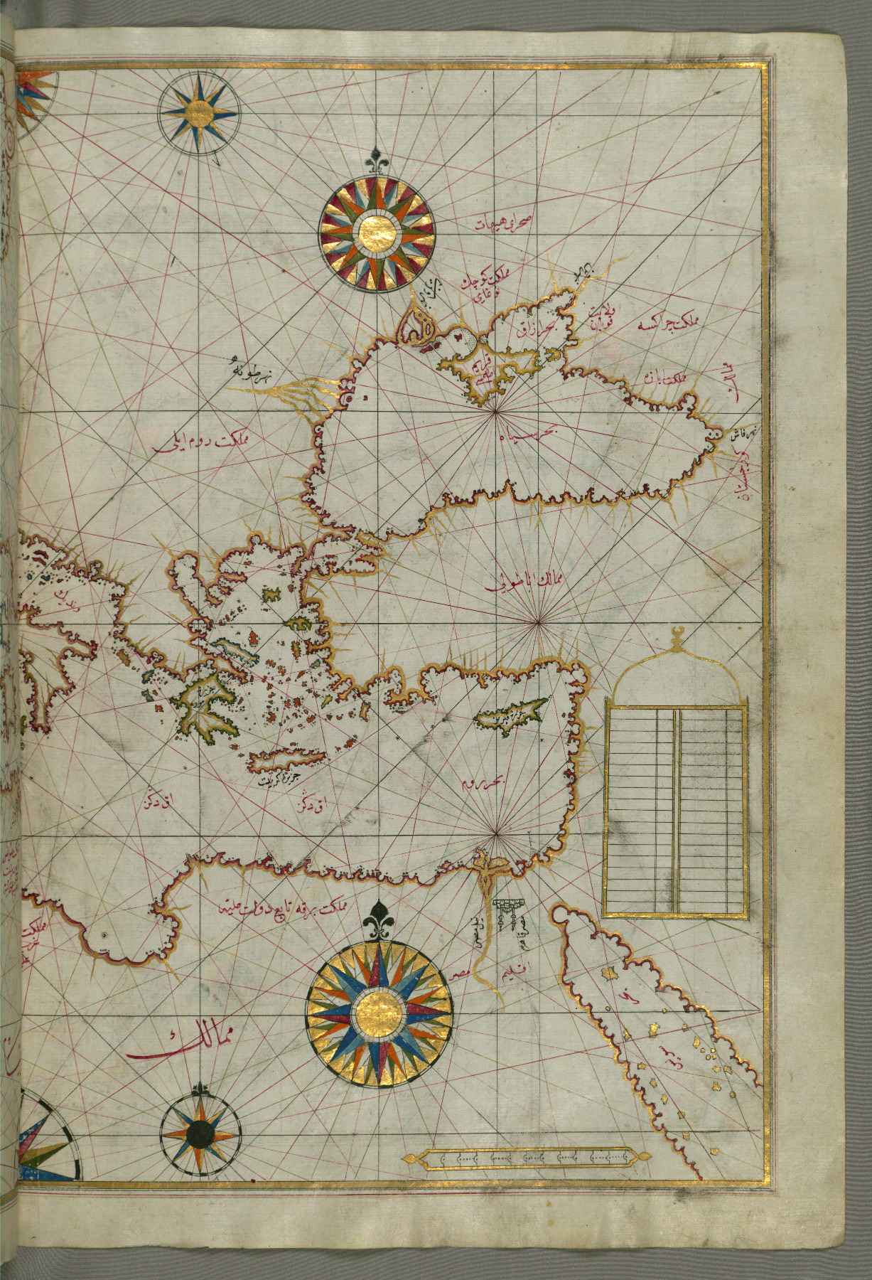
fol. 64a:
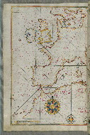
- Title: Western Europe and North Africa
- Form: Illustration
fol. 68b:
- Title: Anatolian coastline around the Bay of Izmir with two Izmir fortresses
- Form: Illustration
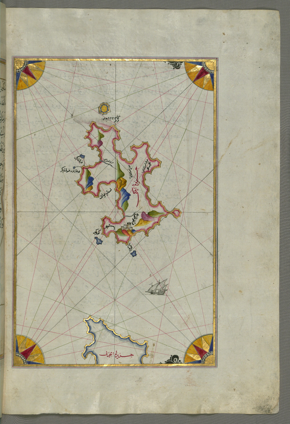
- Label: This map shows the Anatolian coastline around the Bay of Izmir (Smyrna) with two Izmir fortresses.
fol. 70a:
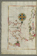
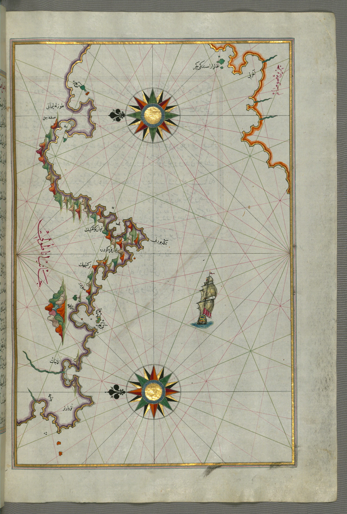
- Title: Island of Chios facing Kysos fortress on the Anatolian side
- Form: Illustration
- Label: This map shows the island of Chios (Sakiz, Sāqiz) facing Kysos (Çeşme) fortress on the Anatolian side.
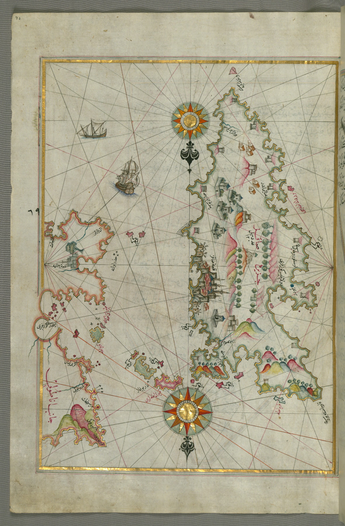
fol. 73a:
- Title: Detail of the island of Chios with its fortress and other topographical features
- Form: Illustration
- Label: This map shows a detail of the island of Chios (Sakiz, Ṣāqiz) with its fortress and other topographical features.
fol. 74a:
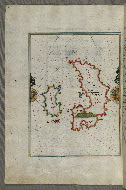
- Title: Island of Psara west of Chios
- Form: Illustration
- Label: This map shows the island of Psara (İpṣara) west of Chios (Sakiz, Ṣāqiz).
fol. 75b:
- Title: Anatolian coastline facing the island of Samos
- Form: Illustration
- Label: This map shows the Anatolian coastline facing the island of Samos (Ṣūṣām).
fol. 77a:
- Title: Anatolian coastline facing the island of Samos
- Form: Illustration
- Label: This map shows the Anatolian coastline facing the island of Samos (Ṣūṣām).
fol. 79b:
- Title: Island of Samos
- Form: Illustration
- Label: This map shows the island of Samos (Ṣūṣām).
fol. 80b:
- Title: Two small islands off the coast of Anatolia south of Samos and east of the city of Balat on the Anatolian side
- Form: Illustration
- Label: This map shows two small islands off the coast of Anatolia south of Samos (Ṣūṣām) and east of the city of Balat on the Anatolian side.
fol. 81b:
- Title: Several islands of the eastern Aegean Sea including Leros and Patmos
- Form: Illustration
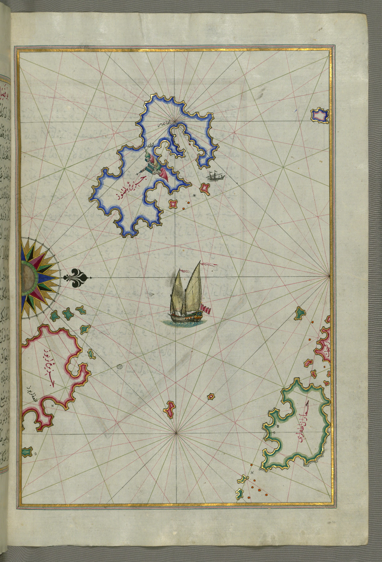
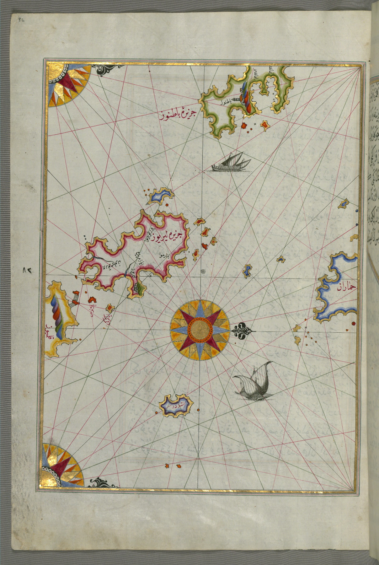
- Label: This map shows several islands of the eastern Aegean Sea including Leros (Līrūs) and Patmos (Bāṭnūz).
fol. 82b:
- Title: Area between the islands of Ikaria and Samos in the eastern Aegean Sea
- Form: Illustration
- Label: This map shows the area between the islands of Ikaria (Ahikere) and Samos (Ṣūṣām) in the eastern Aegean Sea.
fol. 83b:
- Title: Island of Ikaria in the eastern Aegean Sea west of Samos
- Form: Illustration
- Label: This map shows the island of Ikaria (Ahikere) in the eastern Aegean Sea west of Samos (Ṣūṣām).

fol. 84b:
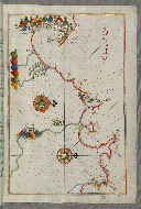
- Title: Island of Patmos southeast of Ikaria in the eastern Aegean Sea
- Form: Illustration
- Label: This map shows the island of Patmos (Bāṭnūz) southeast of Ikaria (Ahikere) in the eastern Aegean Sea.
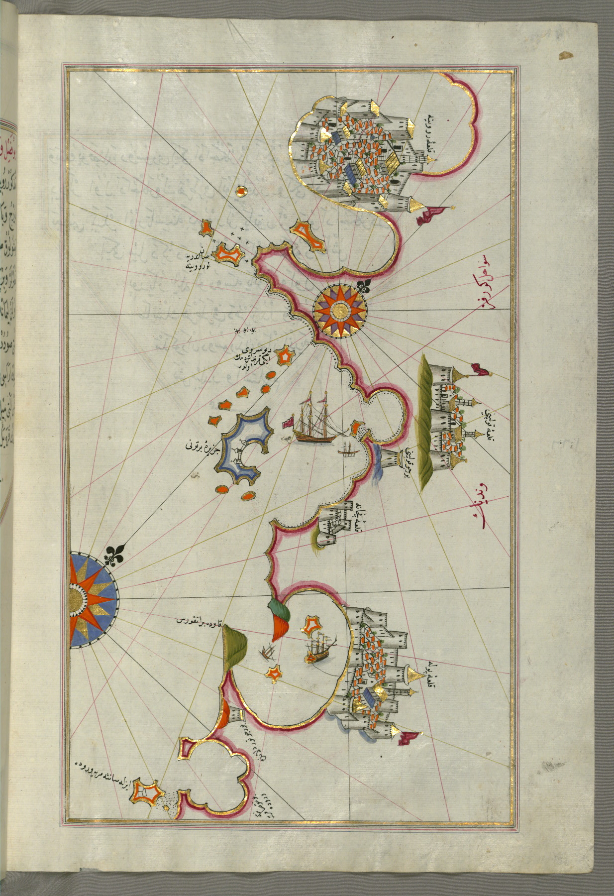
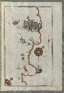
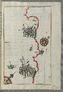
fol. 86a:
- Title: Island of Leros in the eastern Aegean Sea
- Form: Illustration
- Label: This map shows the island of Leros (Līryūs) in the eastern Aegean Sea.
fol. 88a:
- Title: Island of Kalimnos south of Leros in the eastern Aegean Sea
- Form: Illustration
- Label: This map shows the island of Kalimnos (Kalimaz) south of Leros in the eastern Aegean Sea.
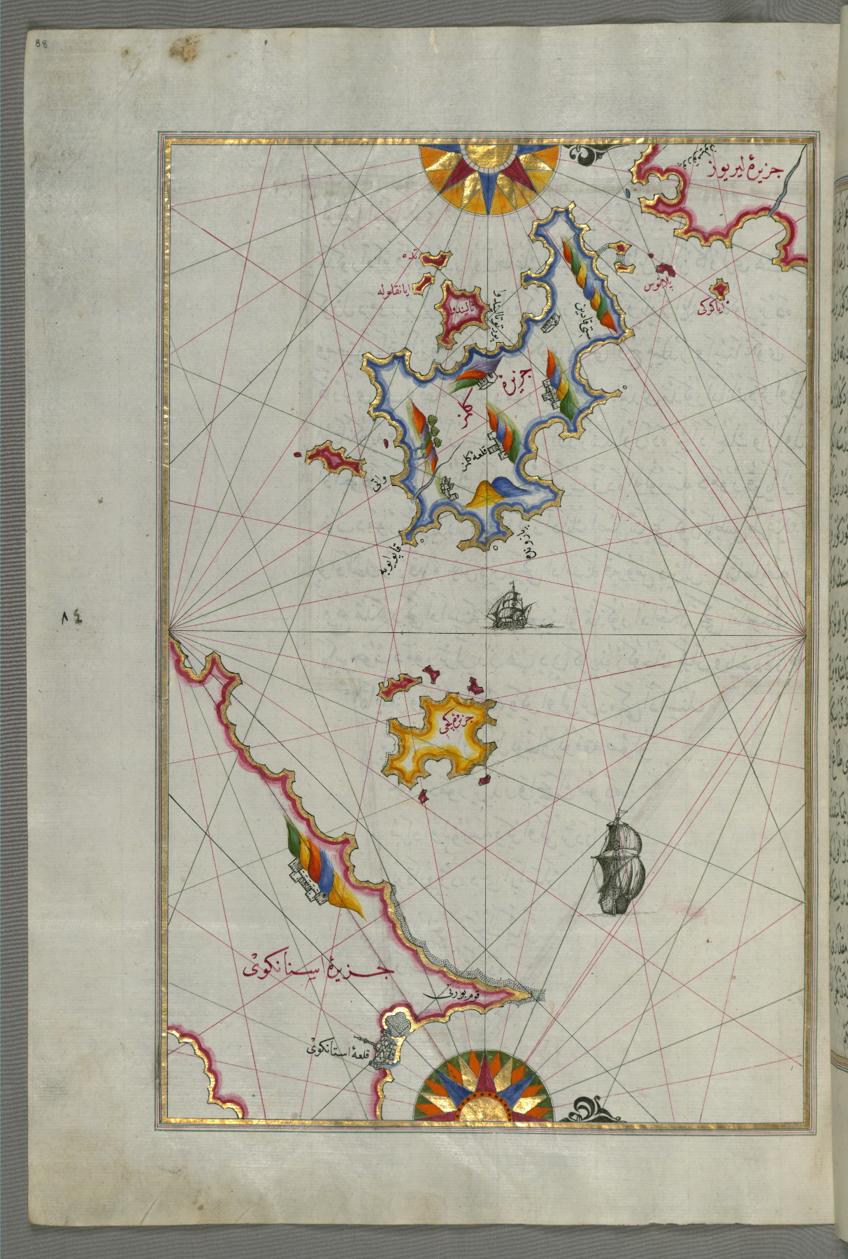
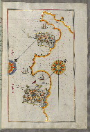
fol. 89a:
- Title: Island of Cos facing the Anatolian mainland
- Form: Illustration
- Label: This map shows the island of Cos (Stancho, İstanköy) facing the Anatolian mainland.
fol. 90b:
- Title: Anatolian coastline and the small island of Kara east of the town of Balat
- Form: Illustration
- Label: This map shows the Anatolian coastline and the small island of Kara (Qarah) east of the town of Balat.

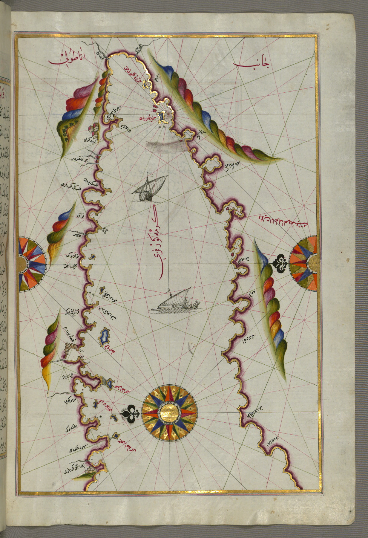
fol. 92a:
- Title: Anatolian coastline along the Bay of Kerme
- Form: Illustration

fol. 93b:
- Title: Anatolian coastline facing the island of Cos
- Form: Illustration
- Label: This map shows the Anatolian coastline facing the island of Cos (Stancho, İstanköy).
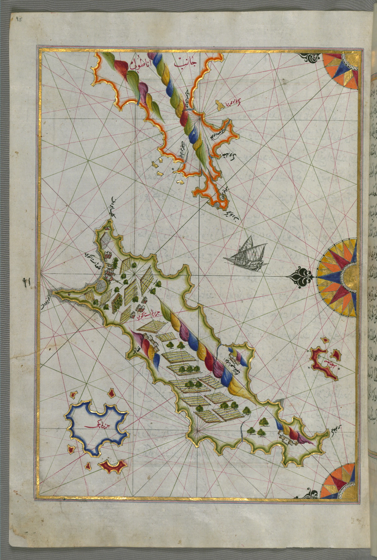
fol. 95a:
- Title: Island of Cos off the Anatolian coast in the eastern Aegean Sea
- Form: Illustration
- Label: This map shows the island of Cos (Stancho, İstanköy) off the Anatolian coast in the eastern Aegean Sea.
fol. 97b:
- Title: Bay of Kerme east of the island of Cos
- Form: Illustration
- Label: This map shows the Bay of Kerme east of the island of Cos (Stancho, İstanköy).
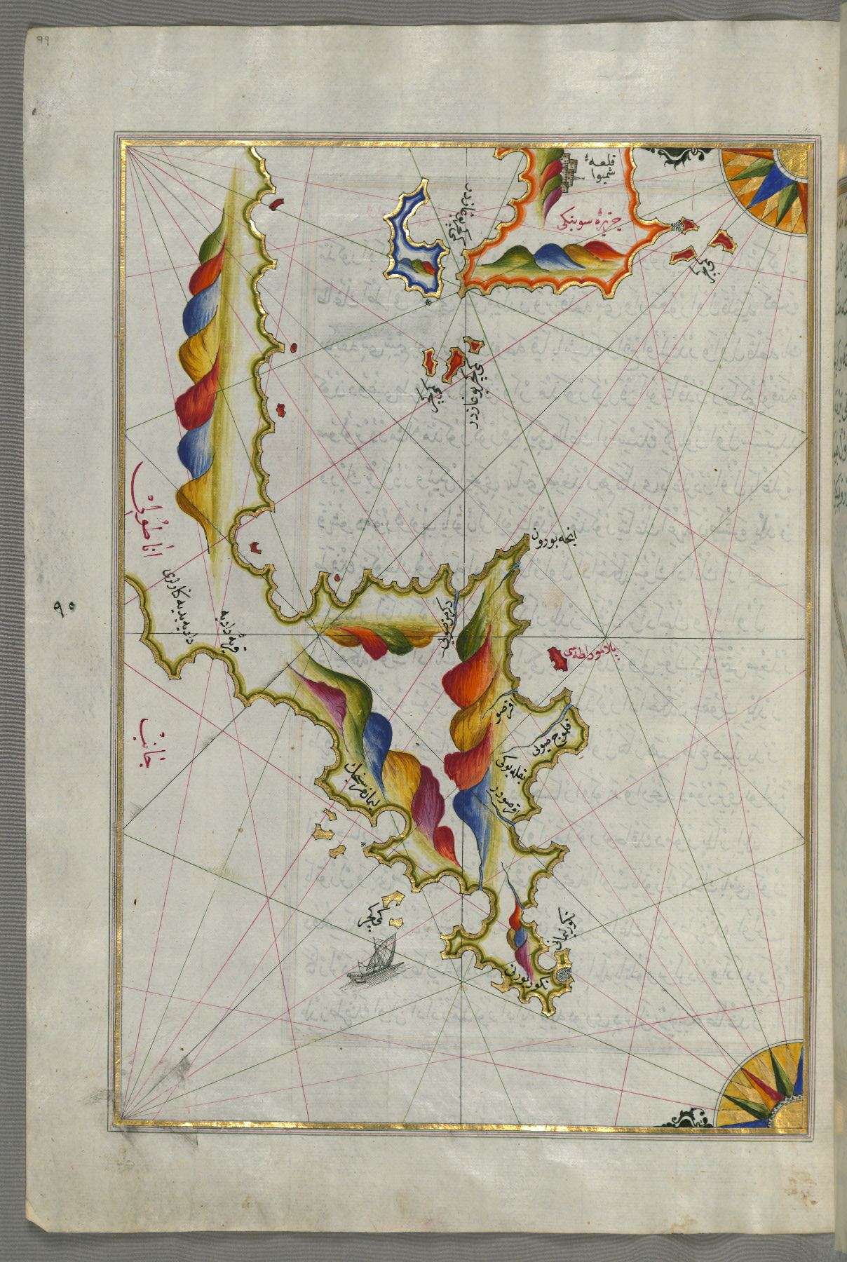
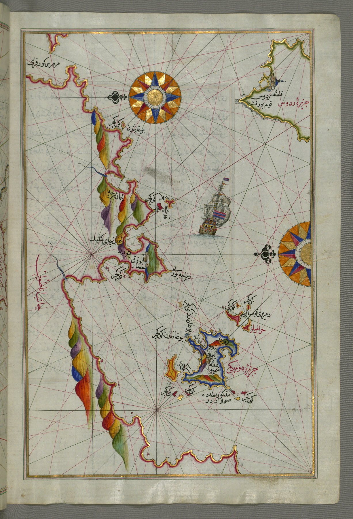
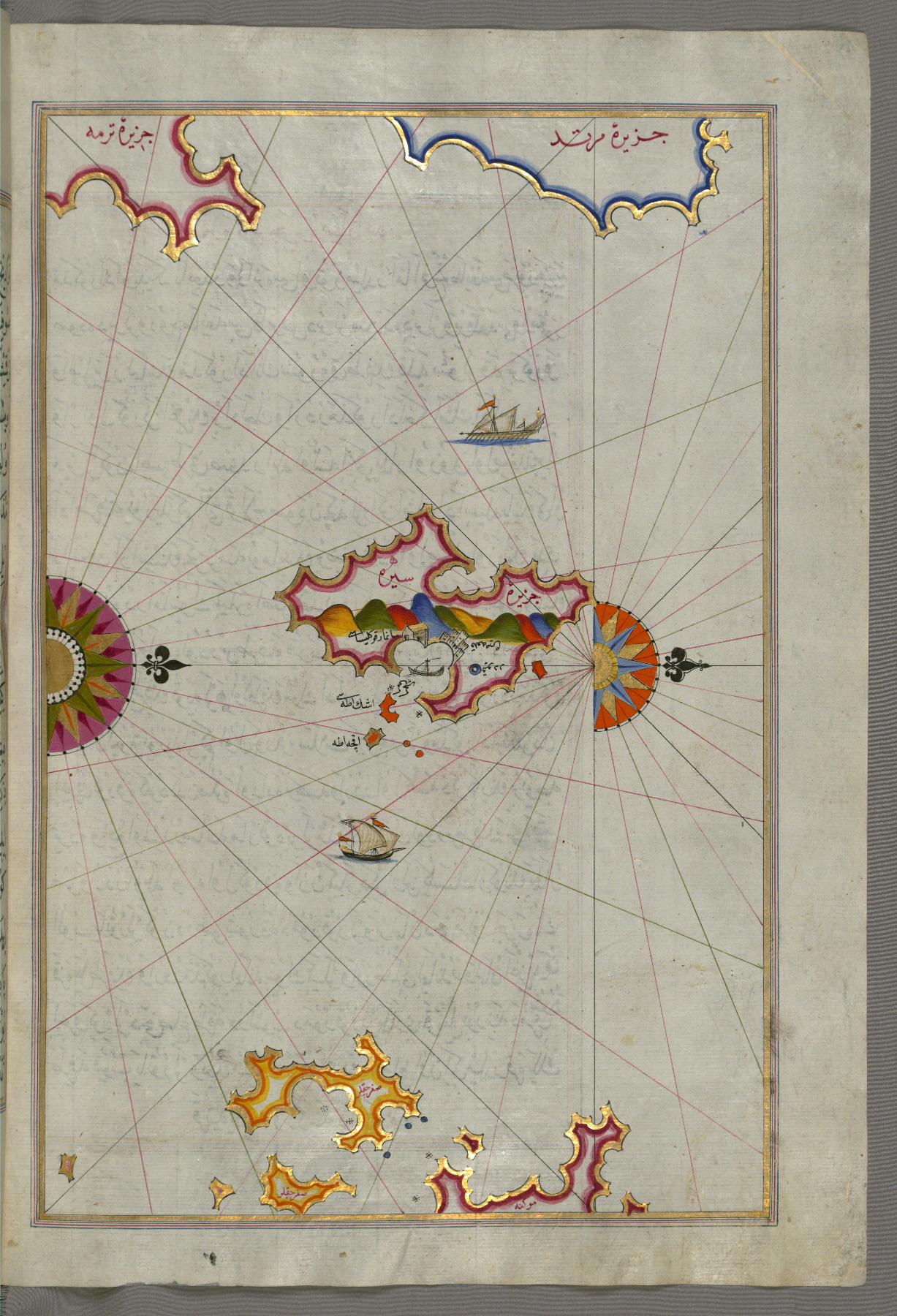
fol. 99a:
- Title: Island of Syme northwest of the island of Rhodes
- Form: Illustration
- Label: This map shows the island of Syme (Sömbeki) northwest of the island of Rhodes (Rodos).
fol. 100b:
- Title: Northeastern tip of the island of Rhodes facing the Anatolian coast with the island of Syme
- Form: Illustration
- Label: This map shows the northeastern tip of the island of Rhodes (Rodos, Rūdūs) facing the Anatolian coast with the island of Syme (Sömbeki).
fol. 101a:
- Title: Islands of the Aegean Sea including Chios, Cos, Rhodes, and Crete
- Form: Illustration
- Label: This map shows the islands of the Aegean Sea including Chios (Sakiz), Cos (Stancho, İstanköy), Rhodes (Rodos), and Crete.
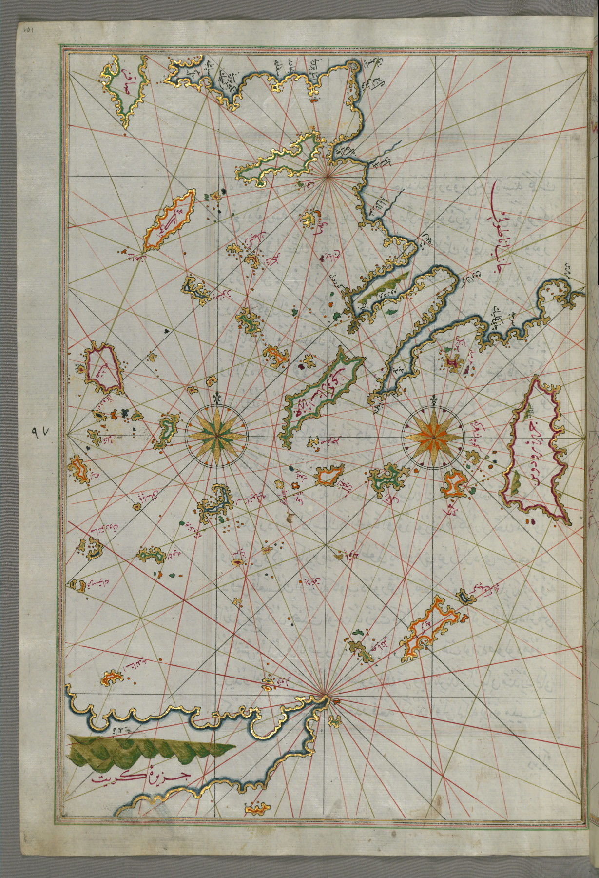
fol. 103a:
- Title: Island of Rhodes (Rodos, Rudūs)
- Form: Illustration
- Label: This map shows the island of Rhodes (Rodos, Rudūs).

fol. 104a:
- Title: Island of Chalkis off the island of Rhodes
- Form: Illustration
- Label: This map shows the island of Chalkis (Herke) off the island of Rhodes.
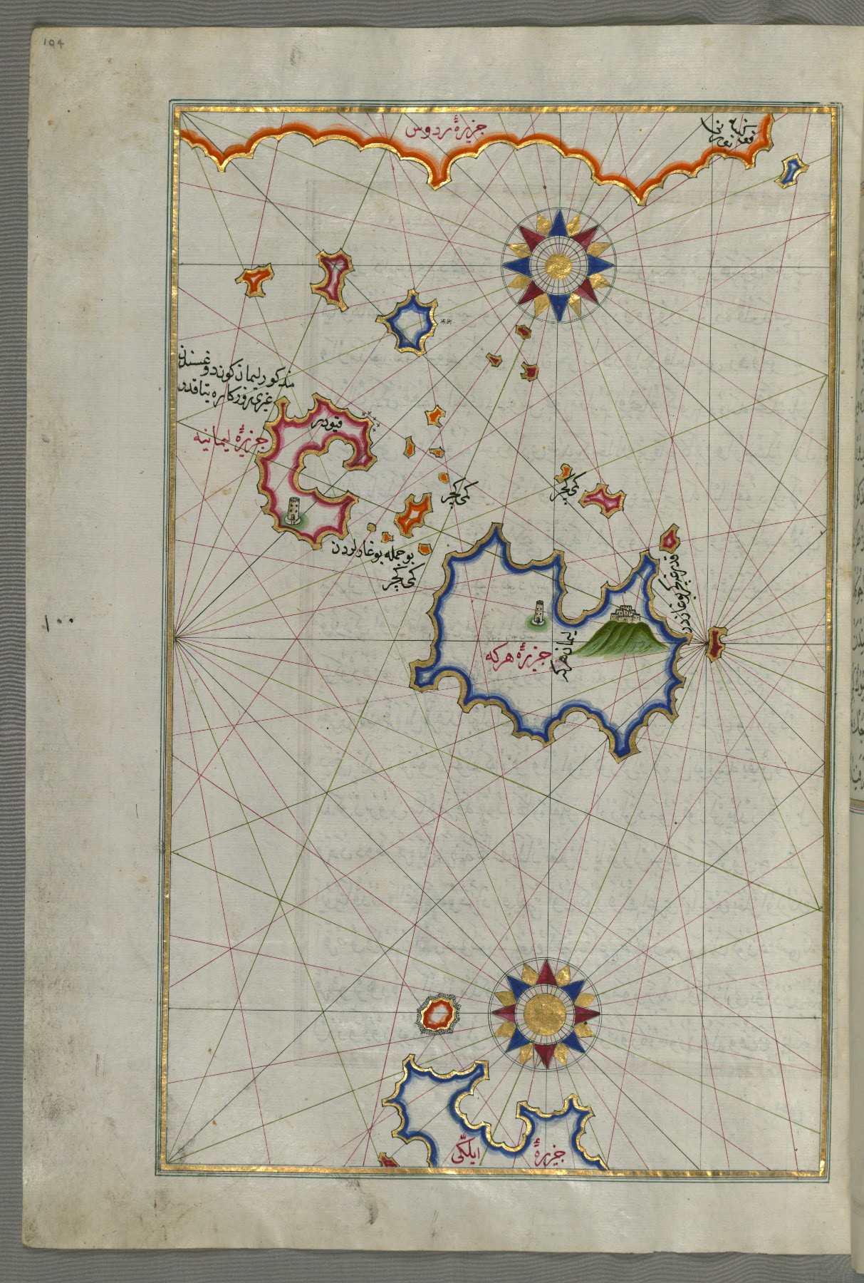
fol. 105b:
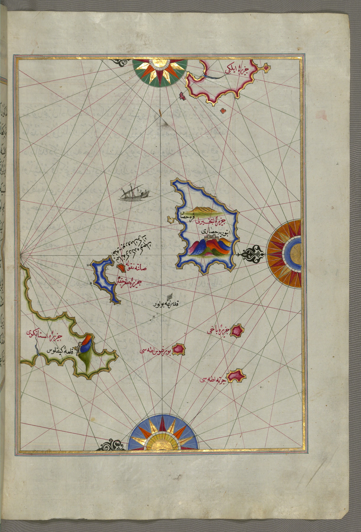
- Title: Island of Telos north of the island of Chalkis in the eastern Aegean Sea
- Form: Illustration
- Label: This map shows the island of Telos (Episkopi, İlyaki) north of the island of Chalkis (Herke) in the eastern Aegean Sea.
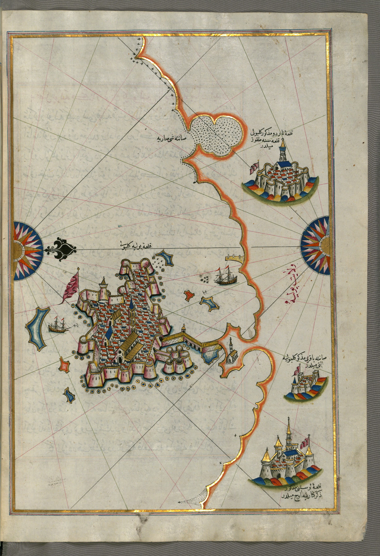
fol. 106b:
- Title: Island of Nisyros south of the island of Cos in the eastern Aegean Sea
- Form: Illustration
- Label: This map shows the island of Nisyros (Inǧirlü) south of the island of Cos (Stancho, İstanköy) in the eastern Aegean Sea.
fol. 107b:
- Title: Two small islands between Amorgos and Cos in the eastern Aegean Sea
- Form: Illustration
- Label: This map shows two small islands between Amorgos (Yamurgi) and Cos (Stancho, İstanköy) in the eastern Aegean Sea.
fol. 108b:
- Title: Island of Amorgos in the southeastern Aegean Sea
- Form: Illustration
- Label: This map shows the island of Amorgos (Yamurgi, Yamorki) in the southeastern Aegean Sea.

fol. 109b:
- Title: Small islands in the region of Naxos and Amorgos in the southeastern Aegean Sea
- Form: Illustration
- Label: This map shows small islands in the region of Naxos (Naḳşe) and Amorgos (Yamurgi) in the southeastern Aegean Sea.

fol. 110b:
- Title: Island of Naxos in the southeastern Aegean Sea
- Form: Illustration
- Label: This map shows the island of Naxos (Naḳşe) in the southeastern Aegean Sea.
fol. 112b:

- Title: Island of Paros in the Aegean Sea
- Form: Illustration
- Label: This map shows the island of Paros (Pare) in the Aegean Sea.
fol. 113b:
- Title: Island of Syros in the Aegean Sea
- Form: Illustration
- Label: This map shows the island of Syros (Sire) in the Aegean Sea.
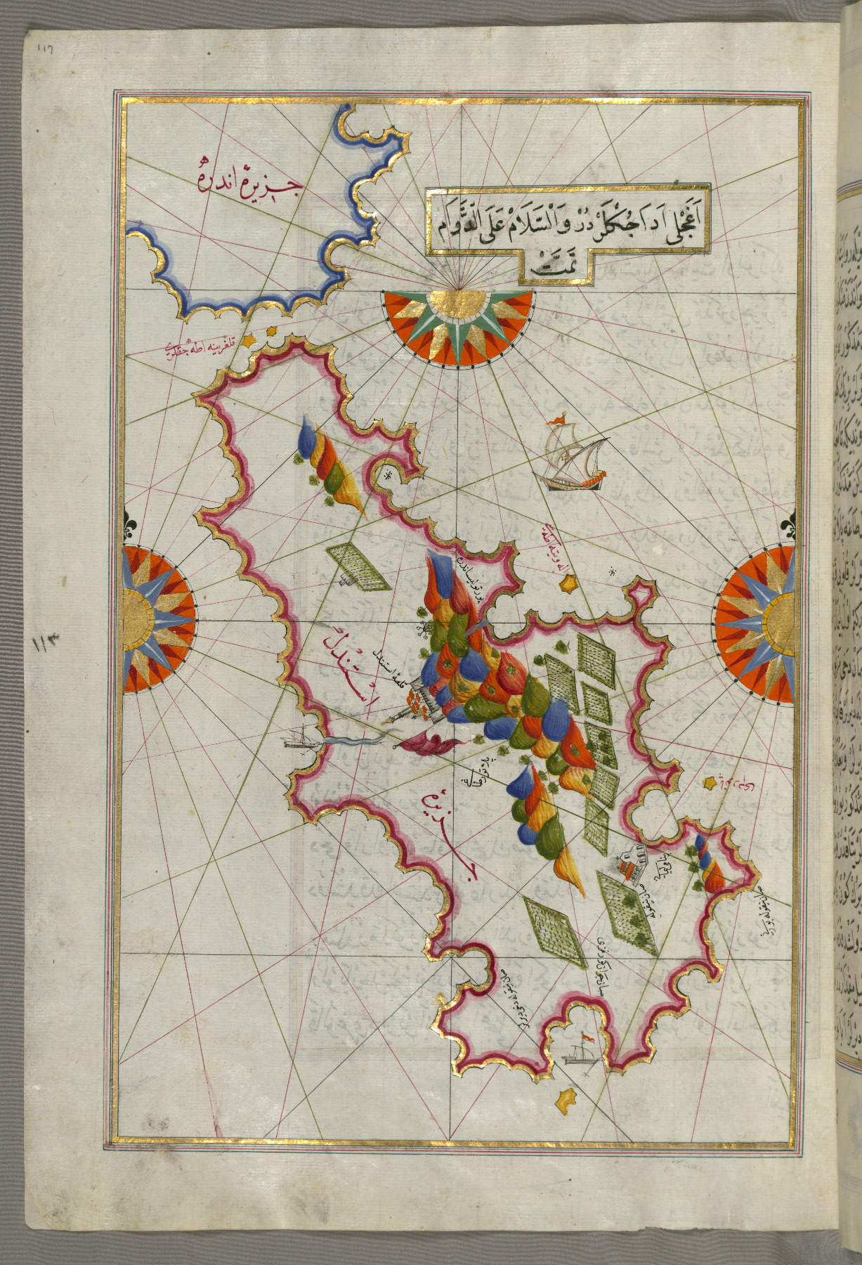
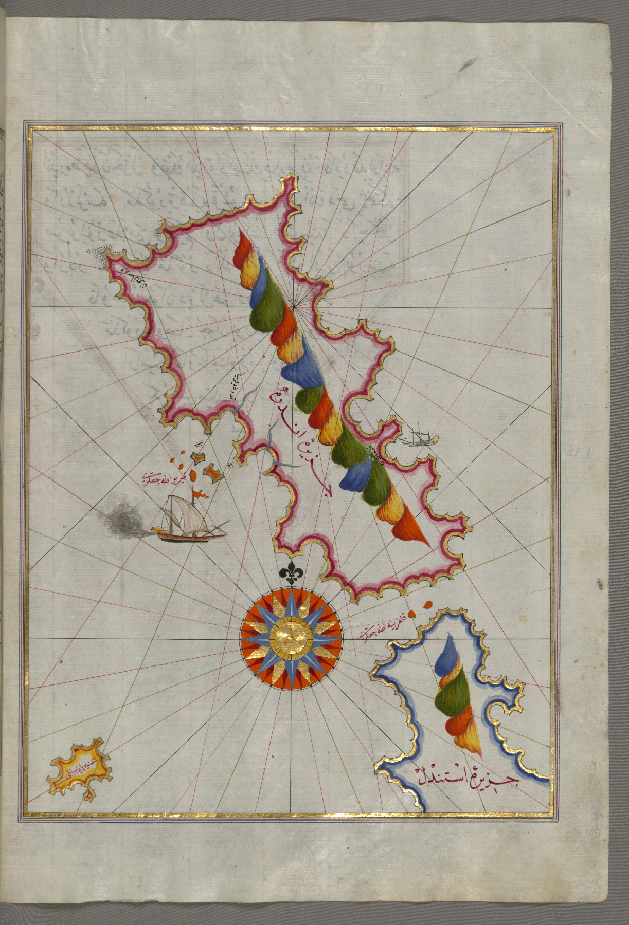
fol. 115a:
- Title: Islands of Delos and Rineia west of Mykonos in the Aegean Sea
- Form: Illustration
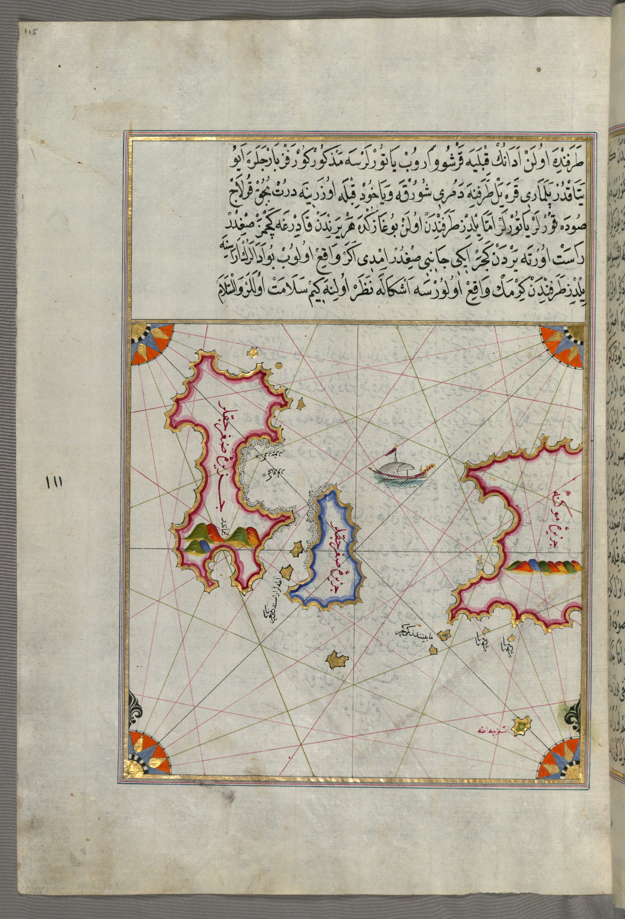
fol. 116a:
- Title: Island of Mykonos in the Aegean Sea
- Form: Illustration

fol. 117a:
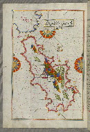
- Title: Island of Tinos in the Aegean Sea
- Form: Illustration
- Label: This map shows the island of Tinos (İstendil) in the Aegean Sea.
fol. 118b:
- Title: Island of Andros in the northern Aegean Sea
- Form: Illustration
- Label: This map shows the island of Andros (Andre, Andra) in the northern Aegean Sea.
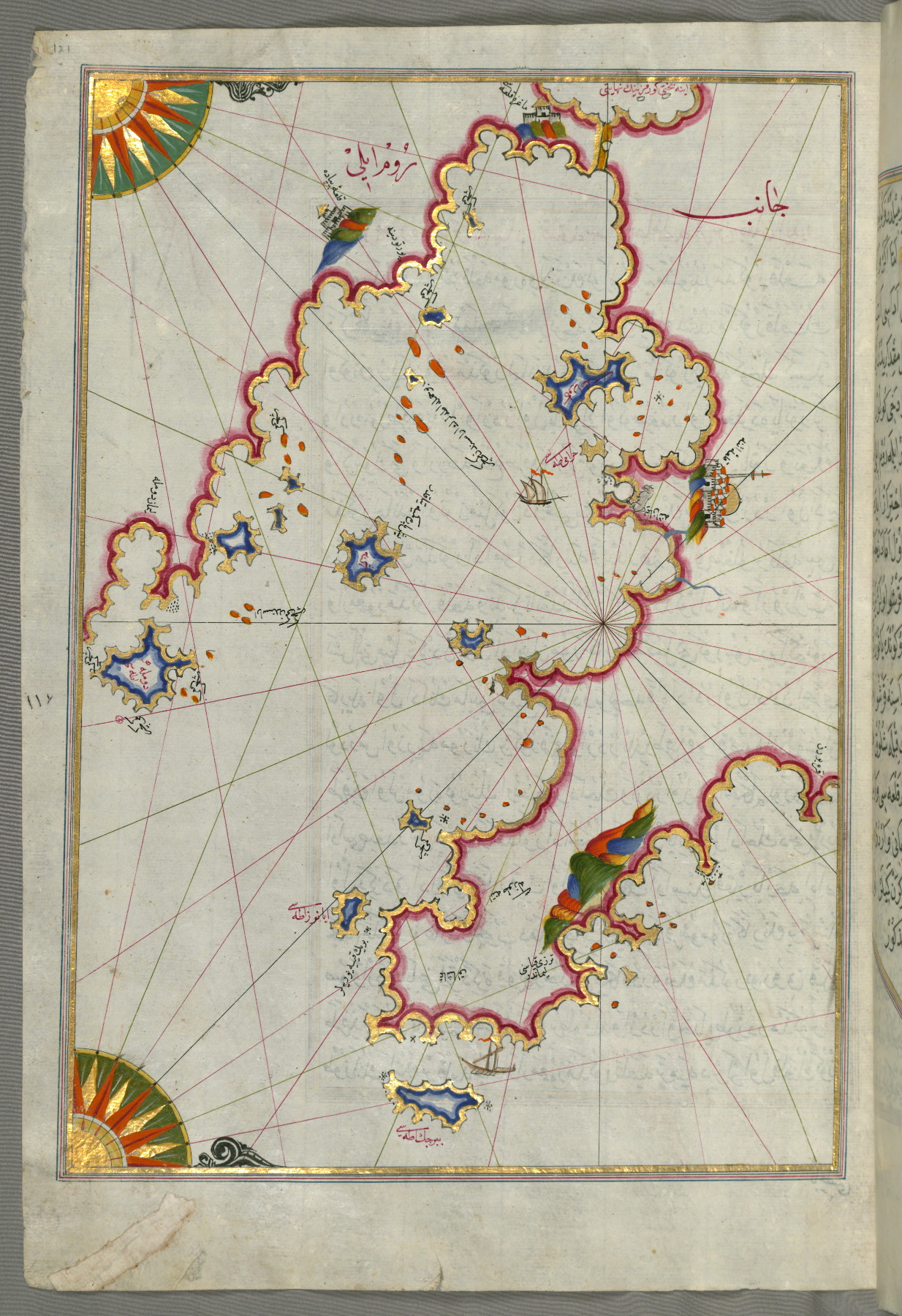
fol. 121a:
- Title: Bay of Saronikos with the city of Athens
- Form: Illustration
- Label: This map shows the Bay of Saronikos (Atene) with the city of Athens.
fol. 122b:
- Title: Bay of Argolikos
- Form: Illustration
- Label: This map shows the Bay of Argolikos (Anaboli).

fol. 123b:
- Title: Bay of Argolikos and the Peloponnese peninsula
- Form: Illustration
- Label: This map shows the Bay of Argolikos (Anaboli) and the Peloponnese (Morea, Mora) peninsula.
fol. 124b:
- Title: Stretch of water between the Peloponnese peninsula and the island of Crete with the island of Kythira
- Form: Illustration
- Label: This map shows the stretch of water between the Peloponnese (Morea, Mora) peninsula and the island of Crete with the island of Kythira (Cerigo, Ҫoka).
fol. 127b:
- Title: Peloponnese peninsula with the island of Kythira and the Bay of Lakonikos
- Form: Illustration
- Label: This map shows the Peloponnese (Morea, Mora) peninsula with the island of Kythira (Cerigo, Ҫoke) and the Bay of Lakonikos.
fol. 129a:
- Title: Bay of Messiniakos
- Form: Illustration
- Label: This map shows the Bay of Messiniakos (Messini).

fol. 129b:
- Title: Cyclades islands between the Peloponnese peninsula and Crete
- Form: Illustration
- Label: This map shows the Cyclades (Kikladhes) islands between the Peloponnese (Morea, Mora) peninsula and Crete.
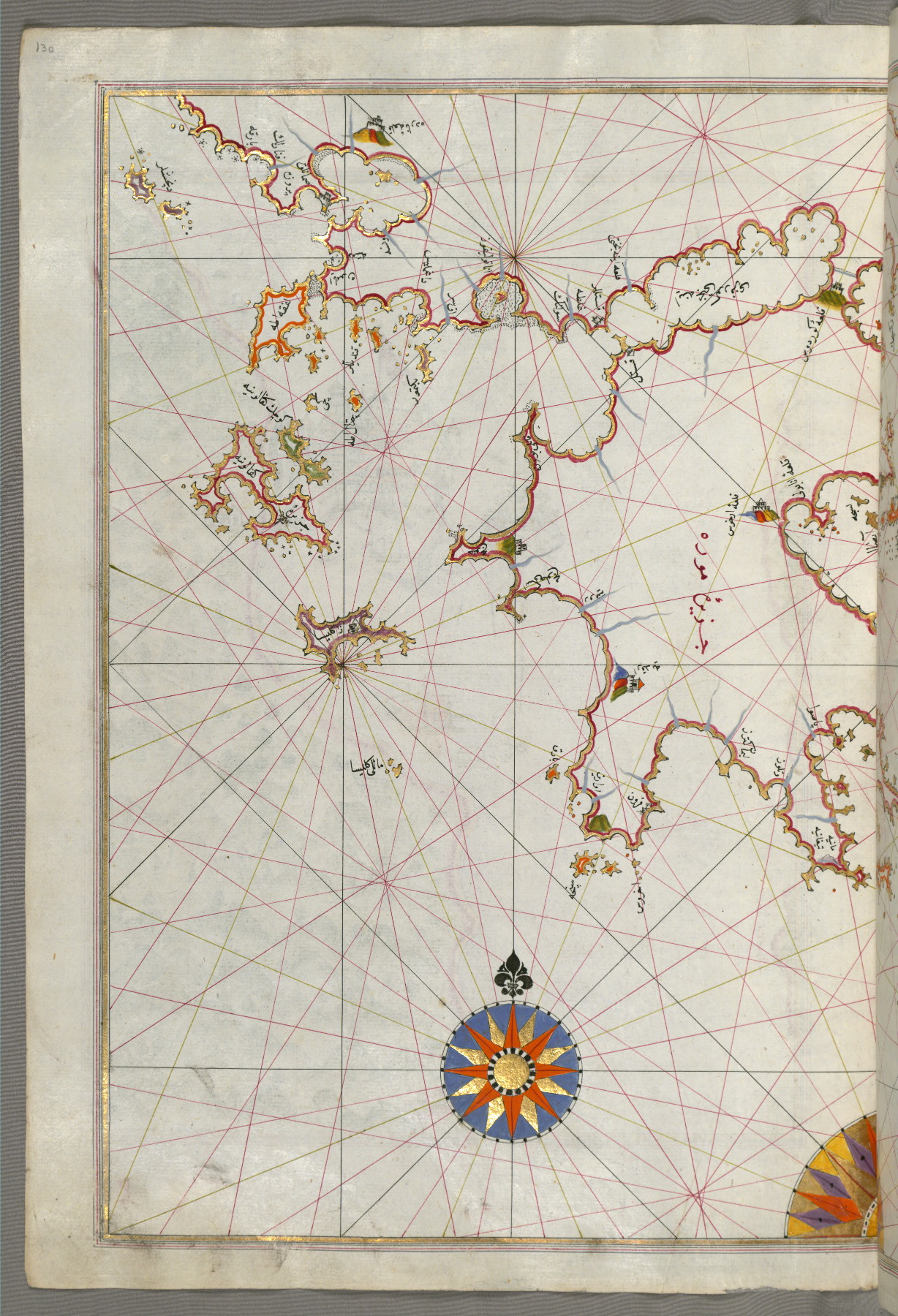
fol. 130a:
- Title: Islands of Zakynthos, Kefalonia, and Lefkada in the Ionian Sea
- Form: Illustration
- Label: This map shows the islands of Zakynthos (Zākīse), Kefalonia (Kefallinia, Kafālūnye), and Lefkada (Levkas, Leucas, Lefqe) in the Ionian Sea.
fol. 130b:
- Title: Methana (Mutūn) fortress in the Bay of Saronikos
- Form: Illustration
- Label: This map shows the Methana (Mutūn) fortress in the Bay of Saronikos (Aiyina).

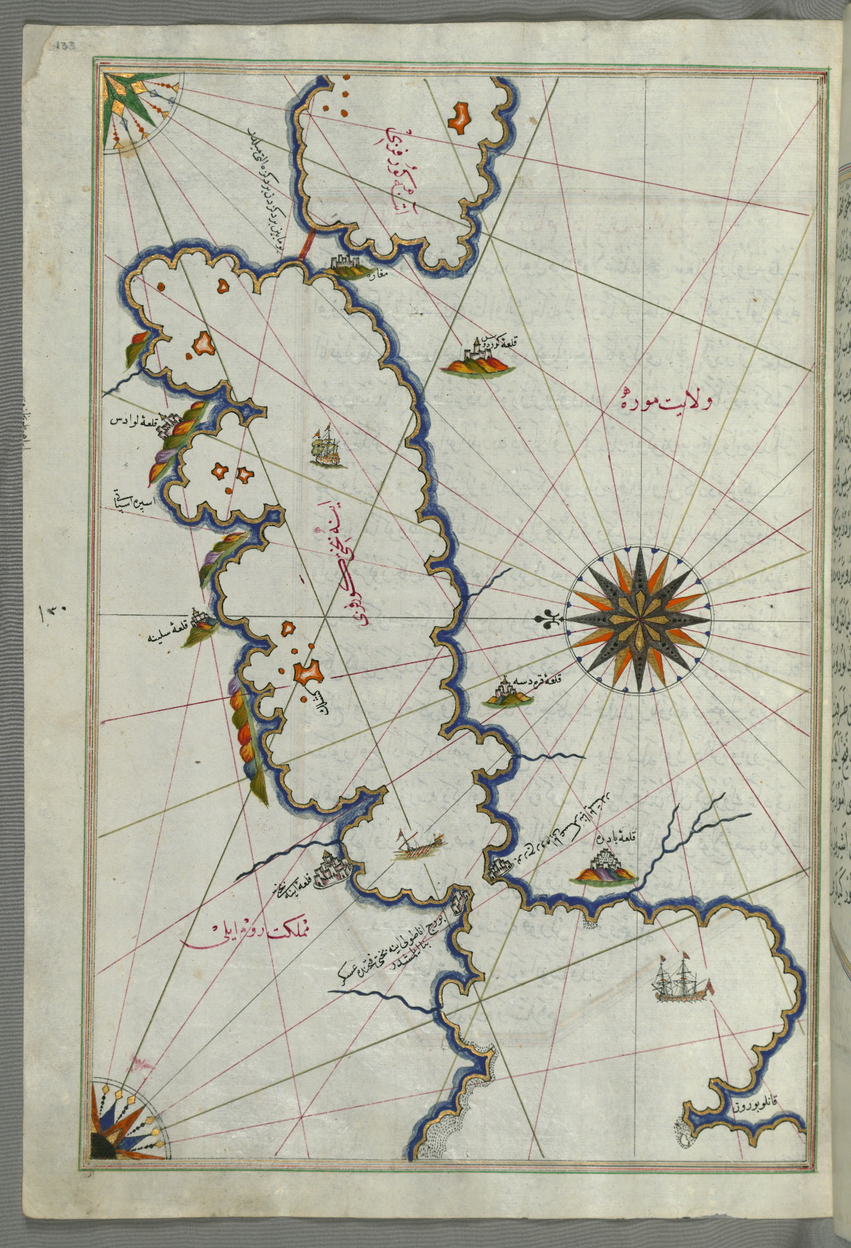
fol. 133a:
- Title: Bay of Saronikos
- Form: Illustration
- Label: This map shows the Bay of Saronikos (Aiyina).
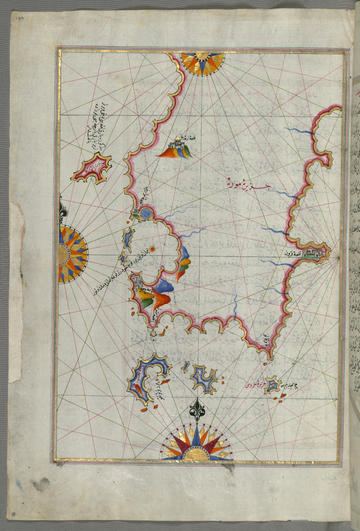
fol. 134a:
- Title: Eastern part of the Peloponnese (Morea, Mora) peninsula
- Form: Illustration
- Label: This map shows the eastern part of the Peloponnese (Morea, Mora) peninsula.
fol. 136b:
- Title: Western part of the Peloponnese peninsula opposite the island of Zakynthos (Zante, Zākīse)
- Form: Illustration
- Label: This map shows the western part of the Peloponnese (Morea, Mora) peninsula opposite the island of Zakynthos (Zante, Zākīse).
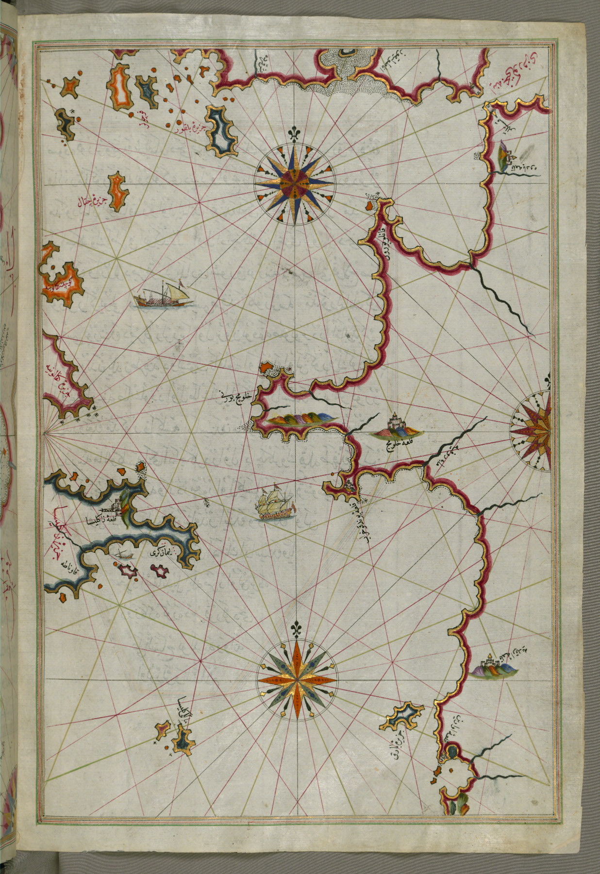
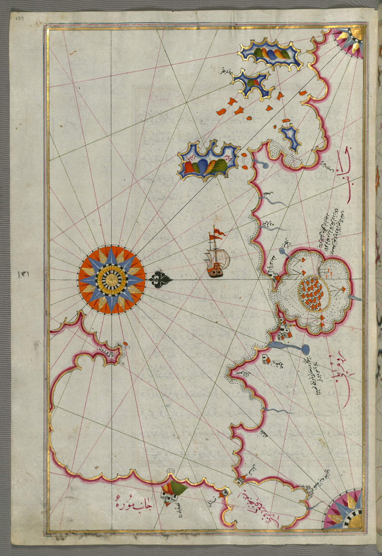
fol. 137a:
- Title: Bay of Corinth
- Form: Illustration
fol. 139a:
- Title: Islands of Kefalonia, Ithaca, and Aya Mavra off the western coast of Greece
- Form: Illustration
- Label: This map shows the islands of Kefalonia (Kefallinia, Kafālūnye), Ithaca (Ithaki, Seyākī), and Aya Mavra off the western coast of Greece.

fol. 141a:
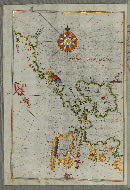
- Title: Western coast of Greece from the island of Levcas going north as far as the island of Paxi
- Form: Illustration
- Label: This map shows the western coast of Greece from the island of Levcas (Lefkada, Leucas, Santa Maura) going north as far as the island of Paxi (Paxoi).
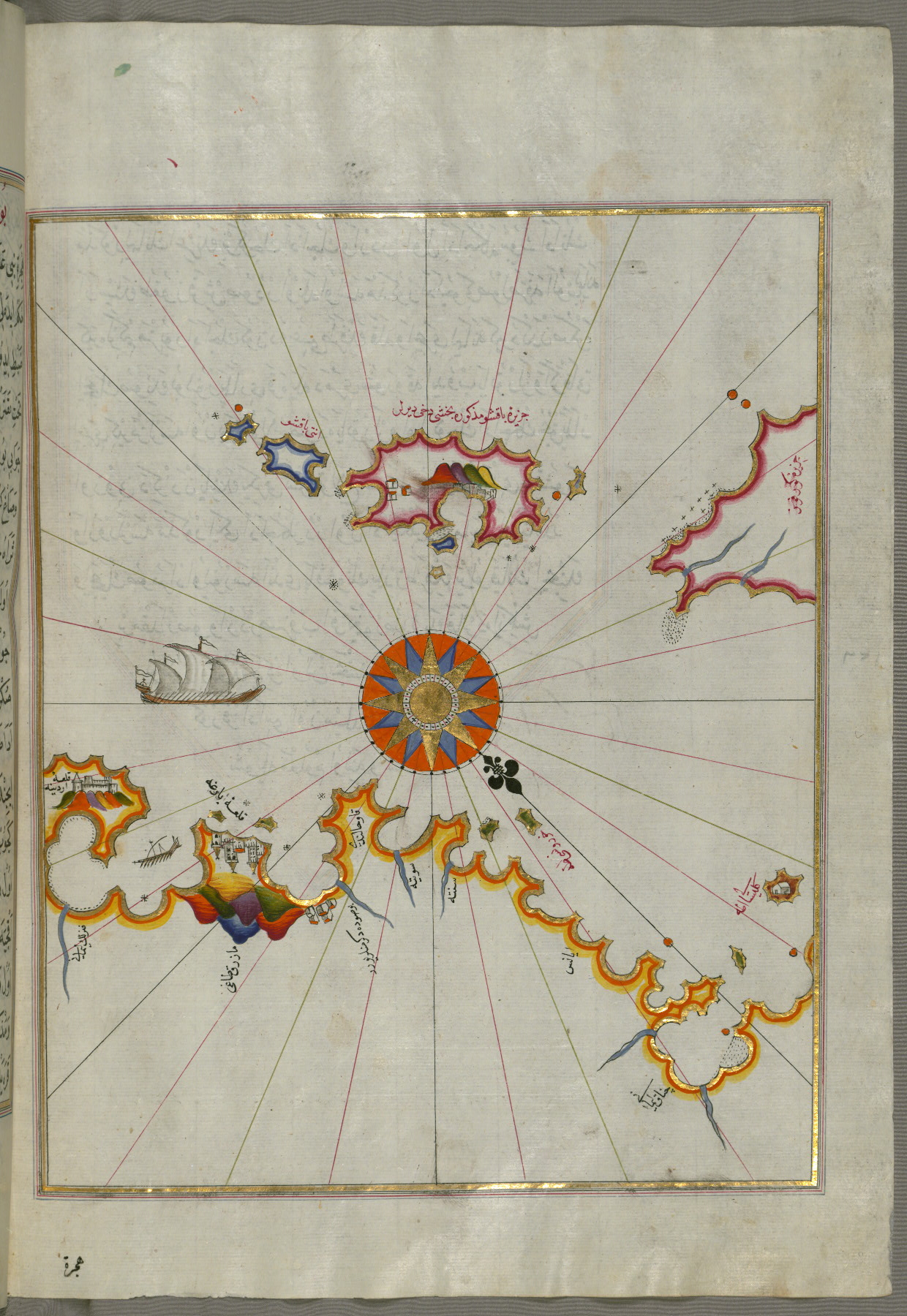
fol. 142b:
- Title: Area between the islands of Corfu and Paxi
- Form: Illustration
- Label: This map shows the area between the islands of Corfu (Kerkira, Kūrfūz) and Paxi (Paxoi).
fol. 145b:
- Title: Islands of Corfu and Paxi
- Form: Illustration
- Label: This map shows the islands of Corfu (Kerkira, Kūrfūz) and Paxi (Paxoi).
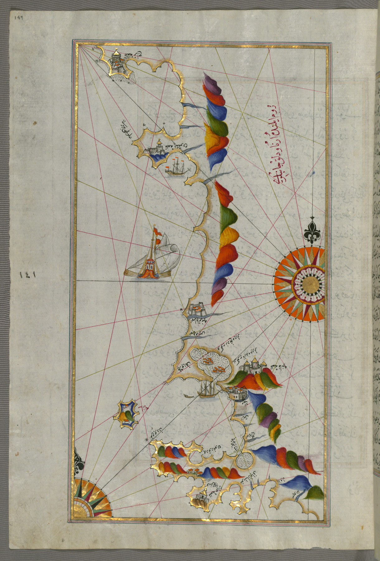
fol. 147a:
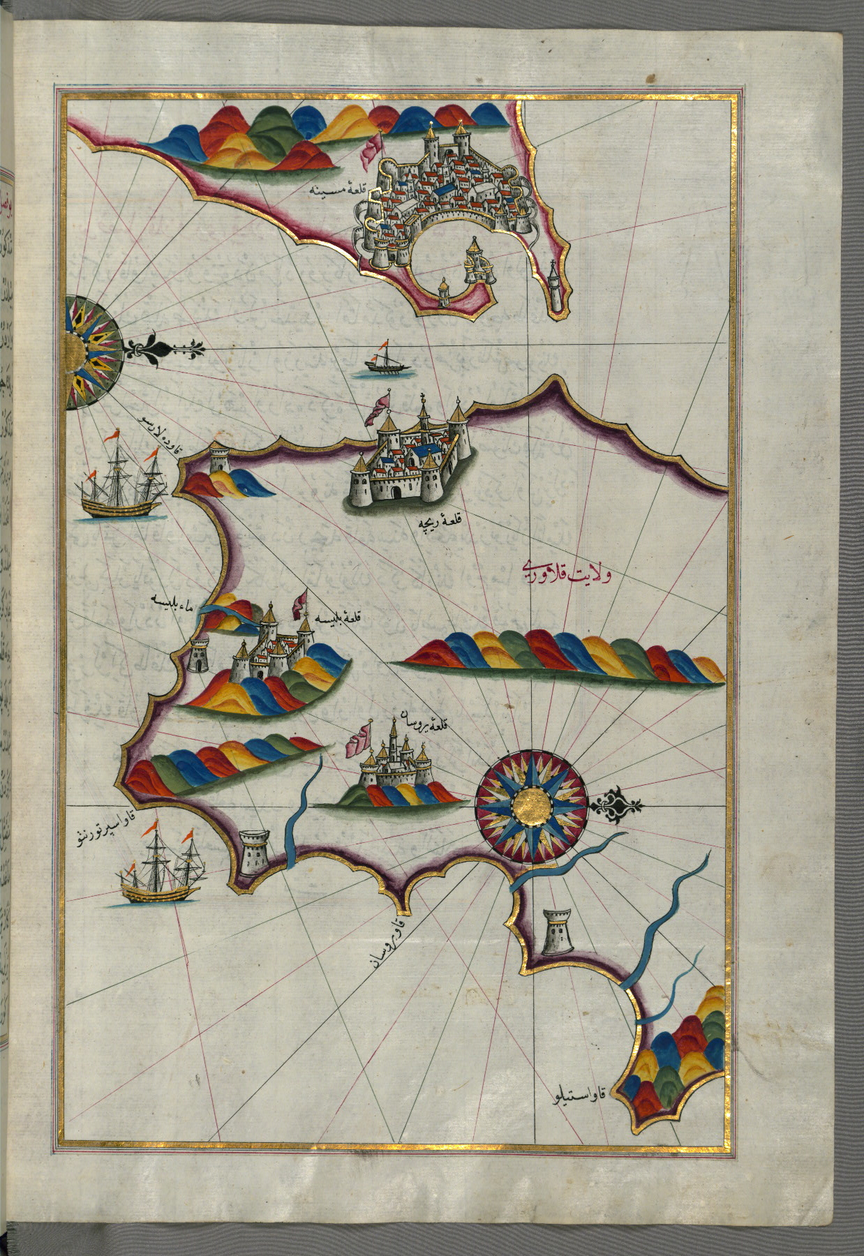
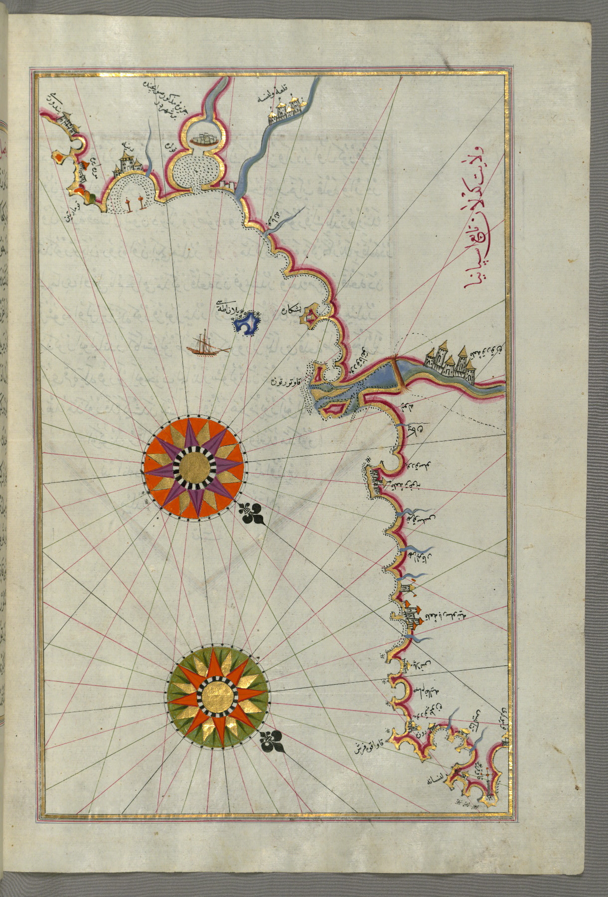
- Title: Adriatic coastline around Karaburun and Vlora
- Form: Illustration
- Label: This map shows the Adriatic coastline around Karaburun and Vlora (Valona).
fol. 148b:
- Title: Adriatic coastline from Drač north of Karaburun as far as Budva
- Form: Illustration
- Label: This map shows the Adriatic coastline from Drač (Durezzo, Trāj) north of Karaburun as far as Budva.
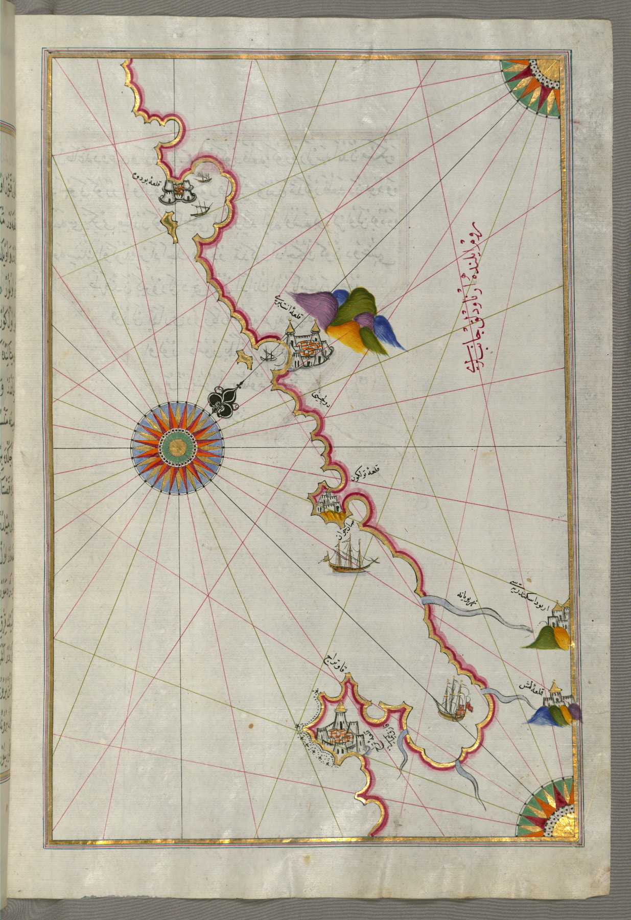
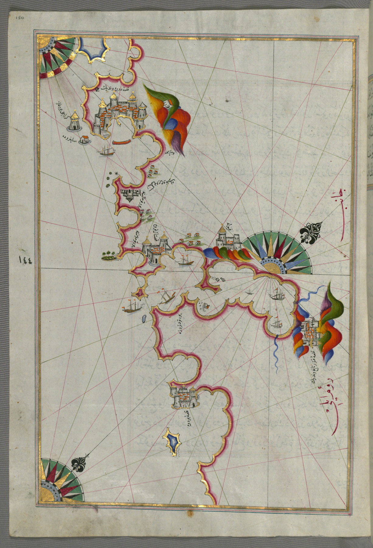
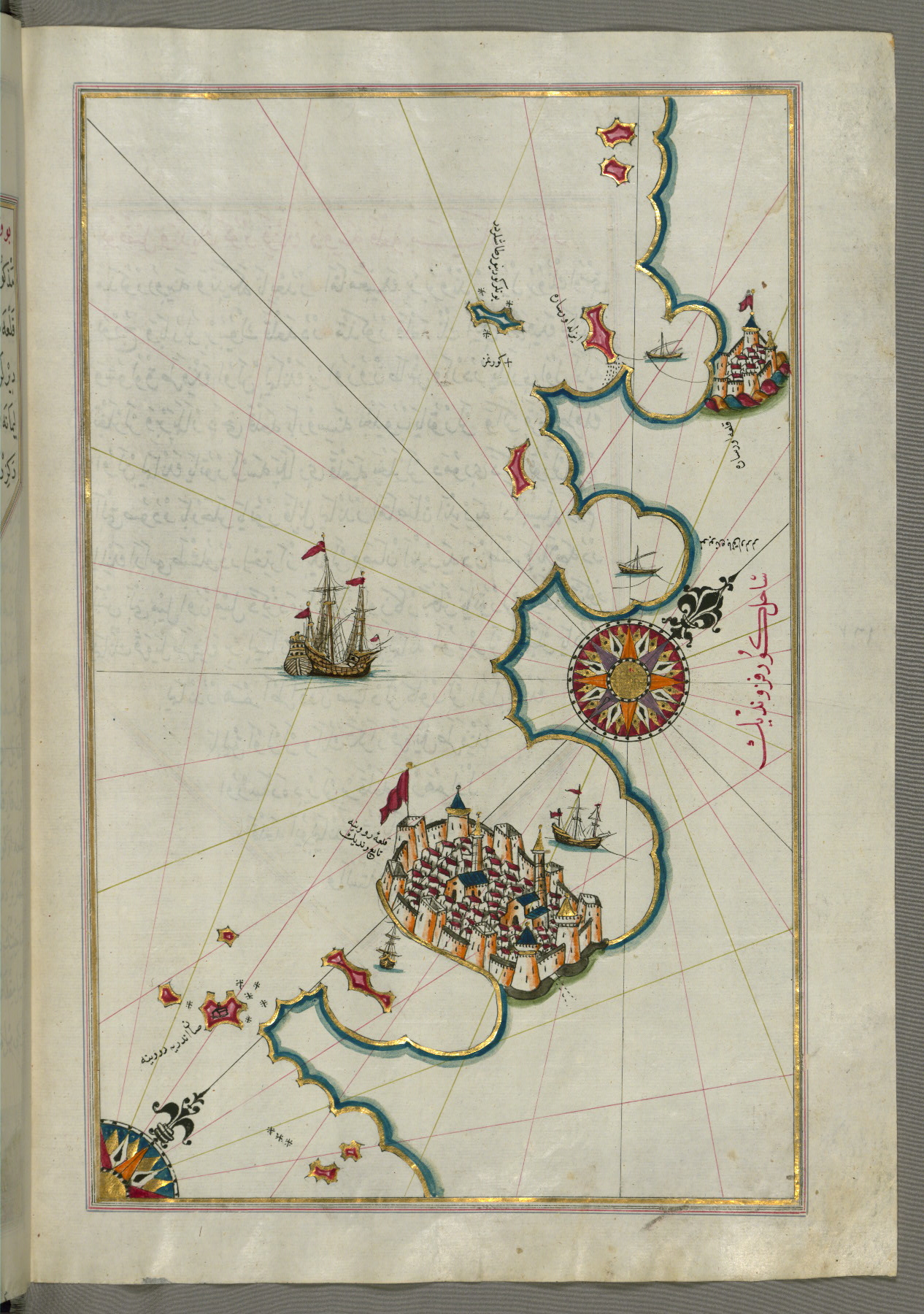
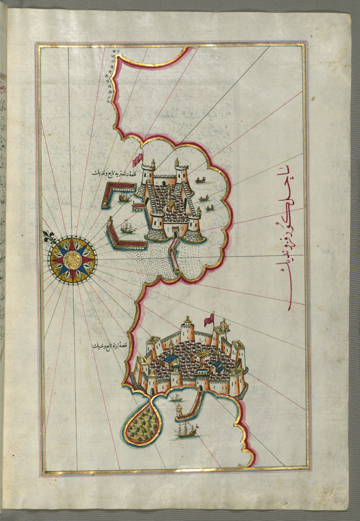
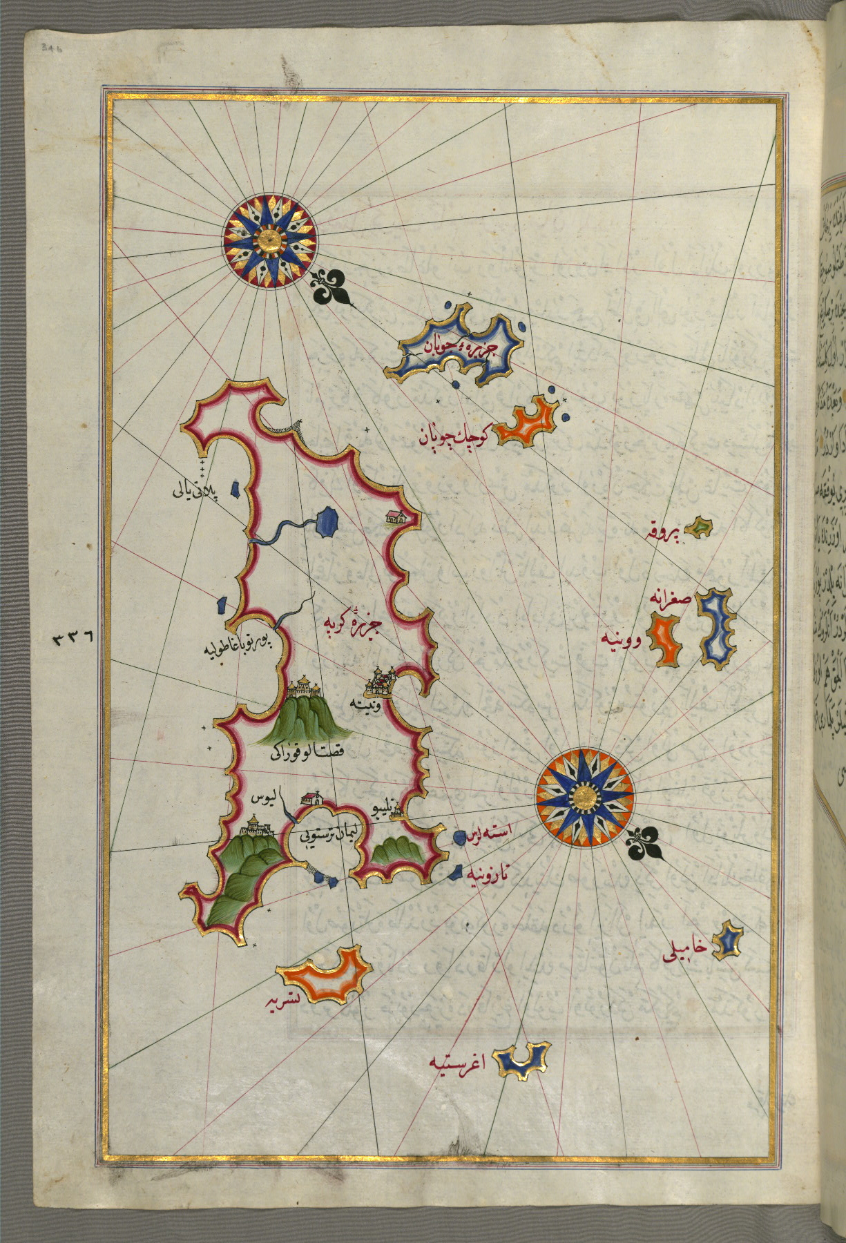
fol. 150a:
- Title: Adriatic coastline from Budva to Dubrovnik
- Form: Illustration
- Label: This map shows the Adriatic coastline from Budva to Dubrovnik (Dūbre Venedīk).
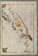
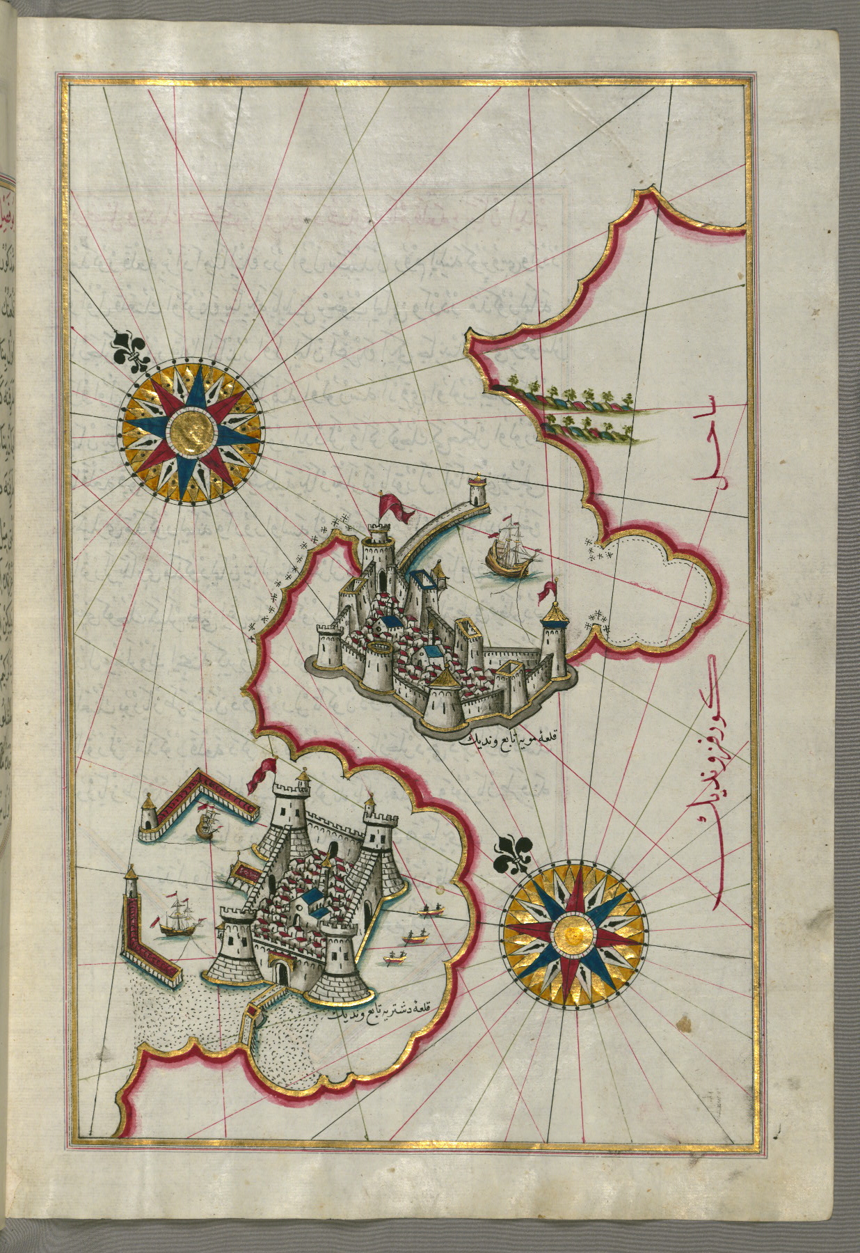
fol. 151b:
- Title: Adriatic coastline north from Dubrovnik
- Form: Illustration
fol. 153a:
- Title: Island of Mljet off Dubrovnik
- Form: Illustration
- Label: This map shows the island of Mljet (Mīlede) off Dubrovnik.
fol. 154b:
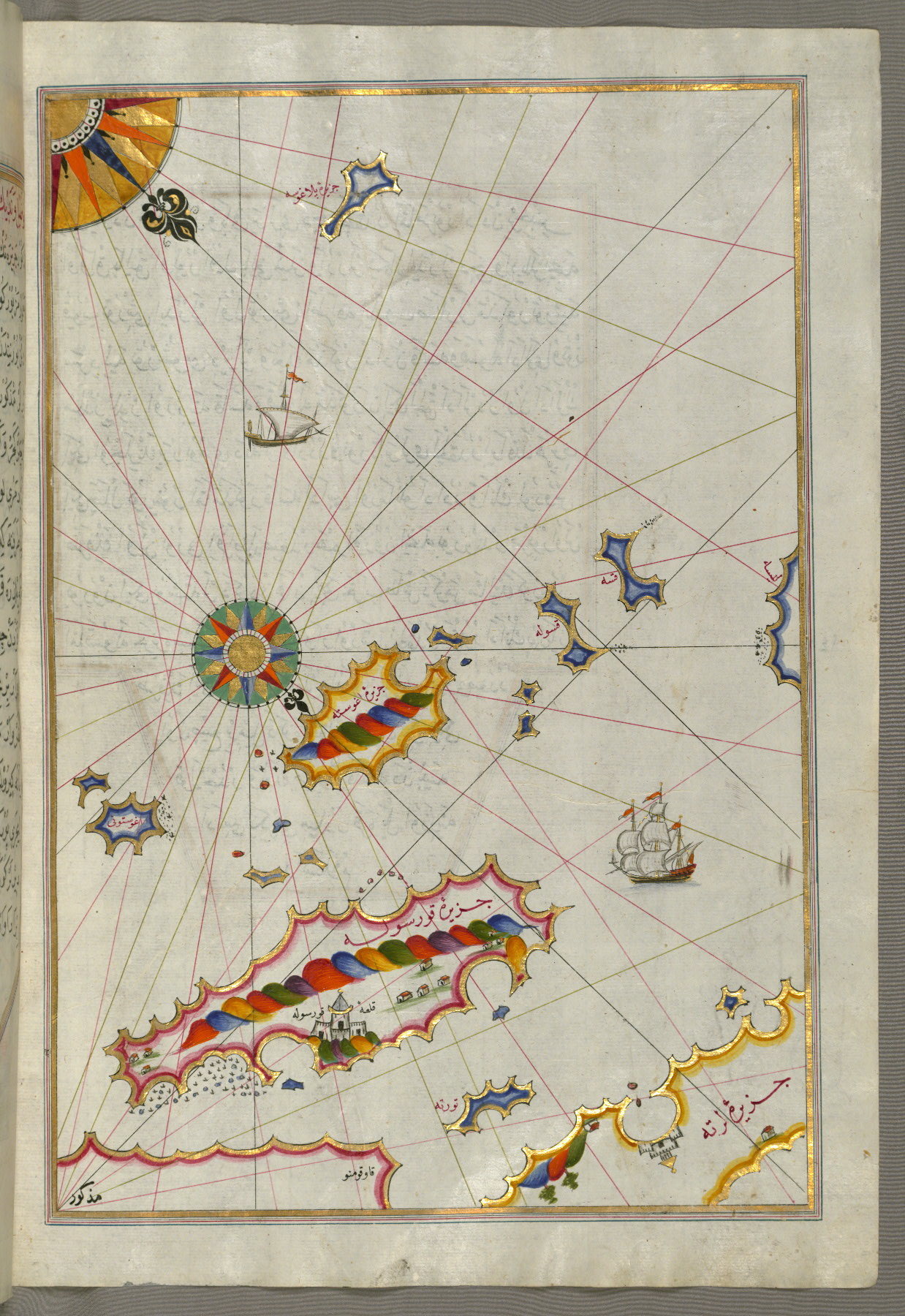
- Title: Dalmatian islands of Korčula and Lastovo off the coast between Dubrovnik and Split
- Form: Illustration
- Label: This shows the Dalmatian islands of Korčula (Qūrsūlah) and Lastovo (Augusta) off the coast between Dubrovnik and Split.
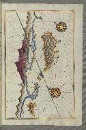
fol. 155b:
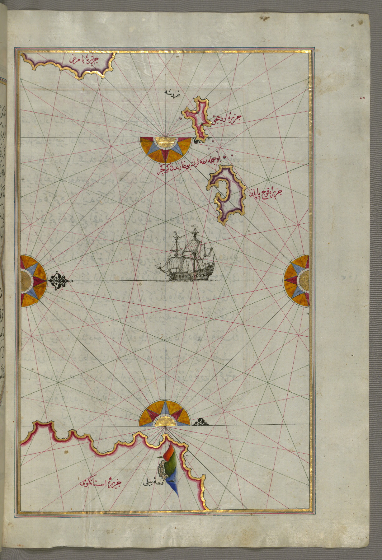
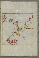
- Title: Two unnamed islands between Dubrovnik and Split
- Form: Illustration
- Label: This map shows two unnamed islands between Dubrovnik and Split.
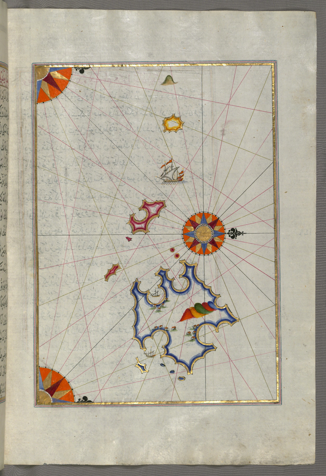
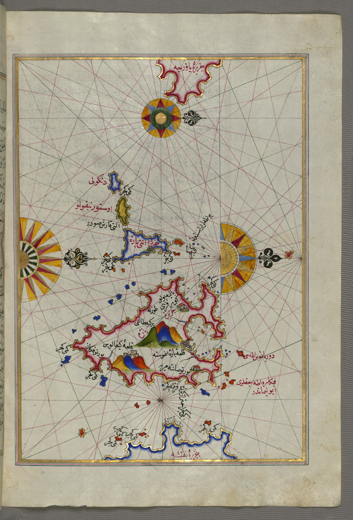
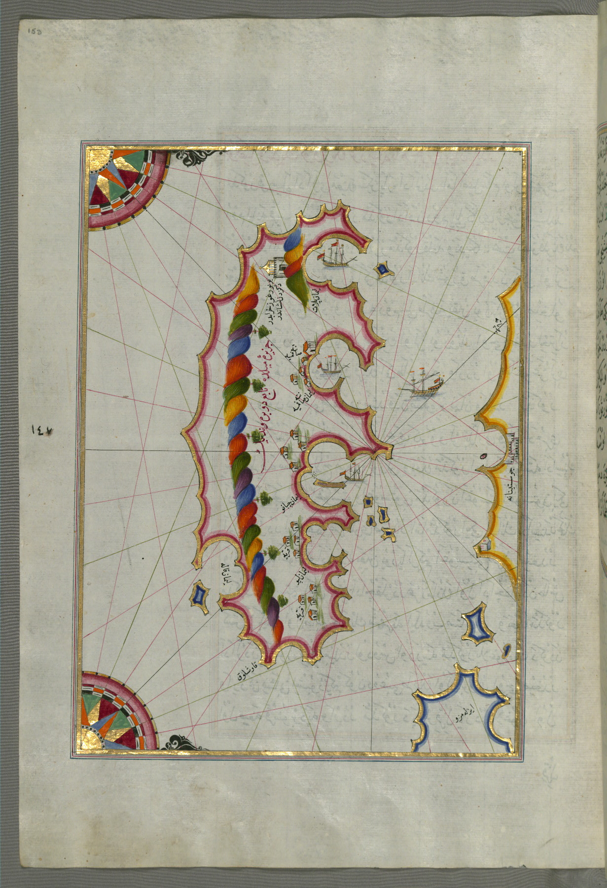
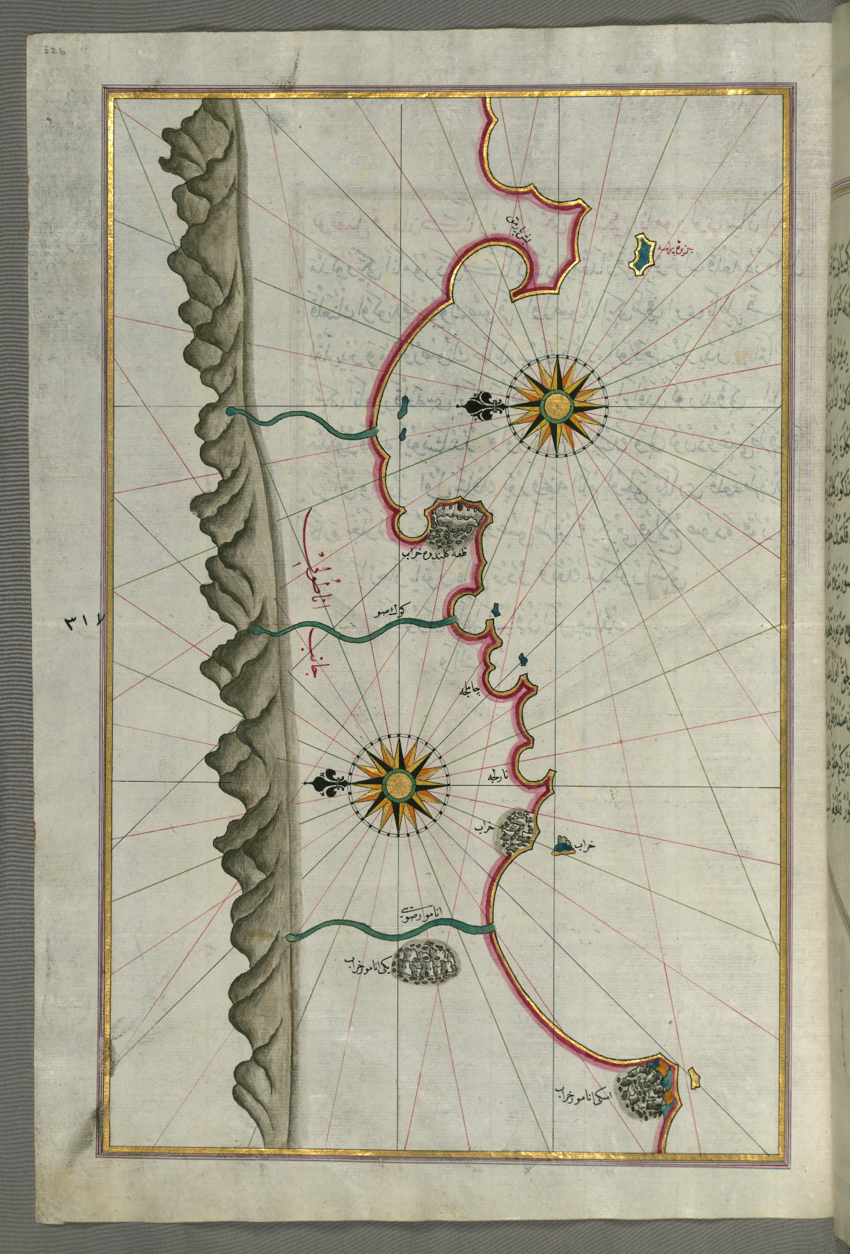
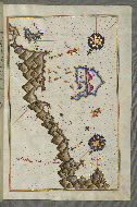
fol. 157a:
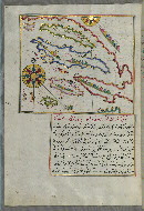
- Title: Group of islands north of Korčula, probably Hvar and Brač
- Form: Illustration
- Label: This map shows a group of islands north of Korčula (Qūrsūlah), probably Hvar and Brač.
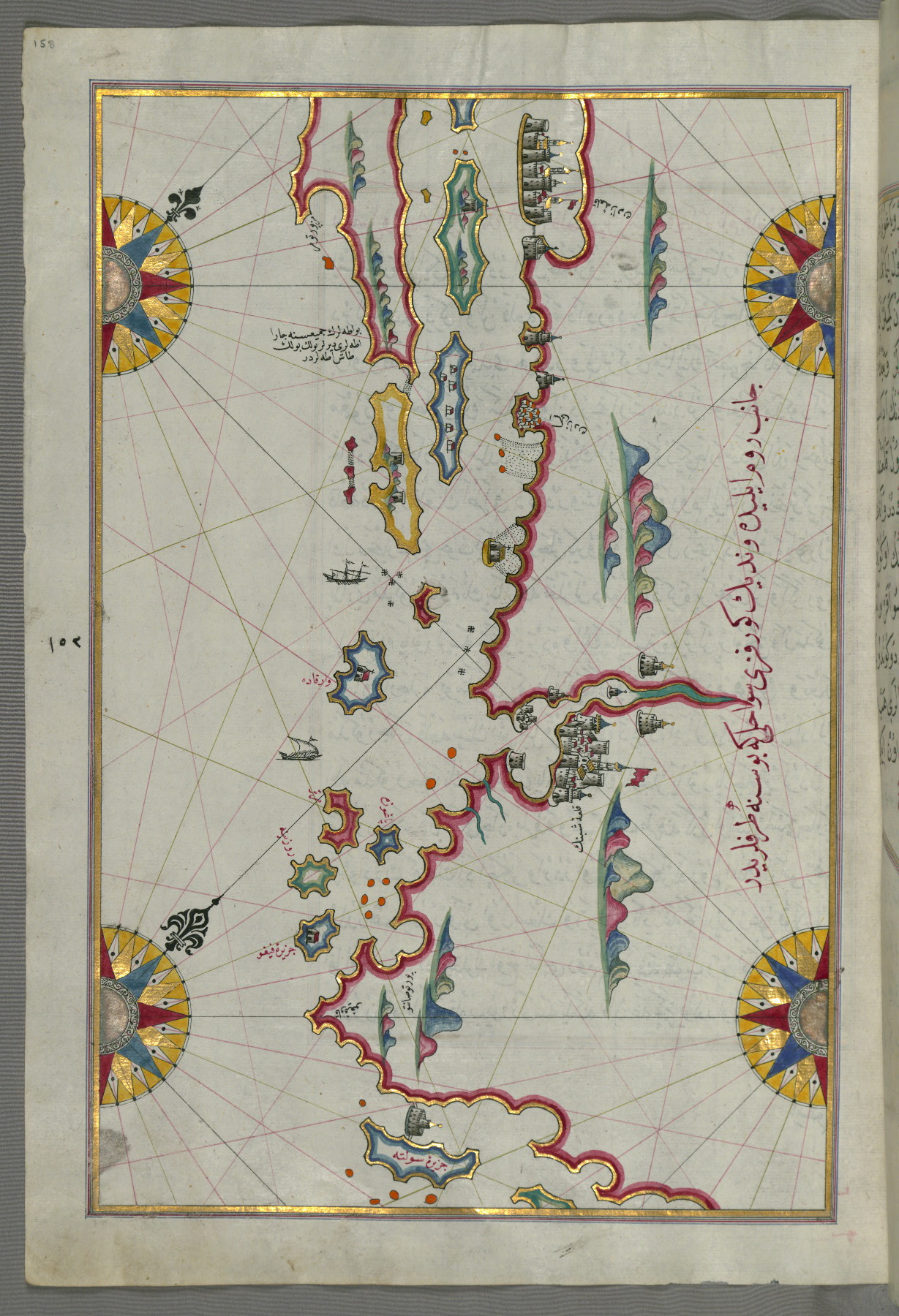
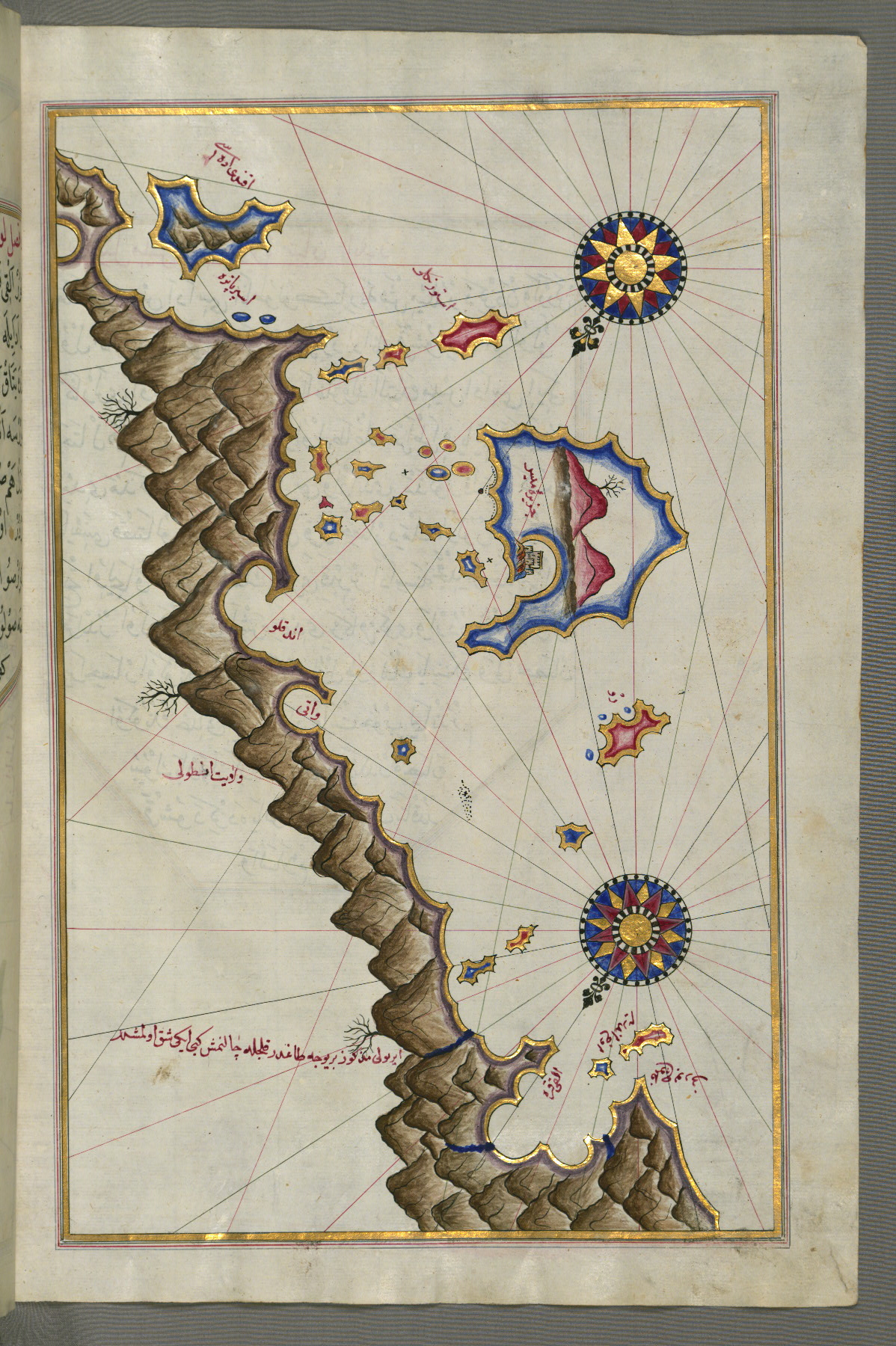
fol. 158a:
- Title: Coastline and islands between Šibenik and Zadar
- Form: Illustration
- Label: This map shows the coastline and islands between Šibenik and Zadar (Zādare).
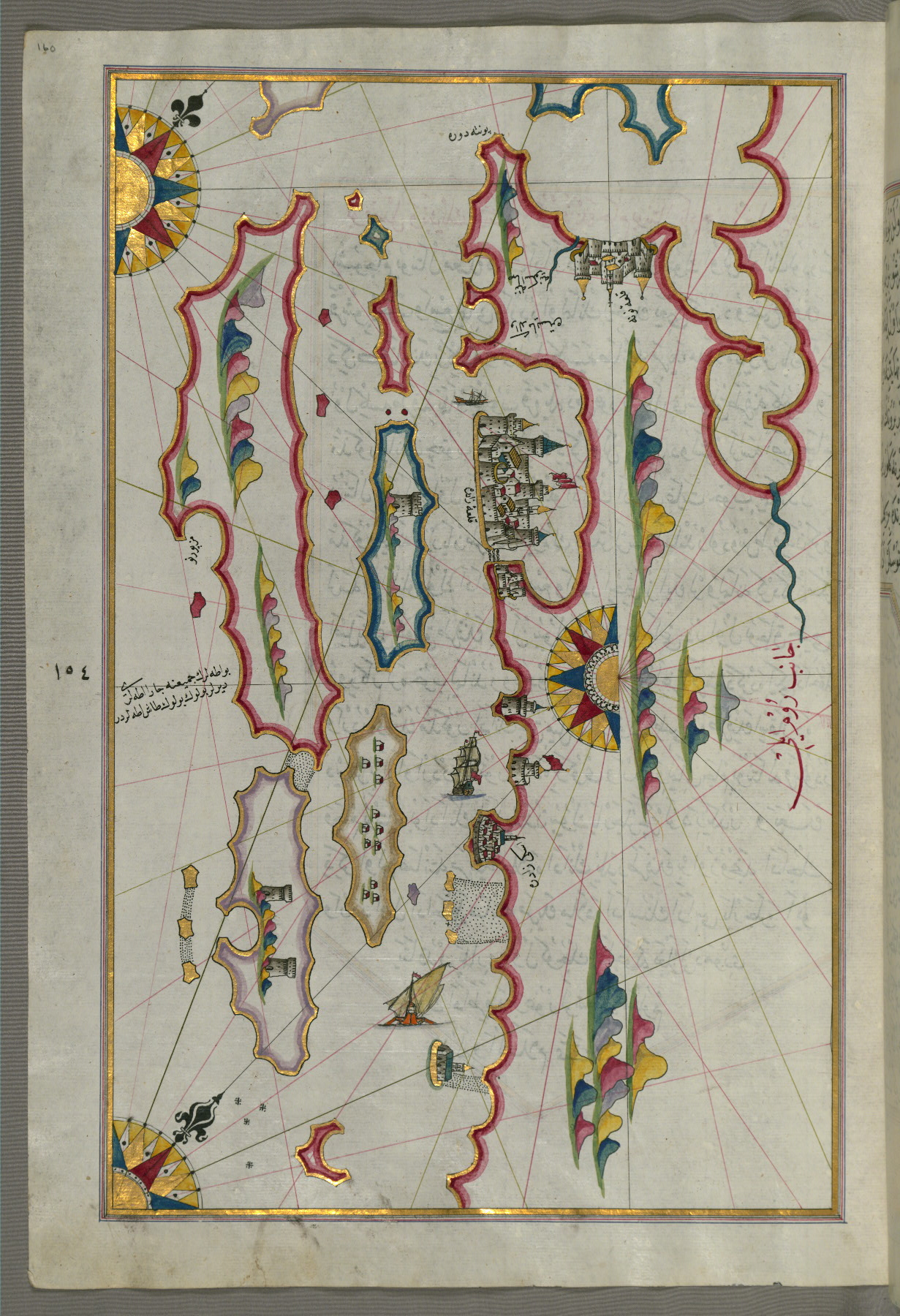
fol. 160a:
- Title: Coastline and islands off Zadar
- Form: Illustration
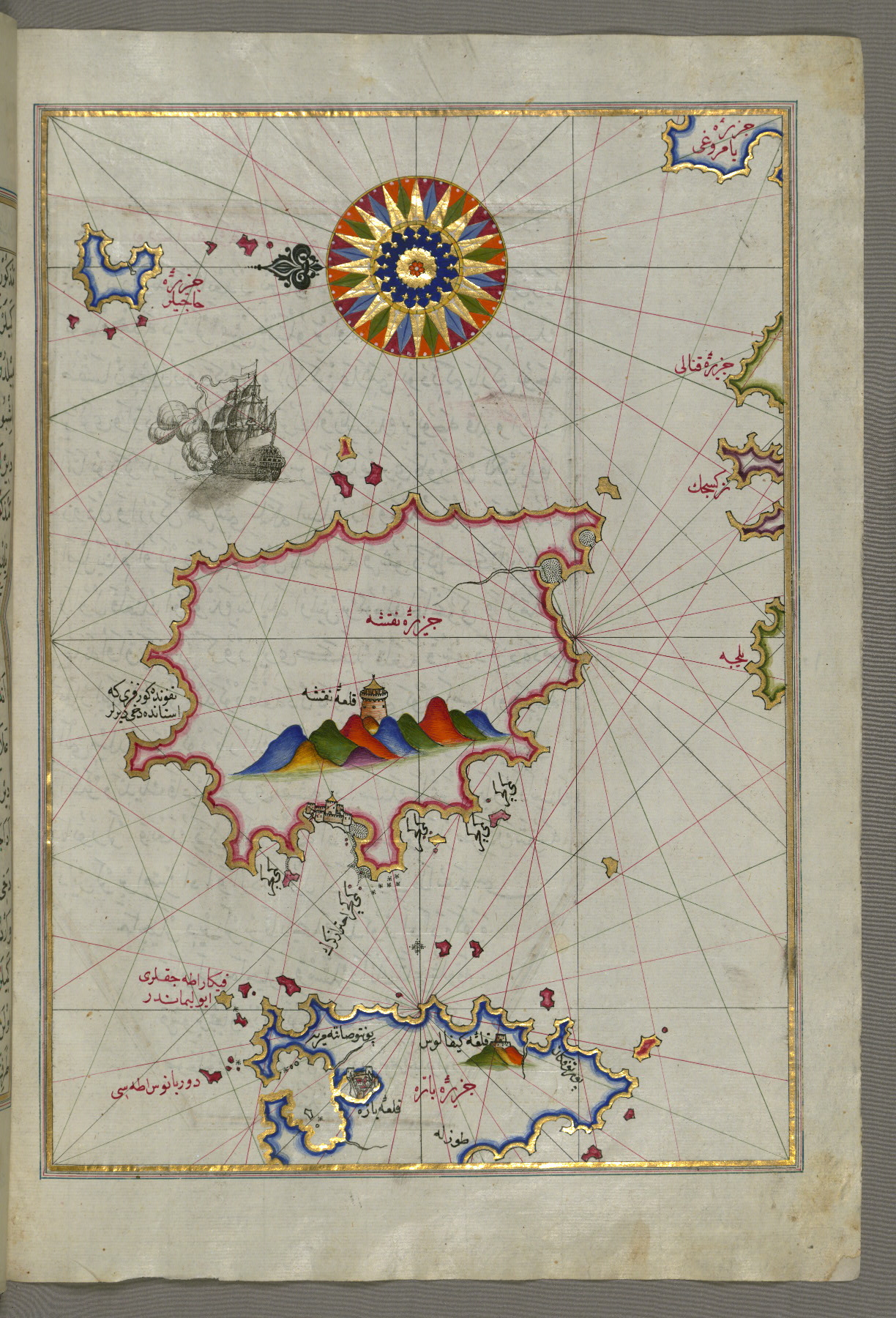
- Label: This map shows the coastline and islands off Zadar (Zādare).
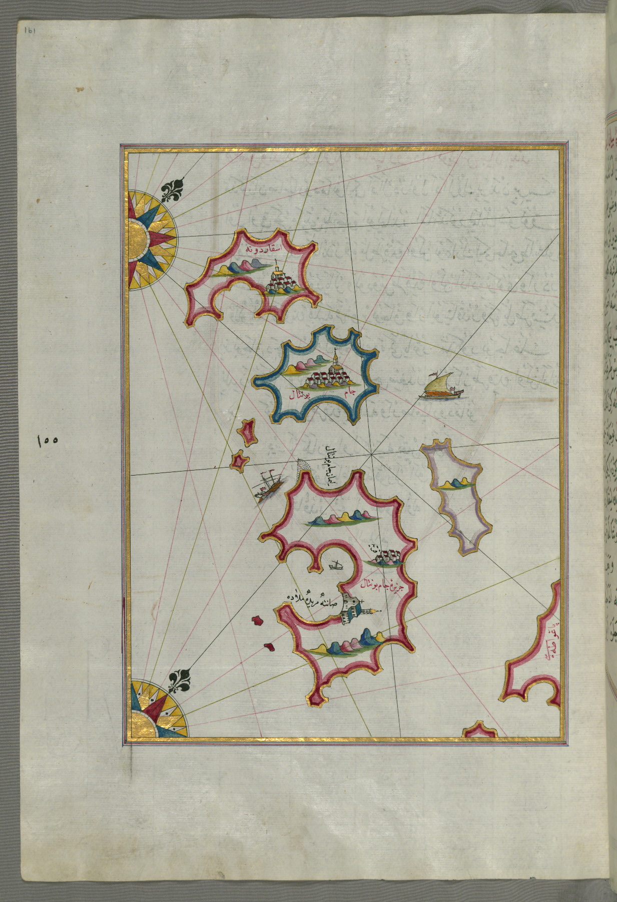
fol. 161a:
- Title: Small islands northwest of the island of Pag
- Form: Illustration
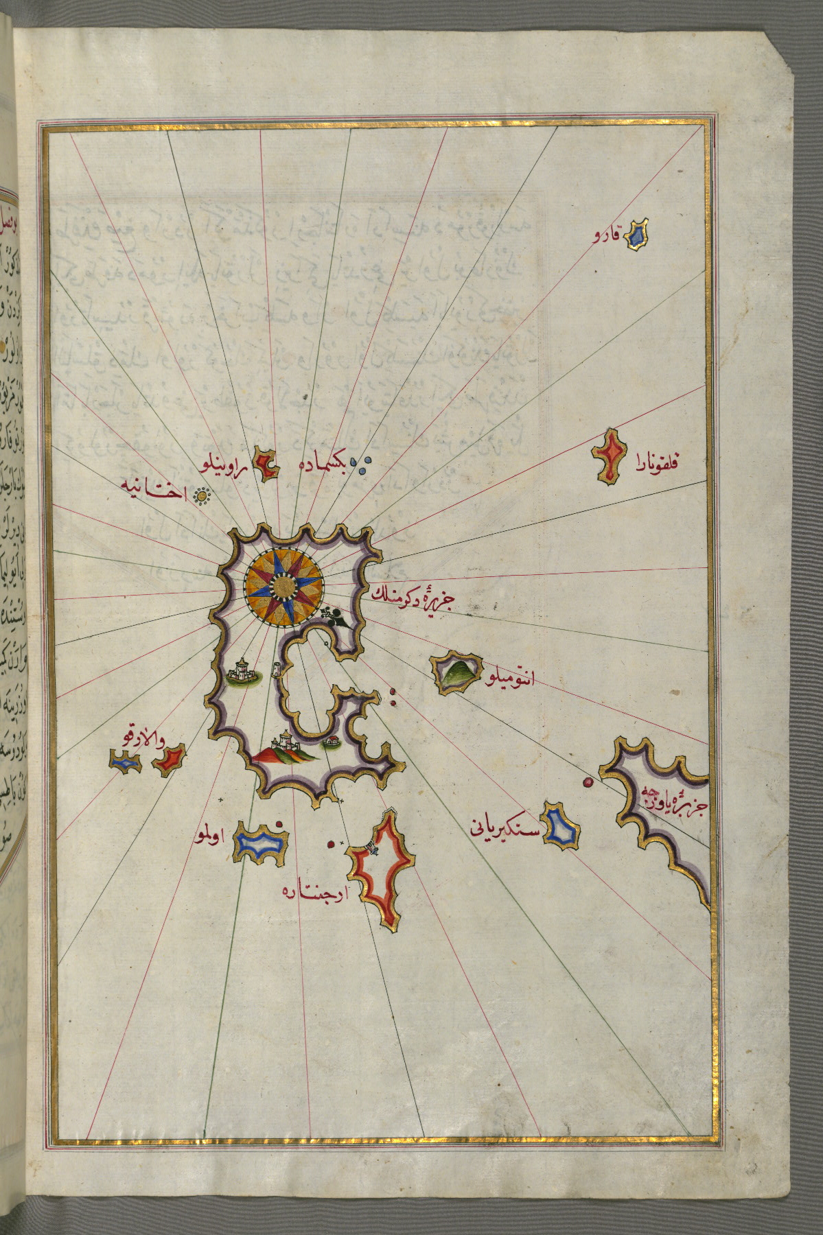
- Label: This map shows small islands northwest of the island of Pag.
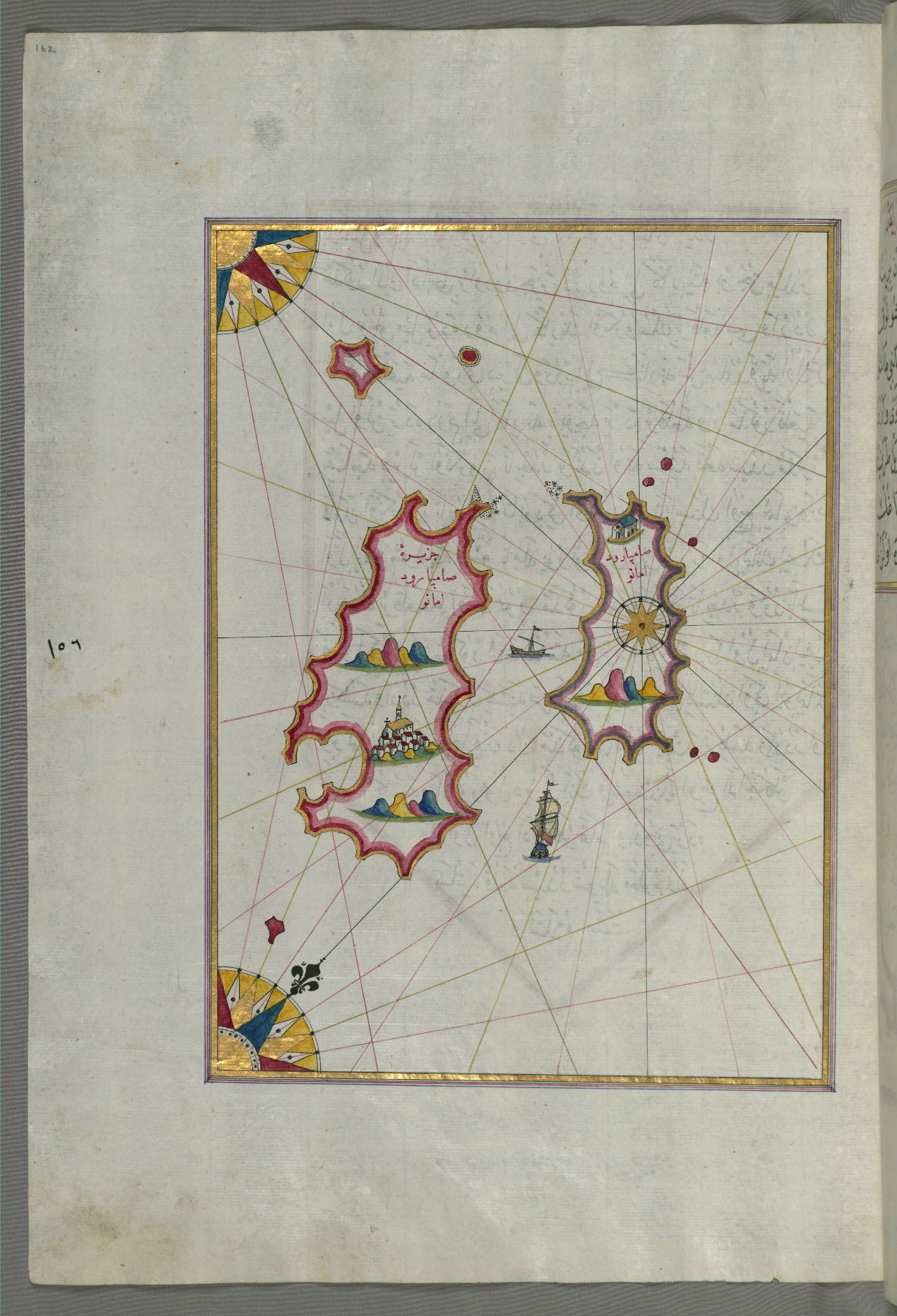
fol. 162a:

- Title: Two as yet unidentified islands in the vicinity of the island of Pag
- Form: Illustration
- Label: This map shows two as yet unidentified islands in the vicinity of the island of Pag.
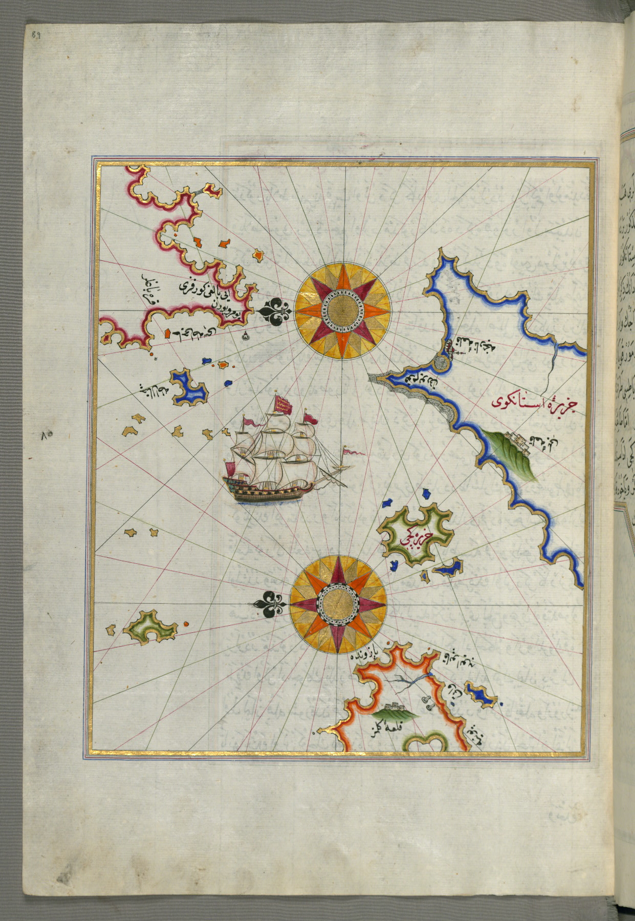
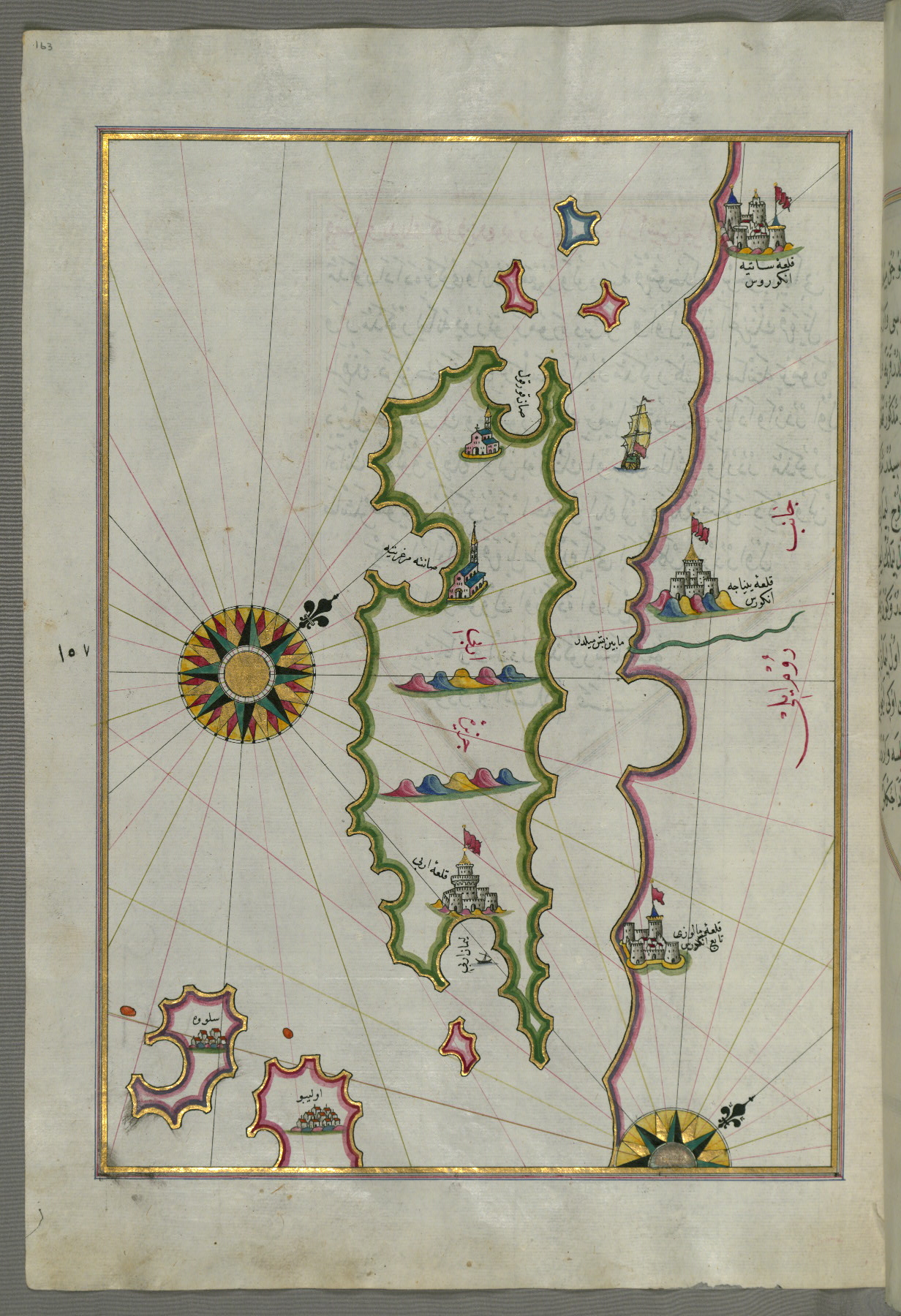
fol. 163a:
- Title: Island of Rab
- Form: Illustration
- Label: This map shows the island of Rab (Arbe).
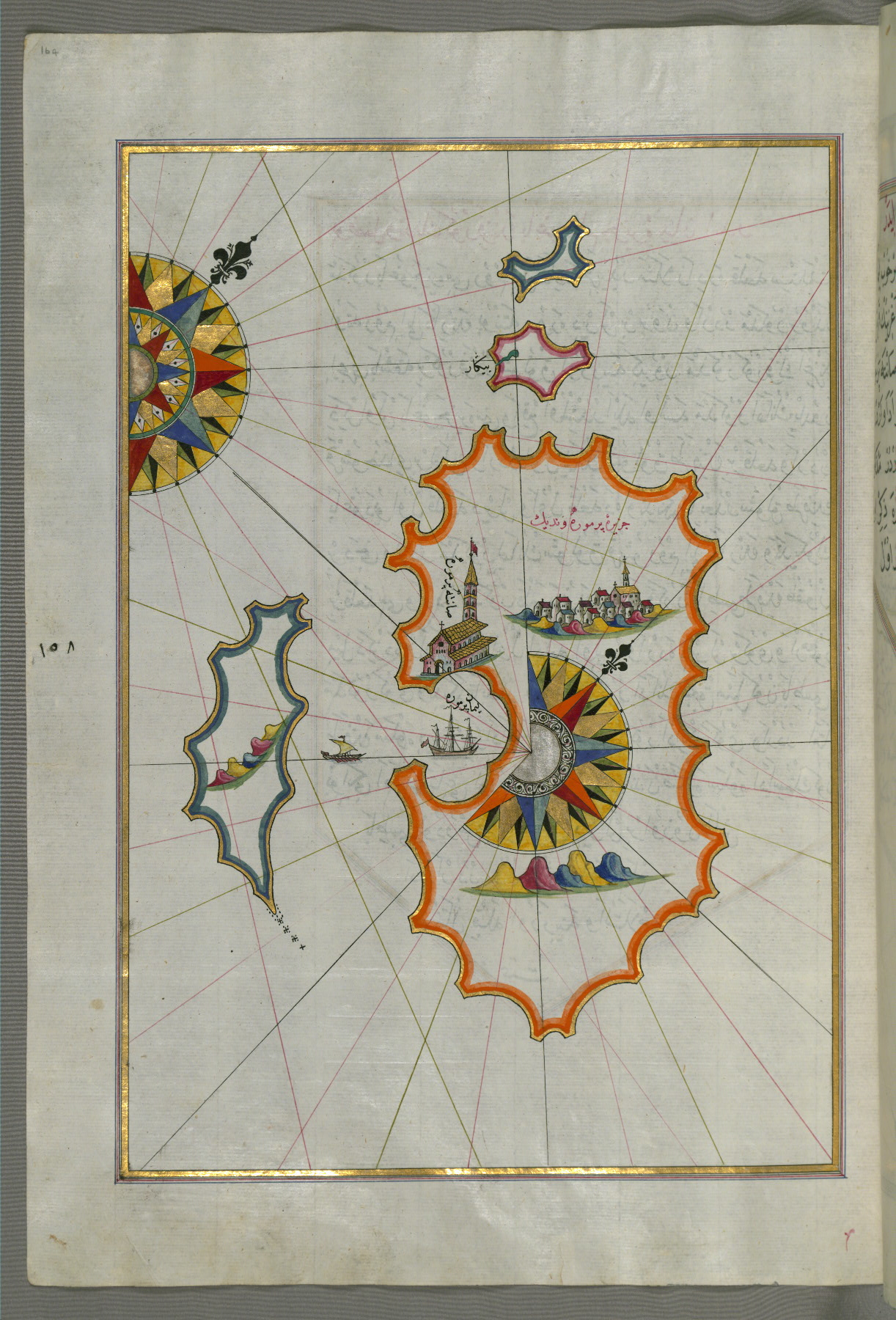
fol. 164a:
- Title: Island of Premuda west of the island of Pag
- Form: Illustration
- Label: This map shows the island of Premuda (Premūde Venedīk) west of the island of Pag.
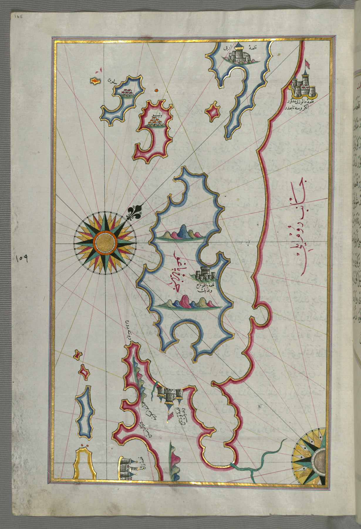
fol. 165a:
- Title: Islands of Pag and Rab
- Form: Illustration
- Label: This map shows the islands of Pag (Pāghū) and Rab (Arbe).
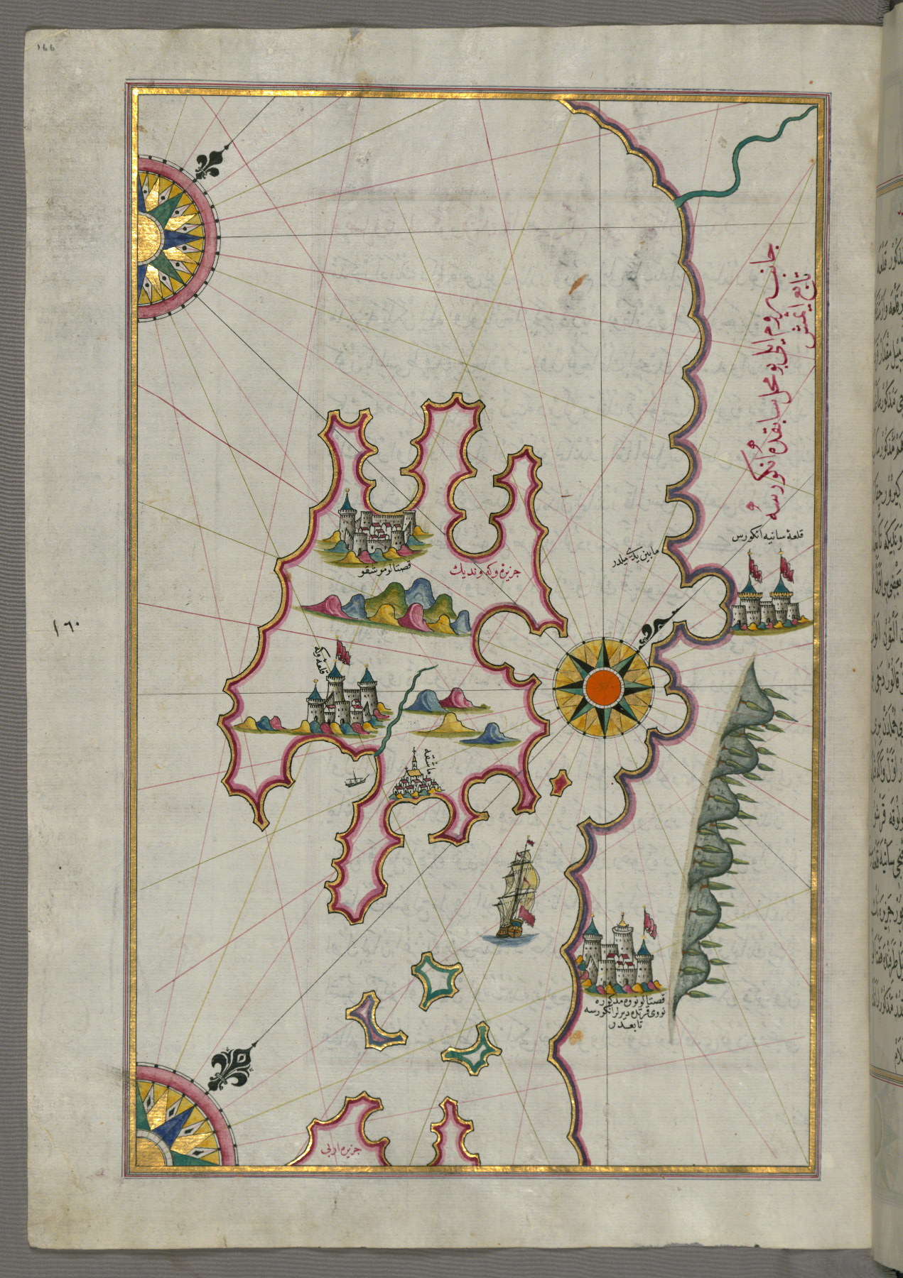
fol. 166a:
- Title: Island of Krk
- Form: Illustration
- Label: This map shows the island of Krk (Veglia, Vake Venedīk).
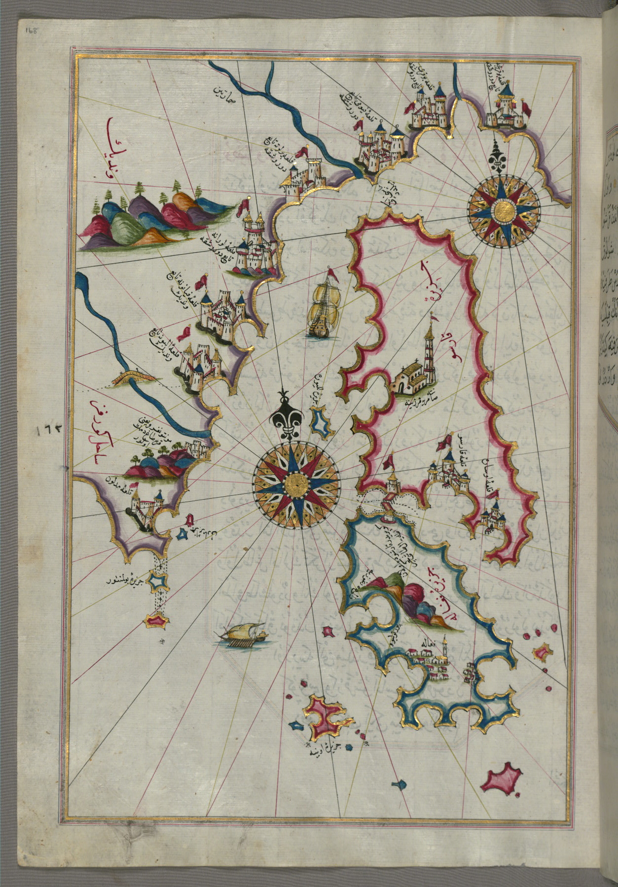
fol. 168a:
- Title: Islands of Cres, Lošinj, and Unije
- Form: Illustration
- Label: This map shows the islands of Cres (Cherso, Qārsū), Lošinj (Feghāle), and Unije.
fol. 169a:
- Title: Island of Unije south of the island of Lošinj
- Form: Illustration
- Label: This map shows the island of Unije (Uniye) south of the island of Lošinj (Feghāle).

fol. 170a:
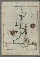
- Title: Coastline north of the Medulin fortress
- Form: Illustration
- Label: This map shows the coastline north of the Medulin fortress.
fol. 171a:
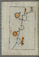
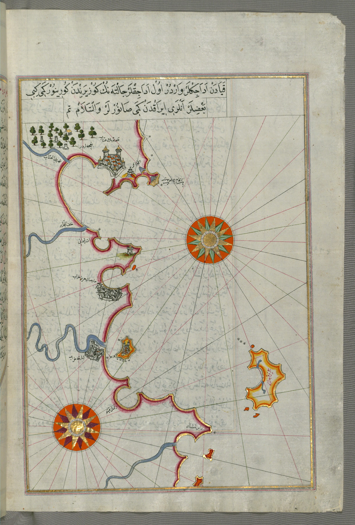
- Title: Coastline from Medulin as far as Pula
- Form: Illustration
fol. 172b:
- Title: Coastline from Pula to Rovinj
- Form: Illustration
- Label: This map shows the coastline from Pula to Rovinj (Rūvinye).
fol. 173b:
- Title: Coastline from Rovinj north
- Form: Illustration
fol. 174b:
- Title: Coastline from Rovinj as far as the fortress of Poreč
- Form: Illustration
- Label: This map shows the coastline from Rovinj as far as the fortress of Poreč (Parenzo, Brānse).
fol. 175b:
- Title: Coastline from Poreč as far as Novi Grad
- Form: Illustration
- Label: This map shows the coastline from Poreč (Parenzo, Brānse) as far as Novi Grad.

fol. 176b:
- Title: Coastline from Novi Grad as far as Umag
- Form: Illustration
- Label: This map shows the coastline from Novi Grad as far as Umag (Umago, Ūmāghū).

fol. 177b:
- Title: Coastline from Umag as far as Piran
- Form: Illustration
- Label: This map shows the coastline from Umag (Umago, Ūmāghū) as far as Piran (Pirānū).
fol. 178b:
- Title: Coastline from Piran as far as Izola
- Form: Illustration
- Label: This map shows the coastline from Piran (Pirānū) as far as Izola (Īzele).
fol. 179b:
- Title: Coastline from Izola as far as Koper
- Form: Illustration
- Label: This map shows the coastline from Izola (Īzele) as far as Koper (Capodistria, Dishtriye).
fol. 180b:
- Title: Coastline between the cities of Koper and Muggia
- Form: Illustration
- Label: This map shows the coastline between the cities of Koper (Capodistria, Dishtriye) and Muggia (Milje, Mūye).
fol. 181b:

- Title: Coastline from Muggia to Trieste
- Form: Illustration
- Label: This map shows the coastline from Muggia (Milje, Mūye) to Trieste (Rishtī).
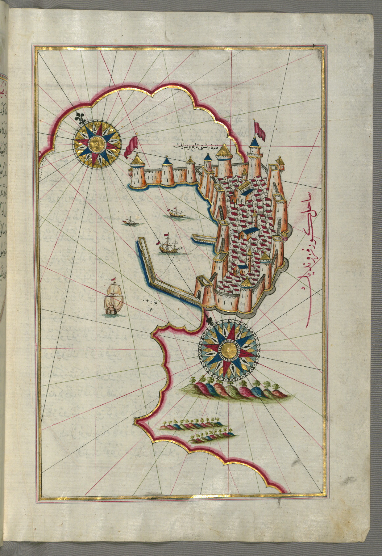
fol. 182b:
- Title: Fortress of Trieste
- Form: Illustration
- Label: This map shows the fortress of Trieste (Rishtī).
fol. 183b:
- Title: Coastline from Marano to Caorle in the province of Venice
- Form: Illustration
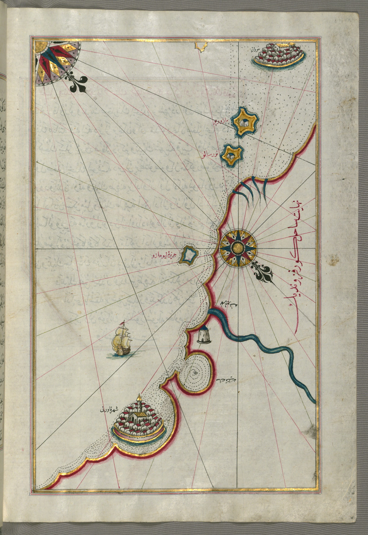
- Label: This map shows the coastline from Marano (Mūrān) to Caorle (Qāvarlī) in the province of Venice.
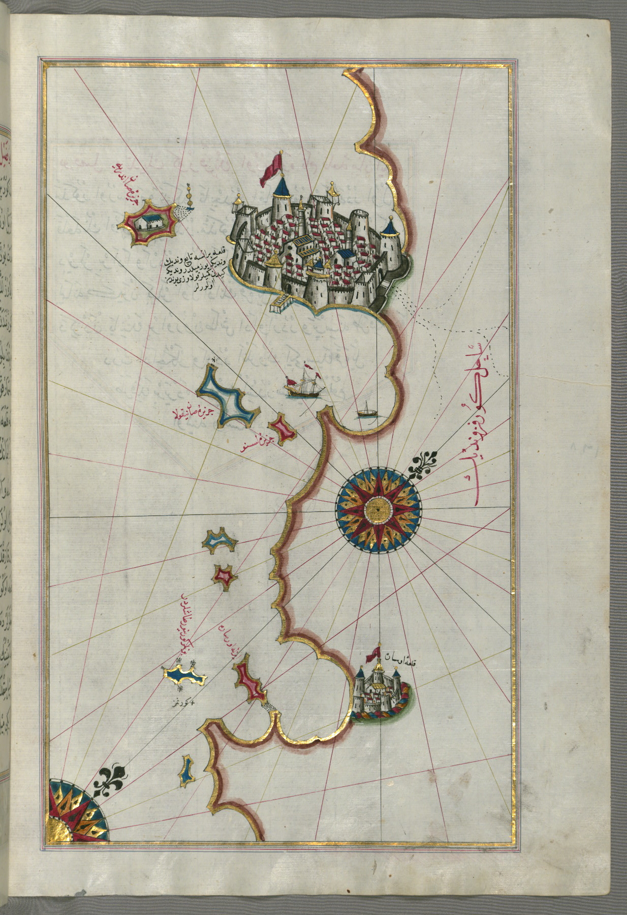
fol. 185b:
- Title: Eastern part of the city of Venice
- Form: Illustration
- Label: This map shows the eastern part of the city of Venice (Venedīk).

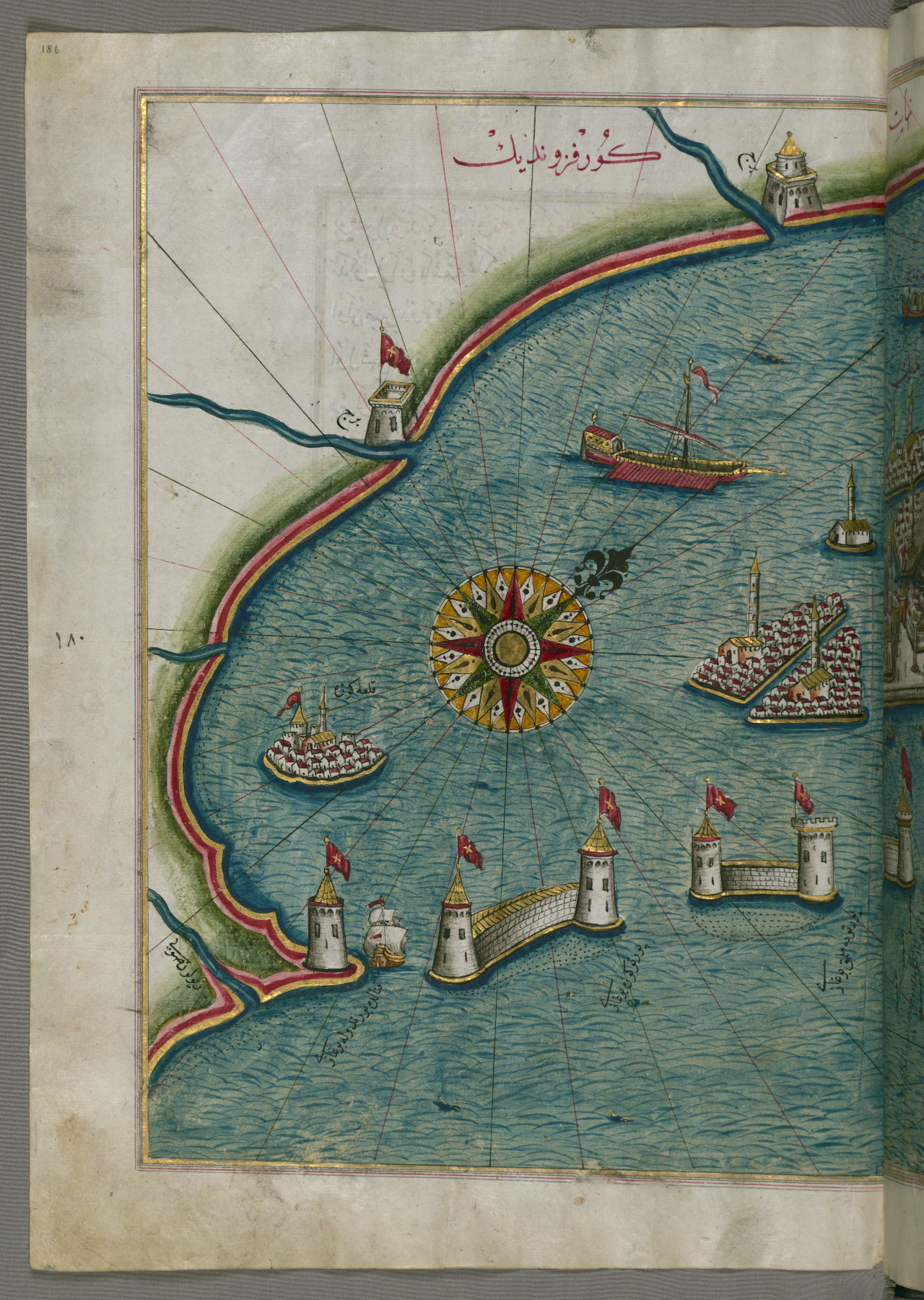
fol. 186a:
- Title: Western part of the city of Venice
- Form: Illustration
- Label: This map shows the western part of the city of Venice (Venedīk).
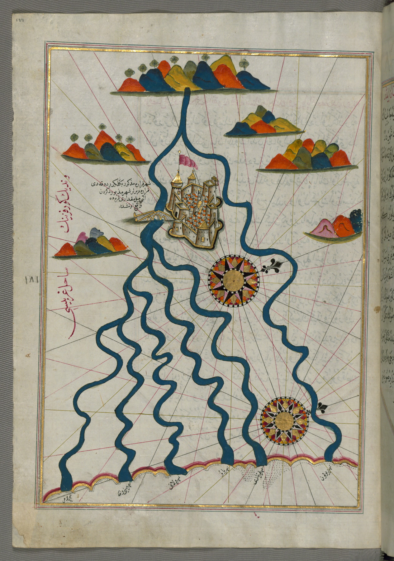
fol. 187a:
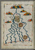
- Title: The city of Ferrara with the six rivers flowing into the Gulf of Venice
- Form: Illustration
fol. 188a:
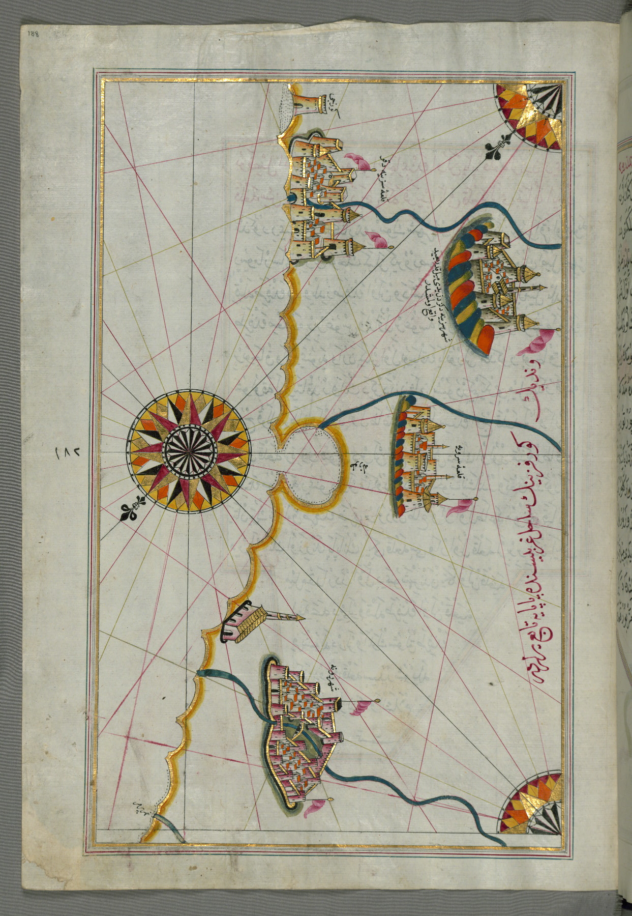
- Title: Italian coastline with the cities of Ravenna and Cesena
- Form: Illustration
- Label: This map shows the Italian coastline with the cities of Ravenna (Ruvenne) and Cesena (Sazīne).
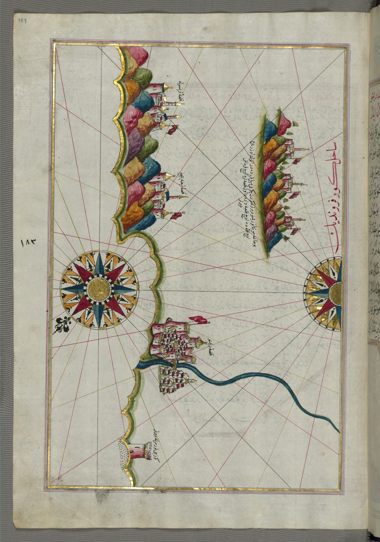
fol. 189a:
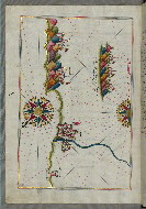
- Title: Italian coastline from Rimini south towards Pesaro
- Form: Illustration
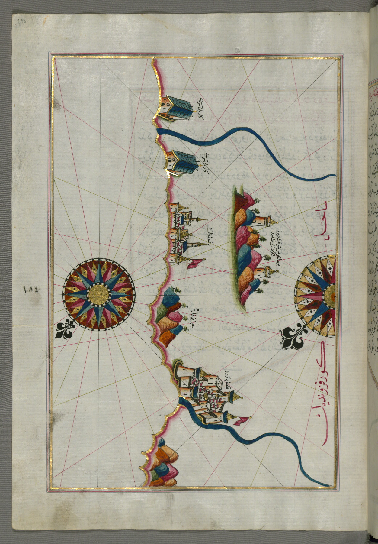
fol. 190a:
- Title: Italian coastline from Pesaro south
- Form: Illustration
- Label: This map shows the Italian coastline from Pesaro (Pāzarū) south.
fol. 191a:
- Title: Town of Urbino and surrounding area
- Form: Illustration
fol. 192a:
- Title: Fortress of Ancona and surrounding area
- Form: Illustration
- Label: This map shows the fortress of Ancona (Anqūnah) and the surrounding area.
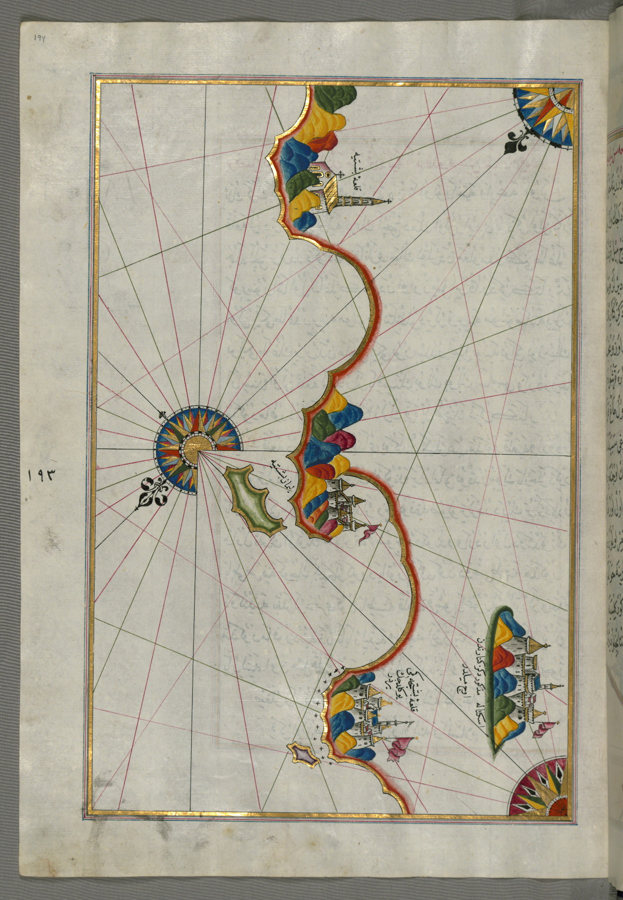
fol. 193a:
- Title: Fortresses and towns south of Ancona, including Loreto
- Form: Illustration

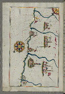
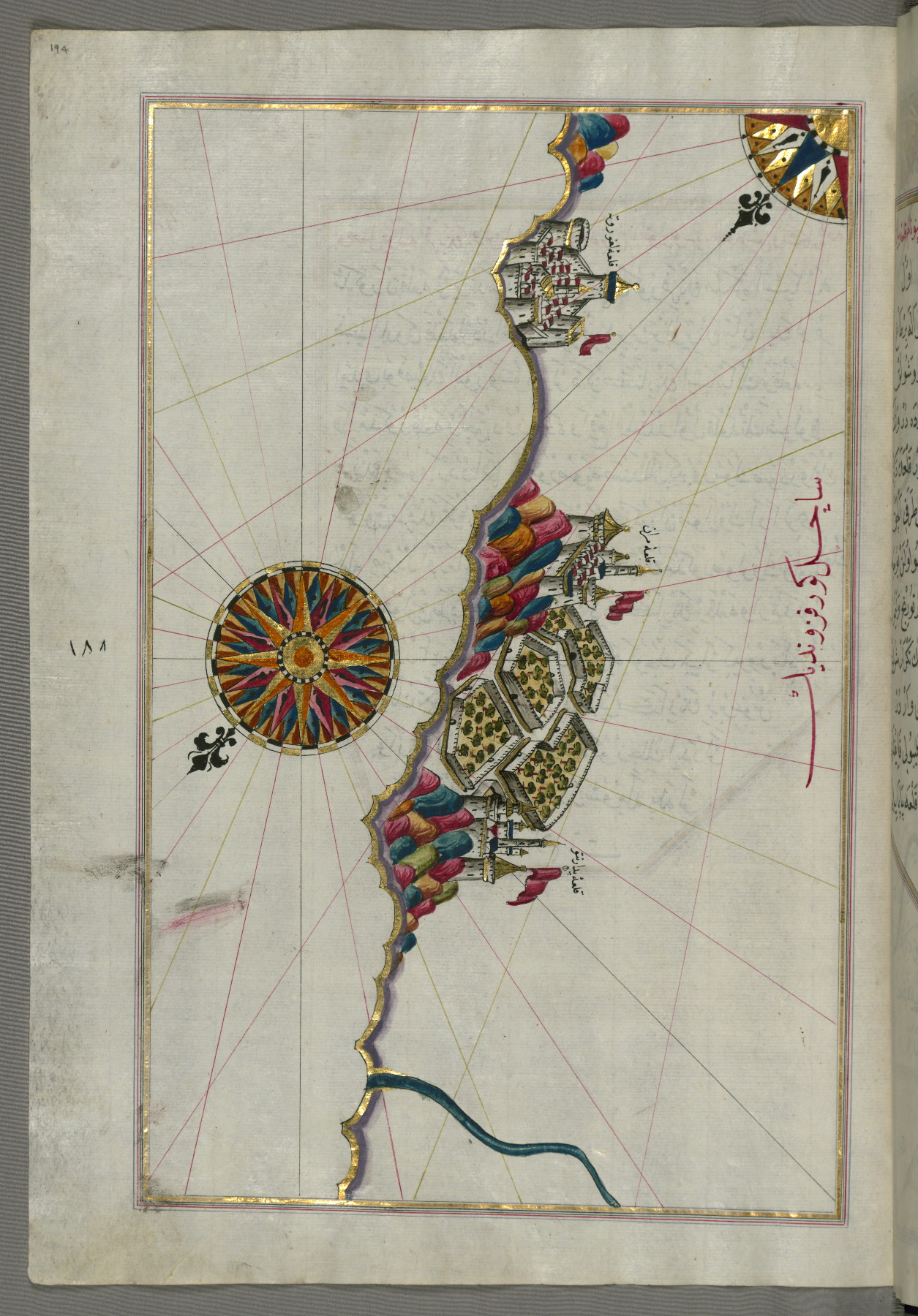
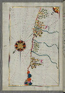
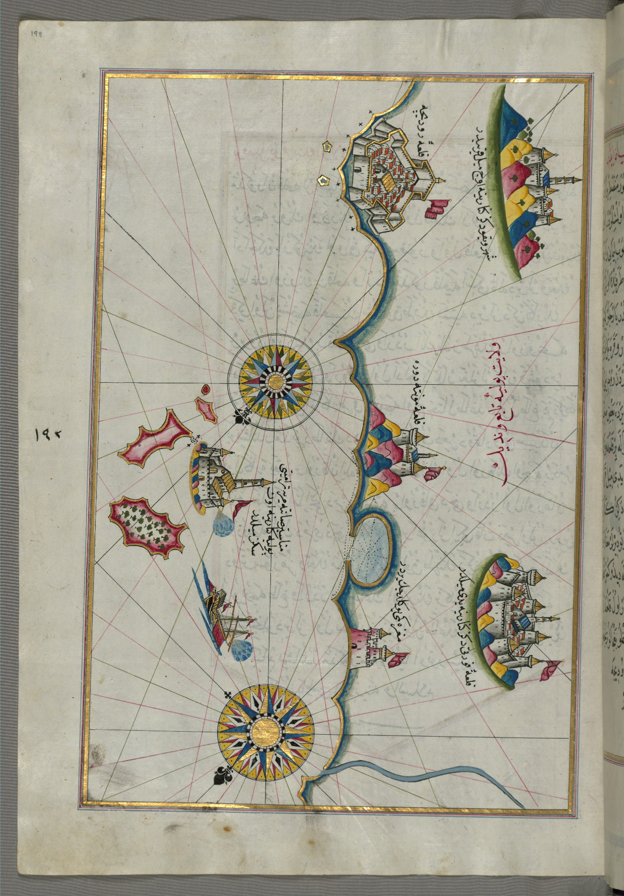
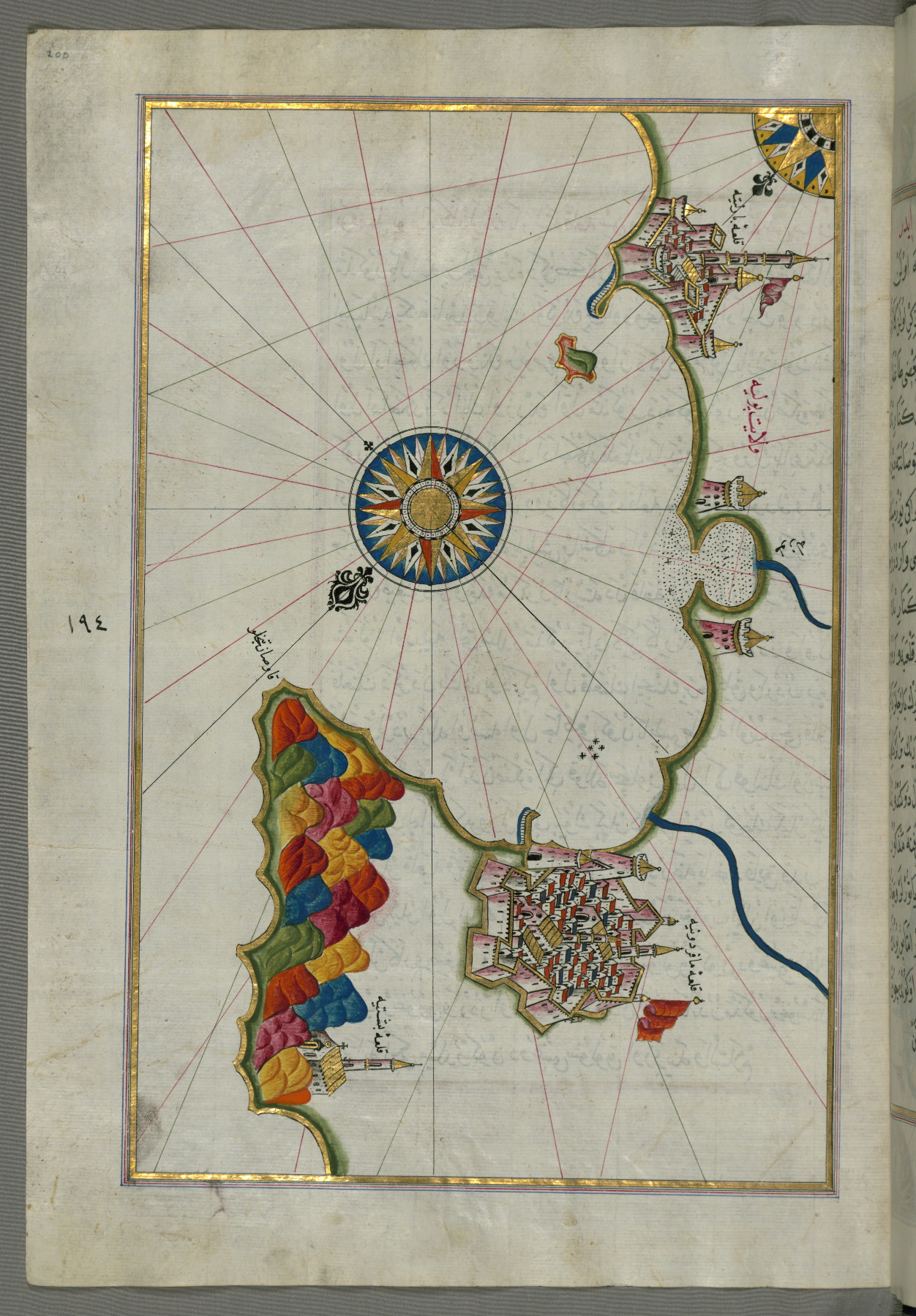
fol. 194a:
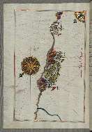
- Title: Italian coastline south of Ancona including Tronto (?)
- Form: Illustration
- Label: This map shows the Italian coastline south of Ancona including Tronto (Padārantū) (?).
fol. 195a:
- Title: Italian coastline south of Ancona as far as the town of Pescara
- Form: Illustration
- Label: This map shows the Italian coastline south of Ancona as far as the town of Pescara (Beshāre).

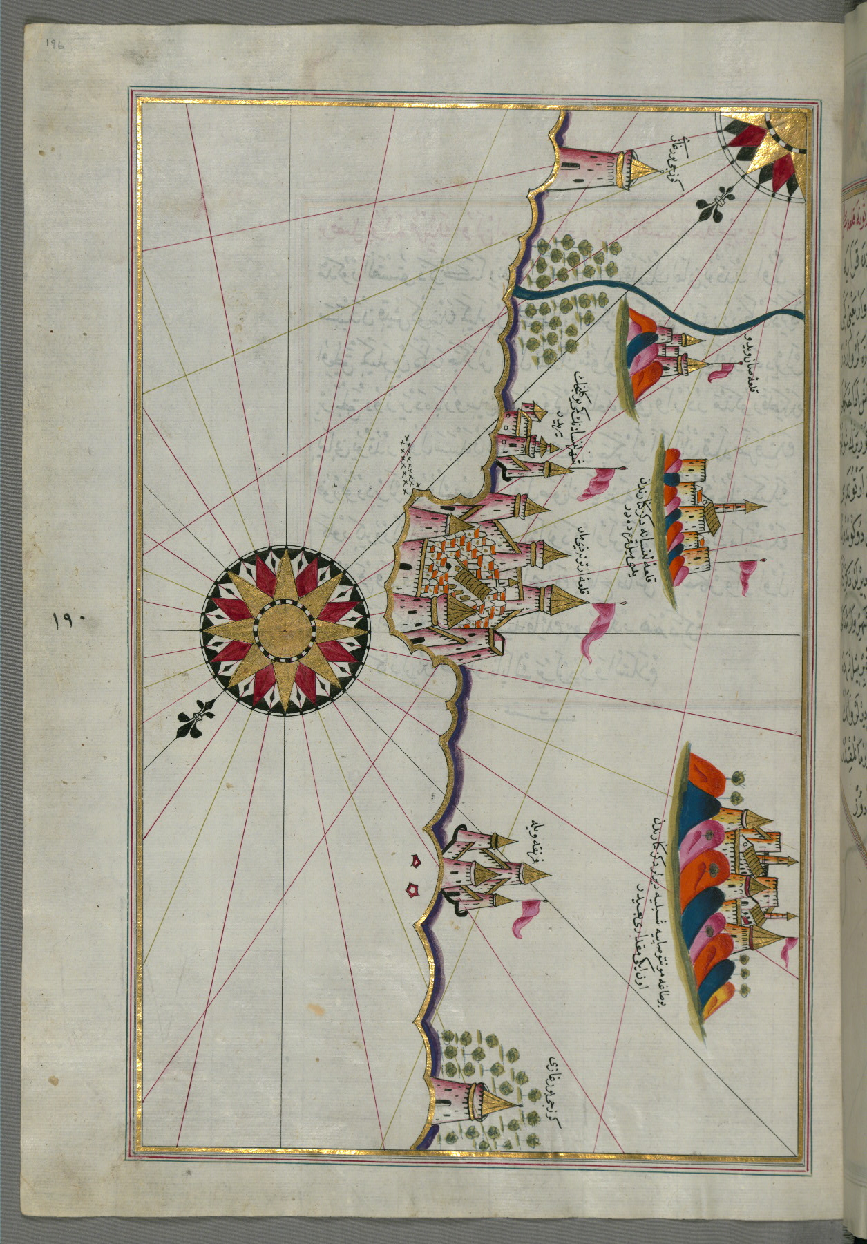
fol. 196a:
- Title: Town of Lanciano and surrounding fortresses
- Form: Illustration
- Label: This map shows the town of Lanciano (Lansāne) and the surrounding fortresses.
fol. 197a:
- Title: Towns of Vasto and Termoli on the Italian coast
- Form: Illustration

fol. 198a:
- Title: Italian coastline between Termoli and Peschici
- Form: Illustration
fol. 199a:
- Title: Italian coastline around Peschici north of Mafredonia
- Form: Illustration
fol. 200a:
- Title: Italian coastline from Mafredonia as far as Barletta
- Form: Illustration
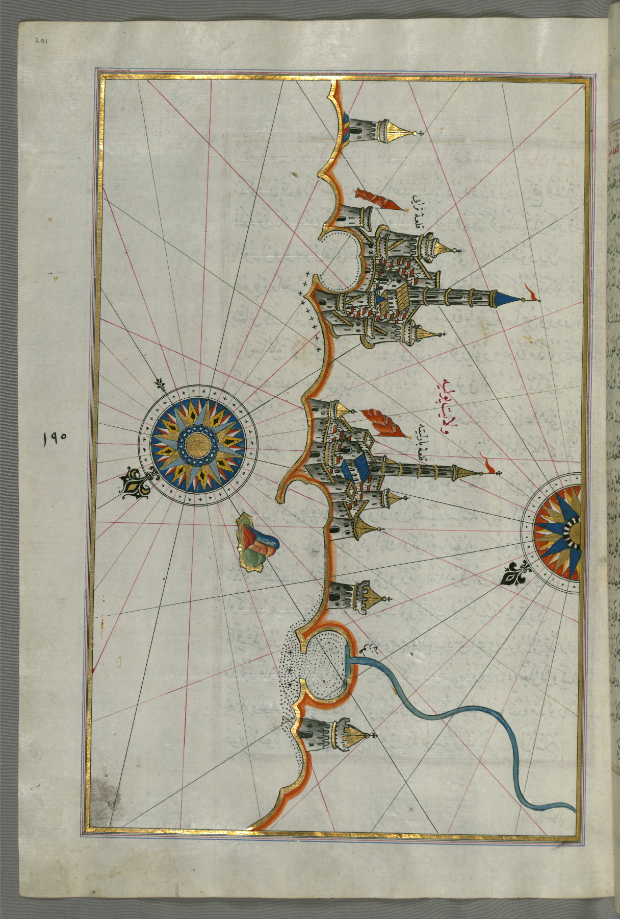
fol. 201a:
- Title: Italian coastline from Barletta to Trani
- Form: Illustration
fol. 202a:
- Title: Italian coastline from Trani as far as Molfetta
- Form: Illustration
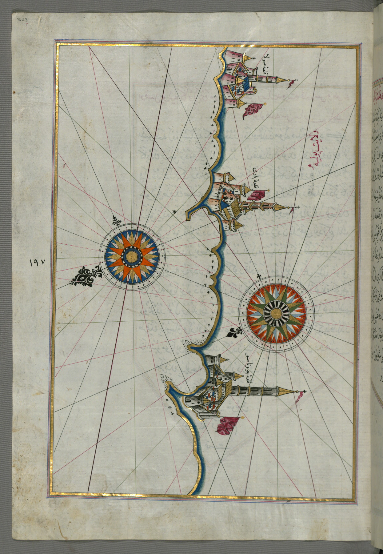
fol. 203a:
- Title: Town of Bari and surrounding area
- Form: Illustration
fol. 204a:
- Title: Italian coastline around Monopoli south of Bari
- Form: Illustration
- Label: This map shows the Italian coastline around Monopoli (Mūnābūlū) south of Bari.

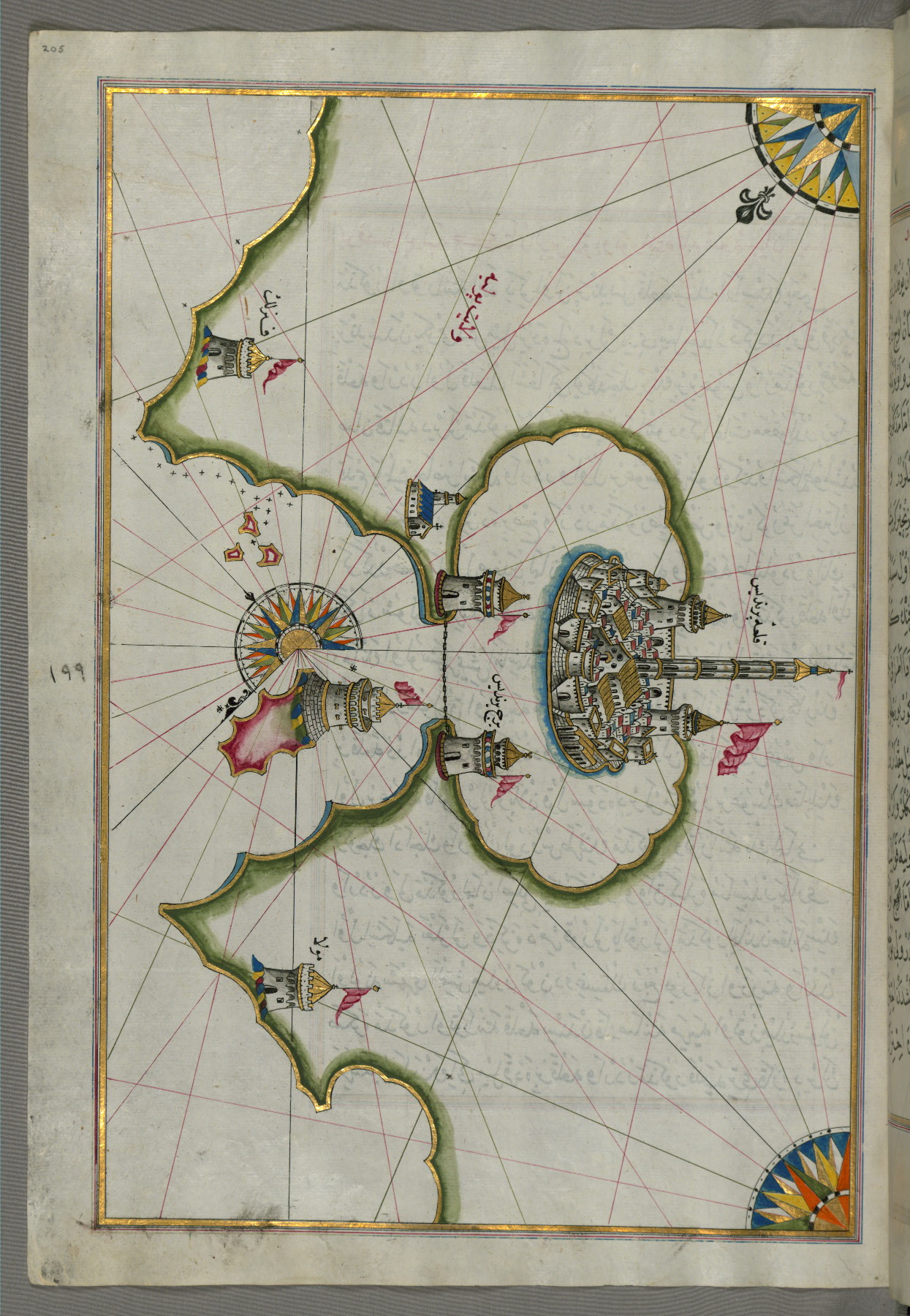
fol. 205a:
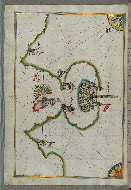
- Title: Port of Brindisi
- Form: Illustration
- Label: This map shows the port of Brindisi (Parindīs).
fol. 206b:
- Title: Italian coastline from Lecce to Gallipoli (toward the Gulf of Taranto)
- Form: Illustration
- Label: This map shows the Italian coastline from Lecce (Laj) to Gallipoli (Kelibūlī) (toward the Gulf of Taranto).
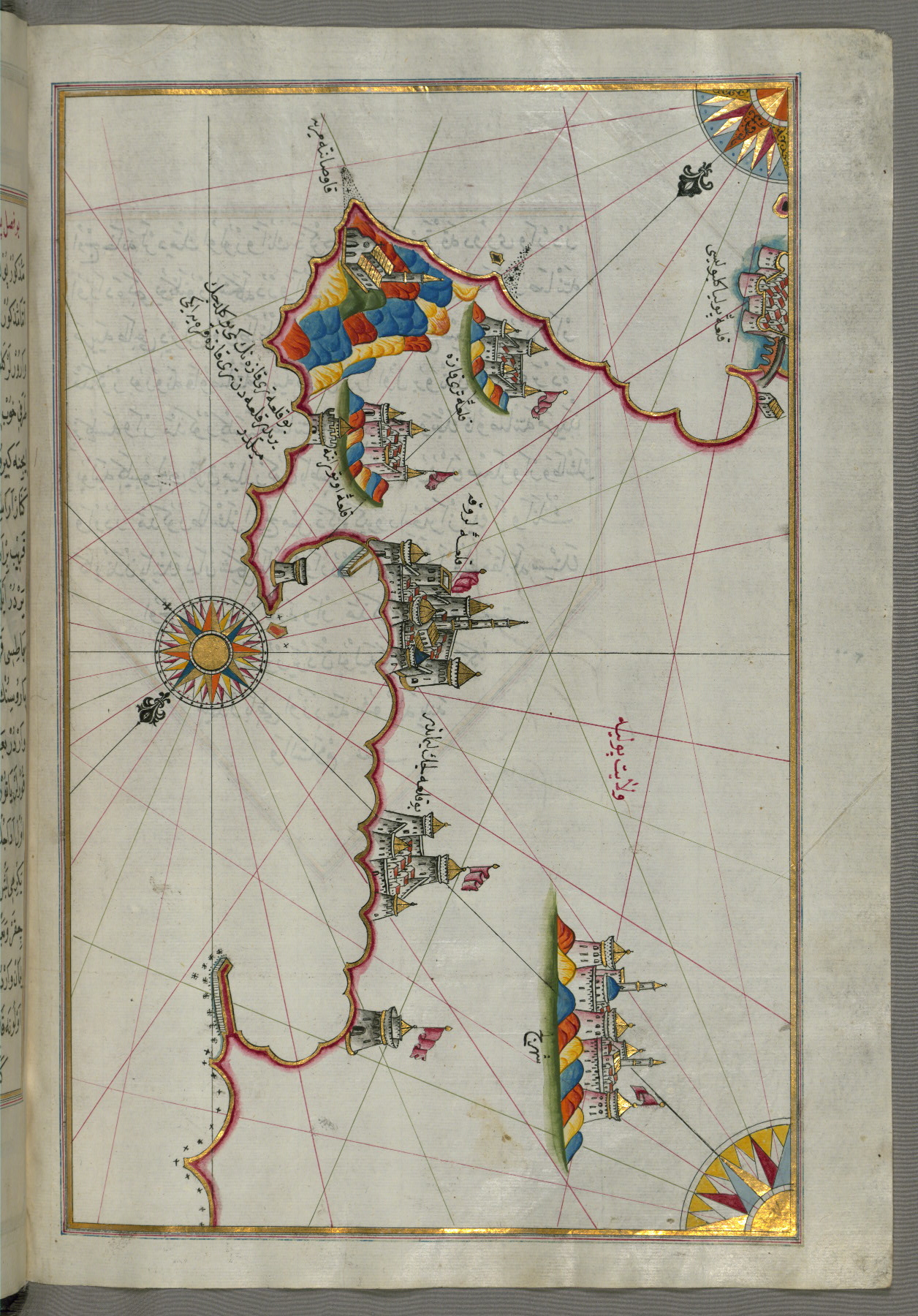
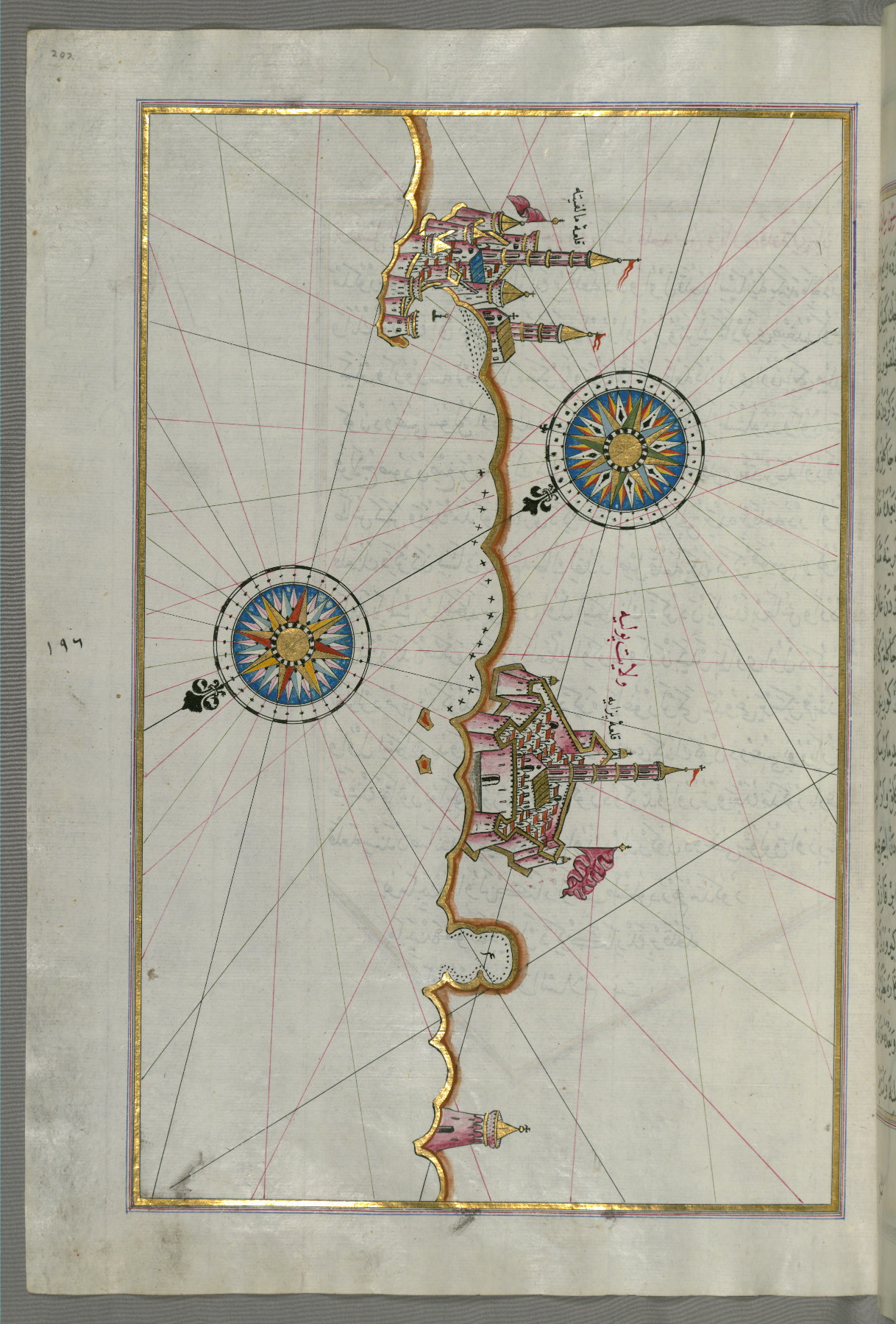
fol. 207b:
- Title: Towns of Gallipoli and Nardo on the Italian coast
- Form: Illustration
- Label: This map shows the towns of Gallipoli (Kelibūlī) and Nardo on the Italian coast.
fol. 208a:
- Title: Coastlines and islands of the Adriatic Sea (given here as the Gulf of Venice)
- Form: Illustration
- Label: This map shows the coastlines and islands of the Adriatic Sea (given here as the Gulf of Venice [Venedīk Kurfazi]).

fol. 208b:
- Title: City of Taranto in the province of Puglia
- Form: Illustration
- Label: This map shows the city of Taranto (Tarānde) in the province of Puglia (Pūlye) (Western Italian coast).
fol. 210a:
- Title: Eastern coastline of Calabria around Rossano
- Form: Illustration

fol. 211b:
- Title: Eastern coastline of Calabria with the towns of Crotone and Catanzaro
- Form: Illustration
fol. 212b:
- Title: Calabrian coastline from Catanzaro to Siquillace
- Form: Illustration

fol. 213b:
- Title: Southern part of the Calabrian peninsula and the straits of Messina
- Form: Illustration
- Label: This map shows the southern part of the Calabrian peninsula and the straits of Messina (Mesīne).
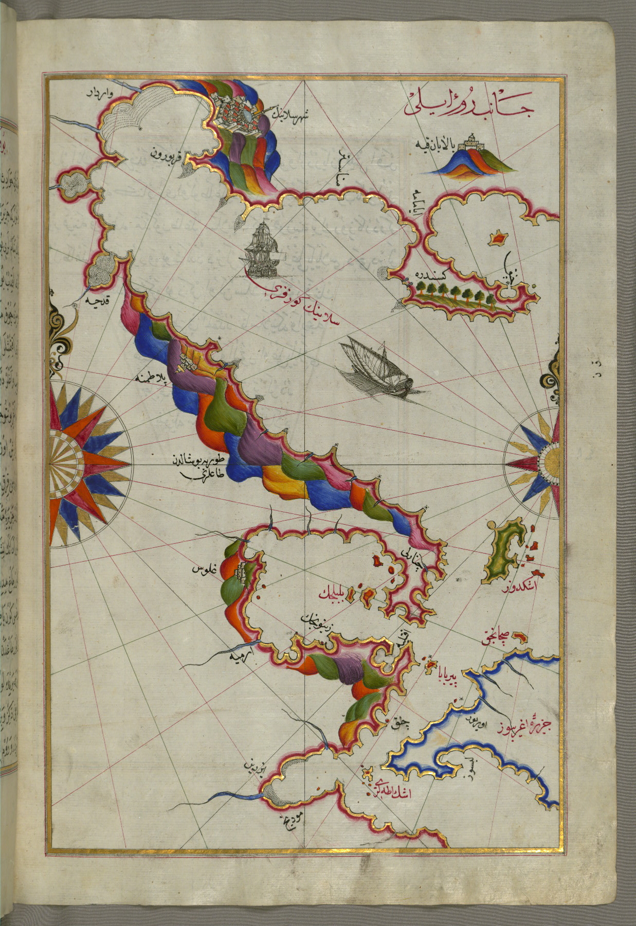
fol. 220b:
- Title: Northern coastline of Sicily (here called the island of Messina) from Milazzo to Palermo
- Form: Illustration
- Label: This map shows the northern coastline of Sicily (here called the island of Messina [Mesīne]) from Milazzo (Milasū) to Palermo.
fol. 221a:
- Title: Island of Sicily
- Form: Illustration
- Label: This map shows the island of Sicily (Çiçilye).

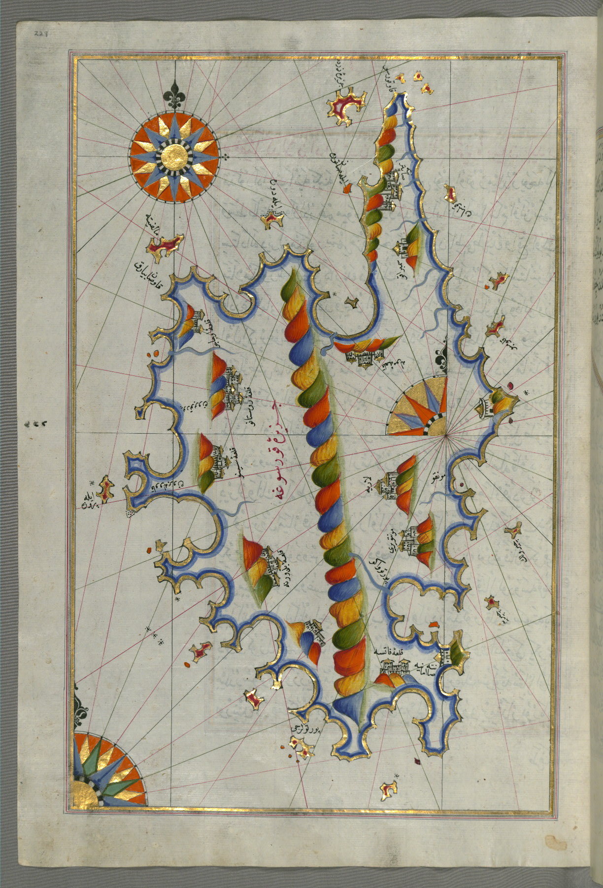
fol. 222b:
- Title: Island of Malta
- Form: Illustration
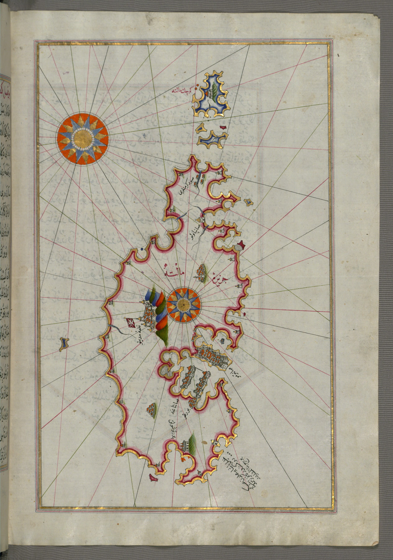
- Label: This map shows the island of Malta (Māltah).
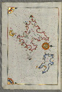
fol. 226a:
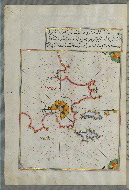
- Title: Two small islands off the coast of Sardinia
- Form: Illustration
- Label: This map shows two small islands off the coast of Sardinia (Sardinye).
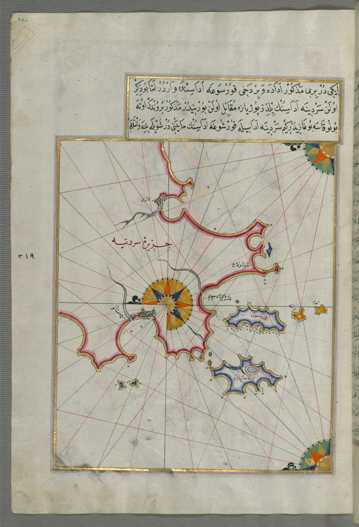
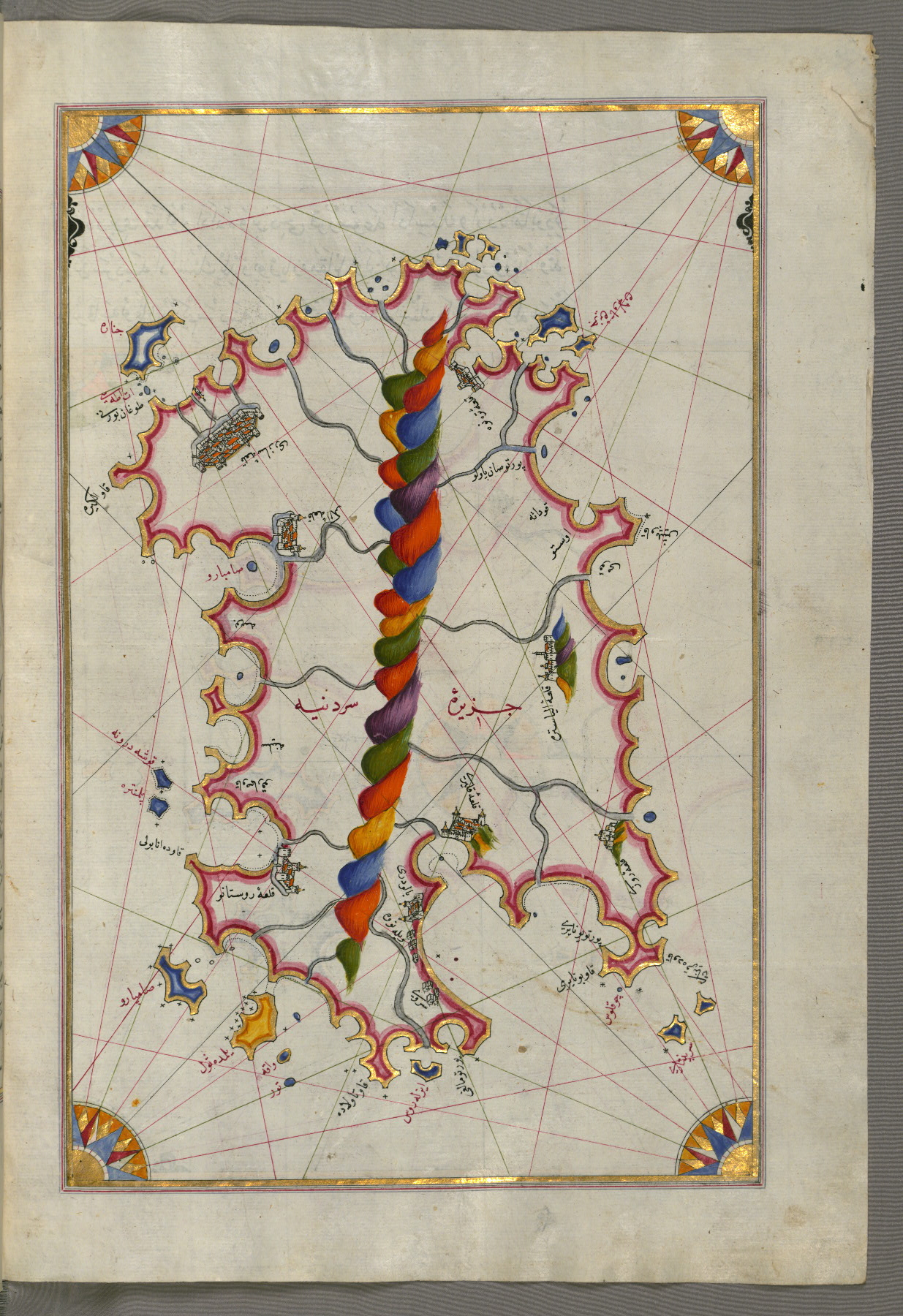
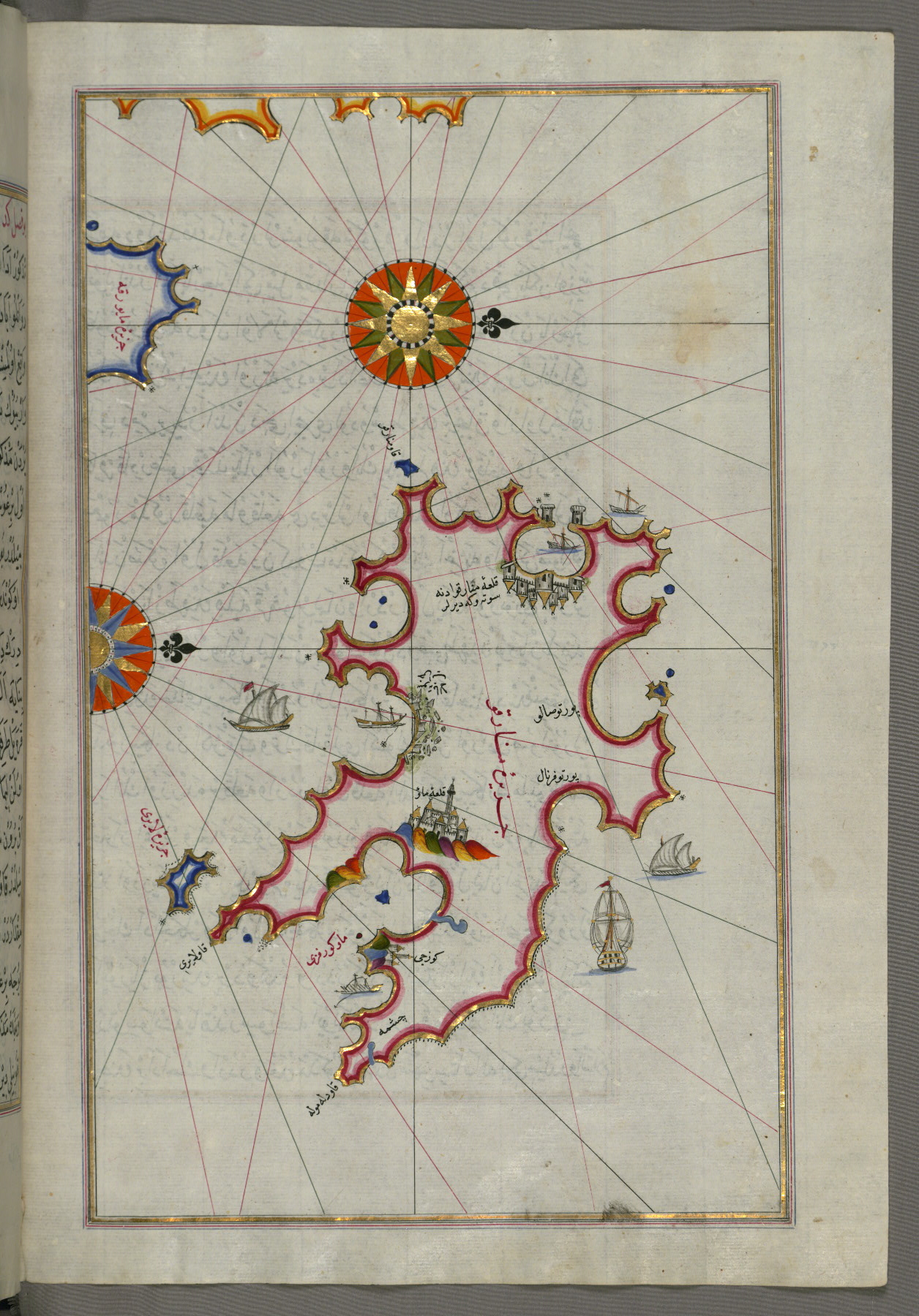
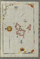
fol. 226b:
- Title: Island of Sardinia
- Form: Illustration
- Label: This map shows the island of Sardinia (Sardinye).
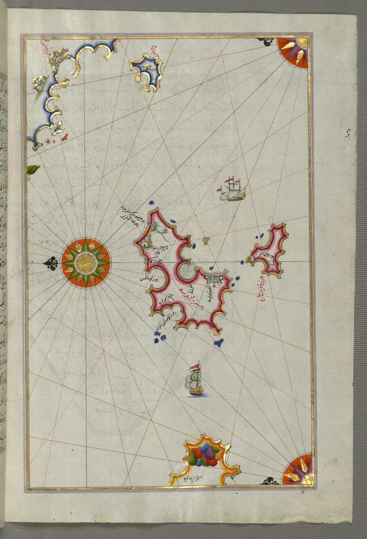
fol. 229a:
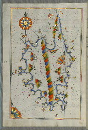
- Title: Island of Corsica
- Form: Illustration
- Label: This map shows the island of Corsica (Qūrsūghah).
fol. 230b:
- Title: Island of Minorca
- Form: Illustration
- Label: This map shows the island of Minorca (Minārqū).
fol. 233a:
- Title: Islands of Majorca and Minorca
- Form: Illustration
- Label: This map shows the islands of Majorca (Miyārqū) and Minorca (Minārqū).
fol. 234b:
- Title: Two islands off Majorca: Ibiza and Formentera
- Form: Illustration
- Label: This map shows two islands off Majorca: Ibiza (Yūse) and Formentera.
fol. 236b:
- Title: Straits of Messina and the western Italian coastline
- Form: Illustration
fol. 238b:
- Title: Western Italian coastline as far as Naples and the island of Ischia
- Form: Illustration
- Label: This map shows the western Italian coastline as far as Naples (Pūlye Anāpūlīsī) and the island of Ischia (Ișqe).
fol. 240b:
- Title: Western Italian coastline as far as the city of Rome
- Form: Illustration
- Label: This map shows the western Italian coastline as far as the city of Rome (Rūmah).
fol. 244a:
- Title: Western Italian coastline as far as the city of Pisa
- Form: Illustration
- Label: This map shows the western Italian coastline as far as the city of Pisa (Pīze).

fol. 246a:
- Title: Western Italian coastline from Pisa to the French border, including the towns of Genoa and Savona
- Form: Illustration
- Label: This map shows the western Italian coastline from Pisa to the French border, including the towns of Genoa (Jinūz) and Savona.

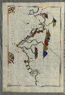
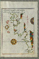
fol. 248a:
- Title: French coastline from the Italian border as far as Nice
- Form: Illustration
- Label: This map shows the French coastline from the Italian border as far as Nice (Nīse).
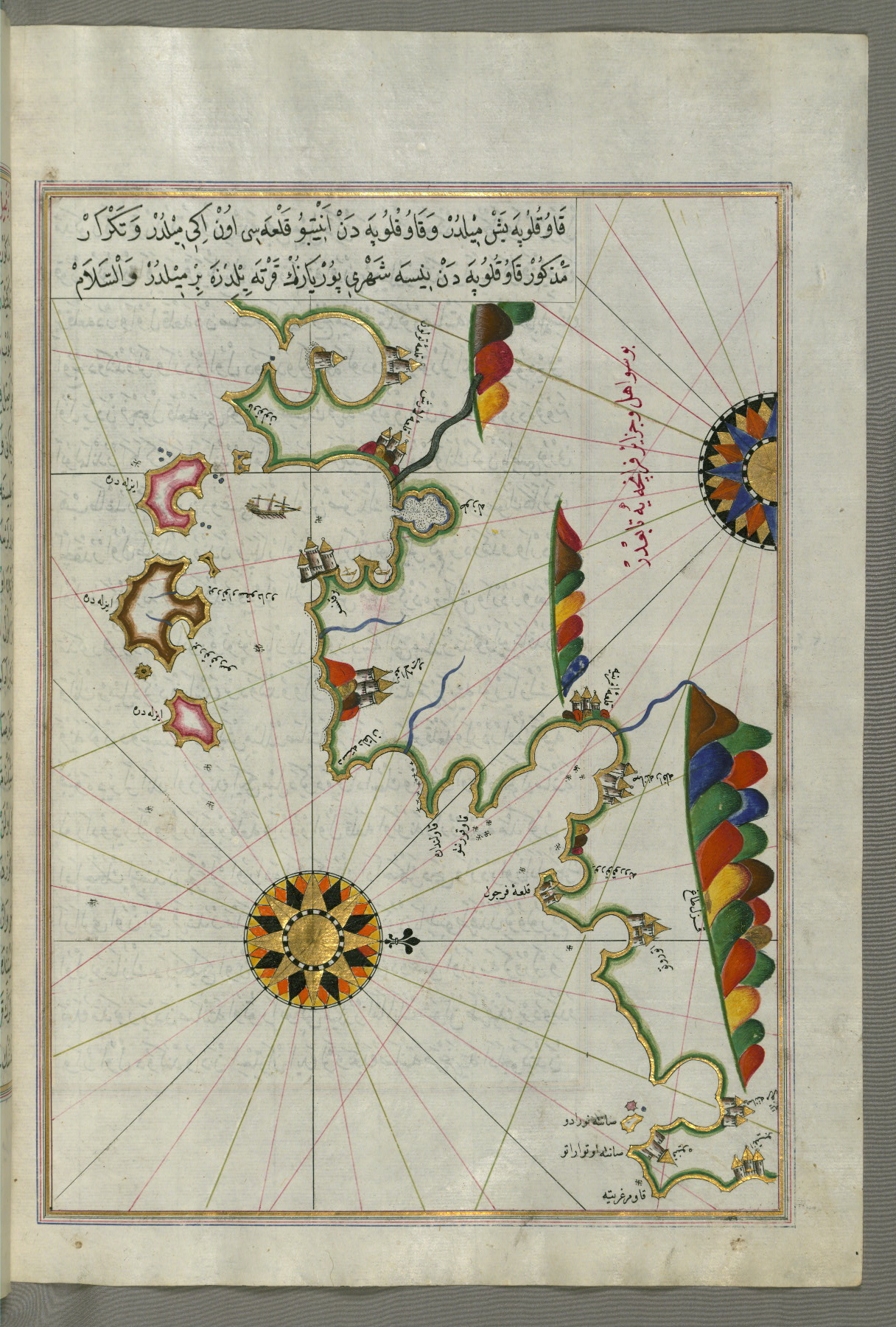
fol. 250b:
- Title: French coastline from Nice as far as Toulon
- Form: Illustration
fol. 253a:
- Title: French coastline around Marseille
- Form: Illustration
- Label: This map shows the French coastline around Marseille (Mārsilye).

fol. 255a:
- Title: Coastline around Narbonne
- Form: Illustration
- Label: This map shows the coastline around Narbonne (Nārbūnah).
fol. 257b:
- Title: Coastline of Catalonia with the ports of Barcellona and Tarragona
- Form: Illustration
- Label: This map shows the coastline of Catalonia with the ports of Barcellona (Bārselūniye) and Tarragona (Tūrratūnah).
fol. 259b:
- Title: Coastline of Andalusia from Valencia to Cartagena
- Form: Illustration
- Label: This map shows the coastline of Andalusia from Valencia (Valense) to Cartagena (Qarte Cine).
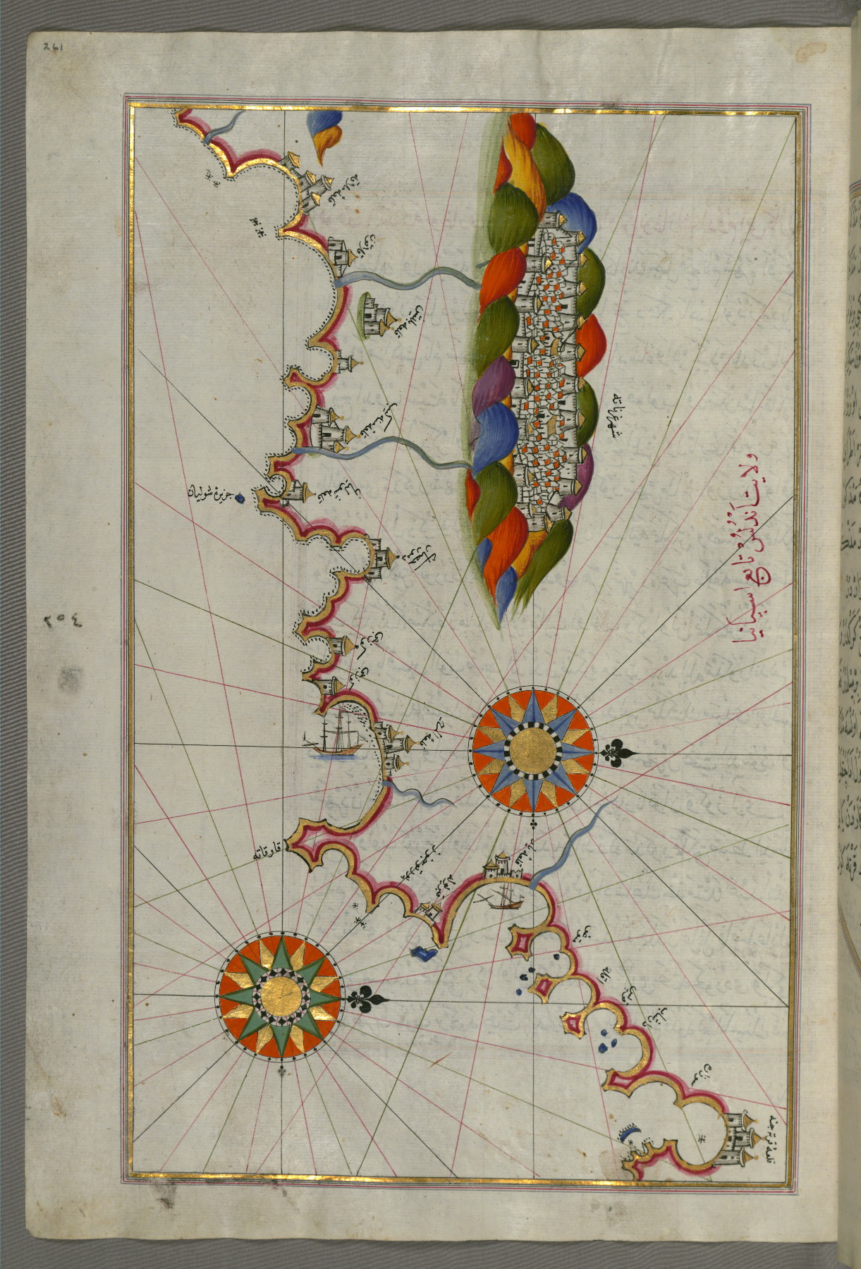
fol. 261a:
- Title: Coastline of Andalusia with the city of Grenada
- Form: Illustration
- Label: This map shows the coastline of Andalusia with the city of Grenada (Gharnātah).
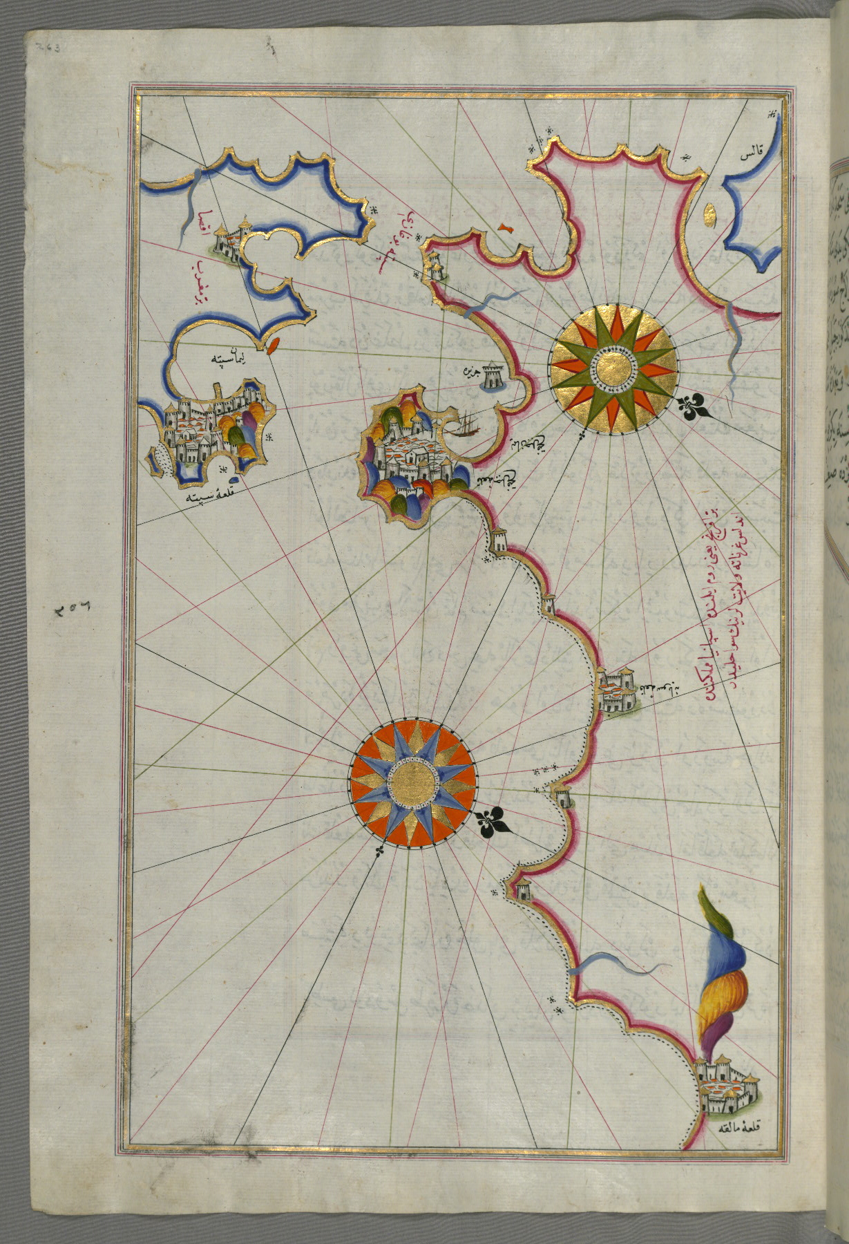
fol. 263a:
- Title: Strait of Gibraltar with the cities of Gibraltar and Ceuta
- Form: Illustration
- Label: This map shows the Strait of Gibraltar with the cities of Gibraltar (Jabal-i Fatḥ) and Ceuta (Sapte, Sabtah).
fol. 264b:
- Title: Southern Spain and Morocco with the cities of Gibraltar, Ceuta, and Tetouan
- Form: Illustration
- Label: This map shows southern Spain and Morocco with the cities of Gibraltar (Jabal-i Fatḥ), Ceuta (Sapte, Sabtah), and Tetouan (Titwān).
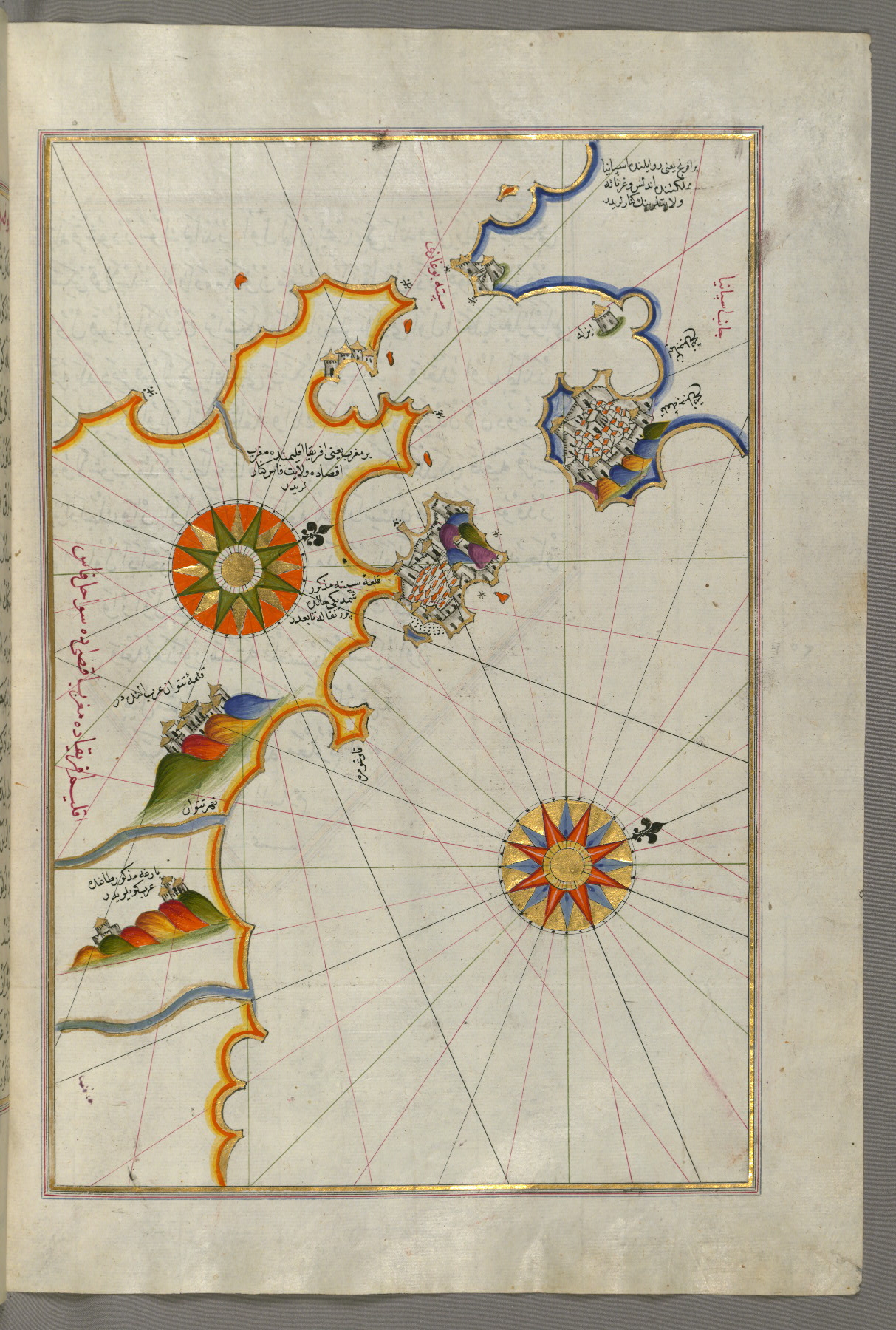
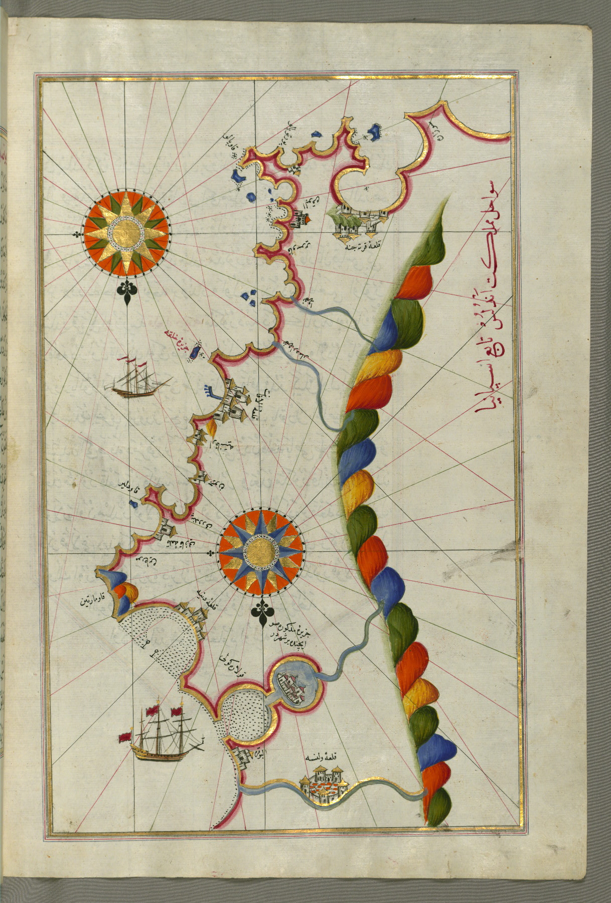
fol. 266a:
- Title: Moroccan coastline from the city of Tetouan west
- Form: Illustration
- Label: This map shows the Moroccan coastline from the city of Tetouan (Titwān) west.
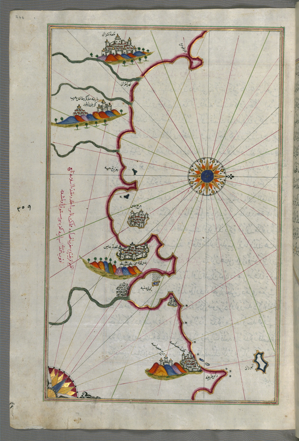
fol. 267b:
- Title: Moroccan and Algerian coastline from Melilla northwest of Tlemcen
- Form: Illustration
- Label: This map shows the Moroccan and Algerian coastline from Melilla (Malīlah) northwest of Tlemcen (Tilimsān).
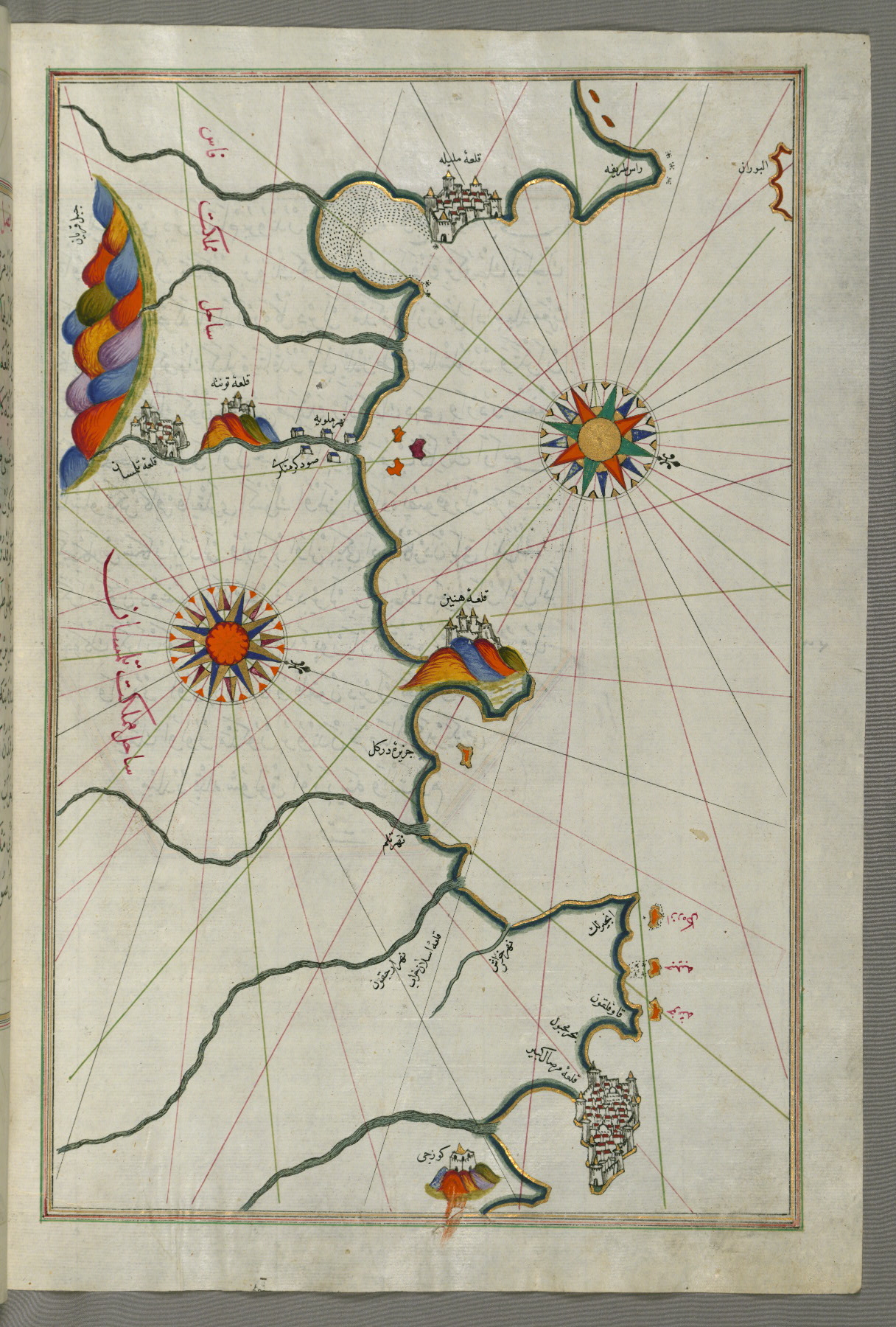
fol. 268b:
- Title: Algerian coastline around Oran and Mostaganem
- Form: Illustration
- Label: This map shows the Algerian coastline around Oran (Wahrān) and Mostaganem (Mustaghānīm).

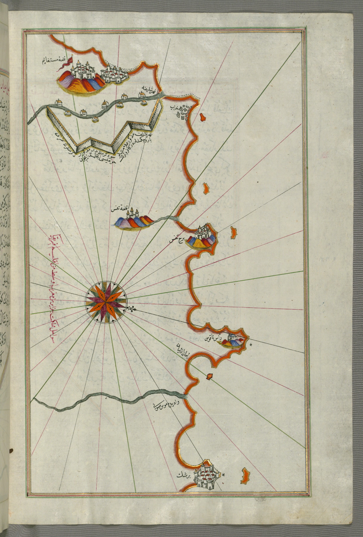
fol. 269b:
- Title: Algerian coastline around Mostaganem
- Form: Illustration
- Label: This map shows the Algerian coastline around Mostaganem.
fol. 270b:
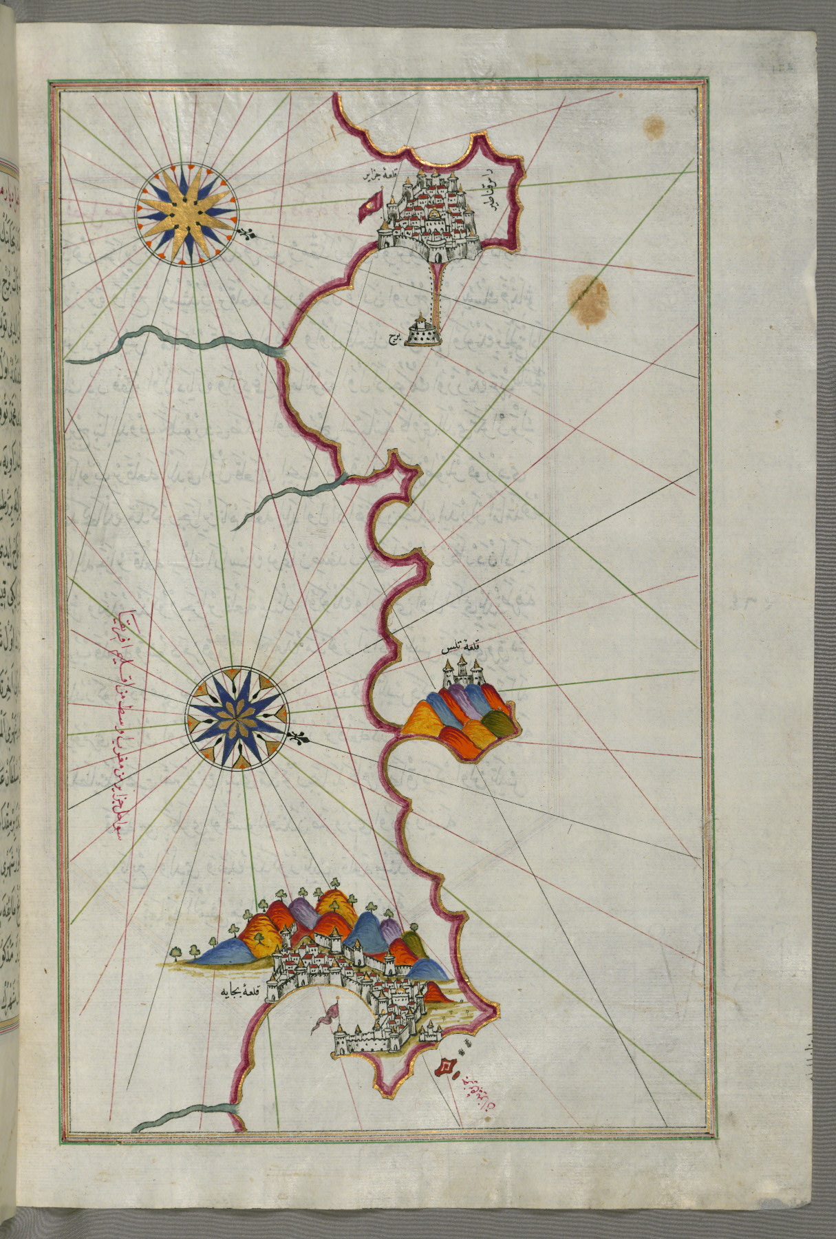
- Title: Algerian coastline around Algiers
- Form: Illustration
- Label: This map shows the Algerian coastline around Algiers (Jazāʾir).
fol. 271b:
- Title: Algerian coastline from Algiers to Bejaia
- Form: Illustration
- Label: This map shows the Algerian coastline from Algiers (Jazāʾir) to Bejaia (Bajāyah).
fol. 274b:
- Title: Algerian coastline from the port of Bejaia as far as Annaba with the city of Constantine
- Form: Illustration
- Label: This map shows the Algerian coastline from the port of Bejaia (Bajāyah) as far as Annaba (Balad al-ʿUnnāb) with the city of Constantine (Qūstantinīyah).
fol. 276b:
- Title: Algerian and Tunisian coastline from Annaba to Tabarka
- Form: Illustration
- Label: This map shows the Algerian and Tunisian coastline from Annaba (Bilād al-ʿUnnāb) to Tabarka (Tabāraqah).
fol. 277b:
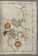
- Title: Coastline of Tunisia with the ports of Bizerte and Tunis
- Form: Illustration
- Label: This map shows the coastline of Tunisia with the ports of Bizerte (Binzert) and Tunis (Ṭūnūs).
fol. 279b:
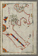
- Title: Tunisian coastline with the ports of Bizerte and Tunis as far as Kelibia
- Form: Illustration
- Label: This map shows the Tunisian coastline with the ports of Bizerte (Binzert) and Tunis (Ṭūnūs) as far as Kelibia (Qalabīyah).
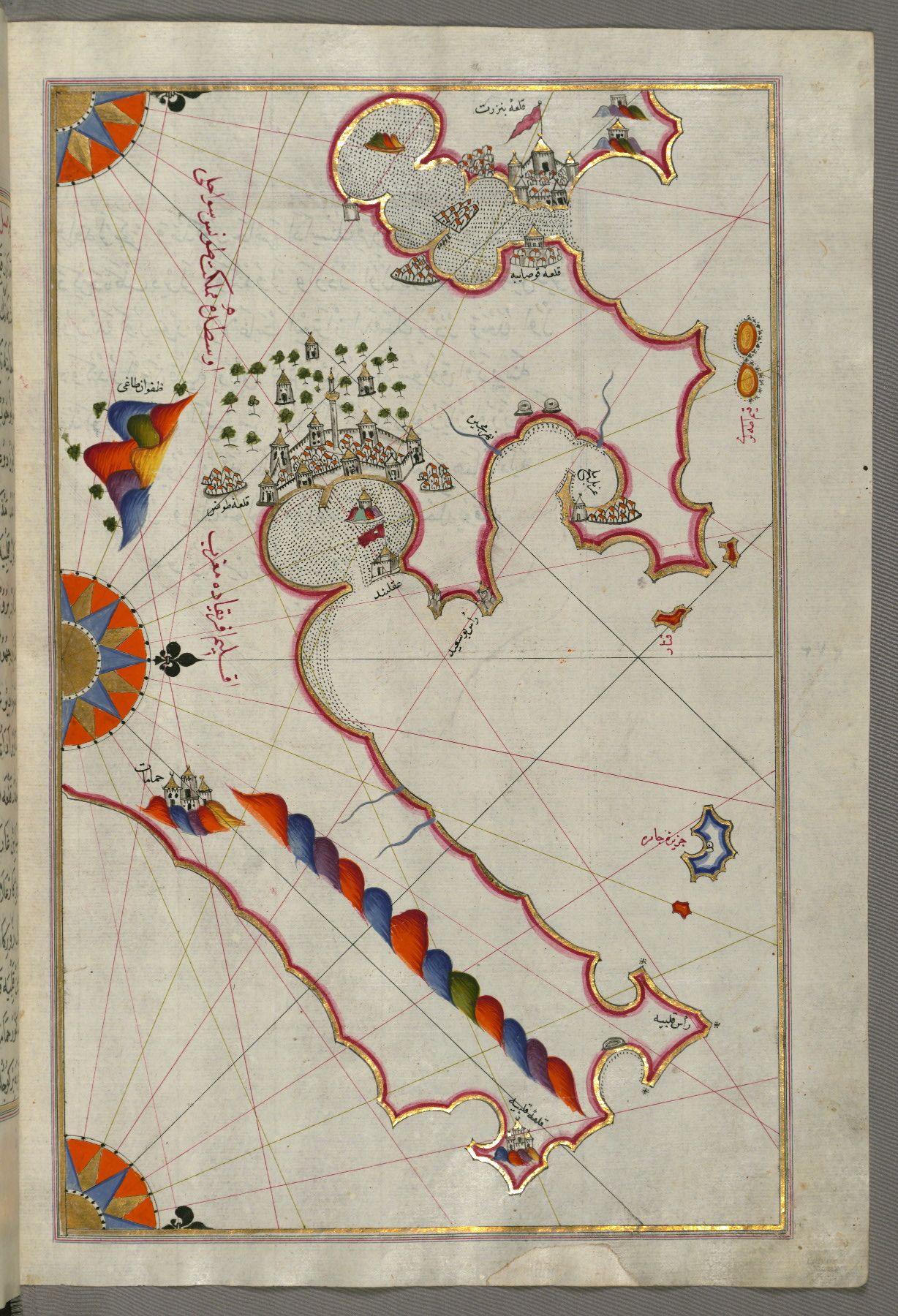
fol. 281b:
- Title: Tunisian coastline with the cities of Kelibia, Hammamet, Sousse, and Monastir
- Form: Illustration
- Label: This map shows the Tunisian coastline with the cities of Kelibia (Qalabīyah), Hammamet (Ḥammāmāt), Sousse (Ṣūṣah), and Monastir (Munṣaṭir).
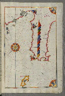
fol. 283b:

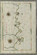
- Title: Tunisian coastline with the fortress of Mahdīyah and the island of Jarbah
- Form: Illustration
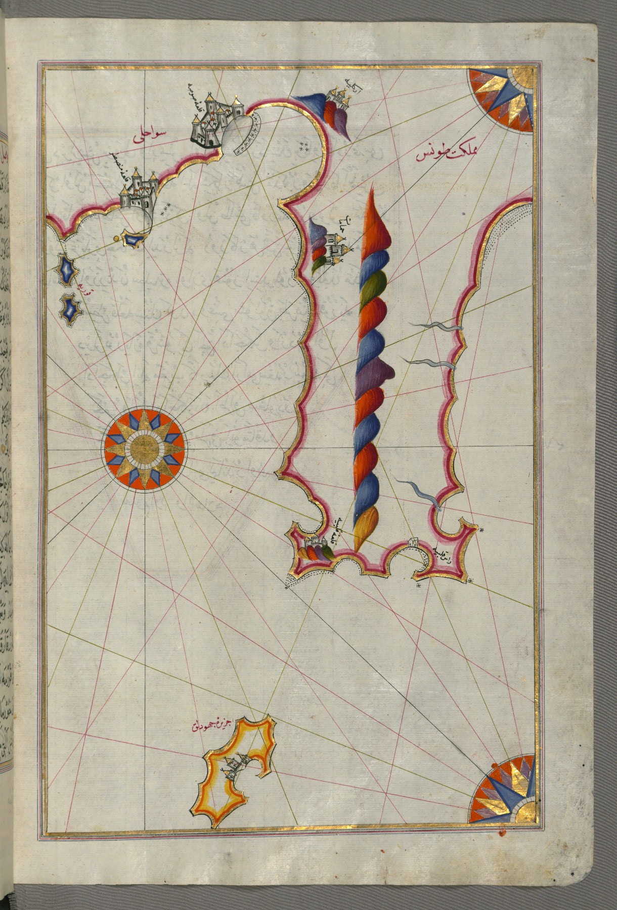
- Label: This map shows the Tunisian coastline with the fortress of Mahdīyah and the island of Jarbah (Jerba).
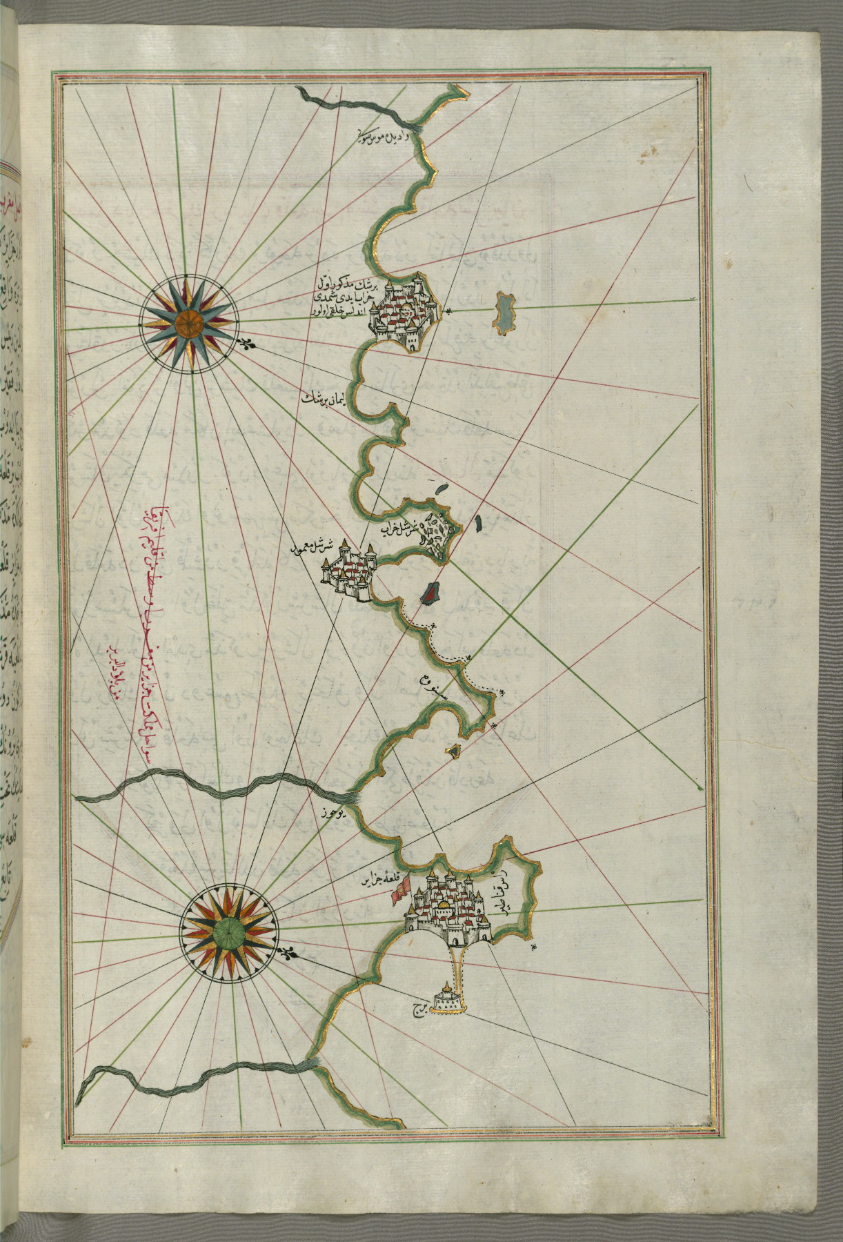
fol. 286b:
- Title: Coastline of Tripoli
- Form: Illustration
- Label: This map shows the coastline of Tripoli (Ṭarābulus).
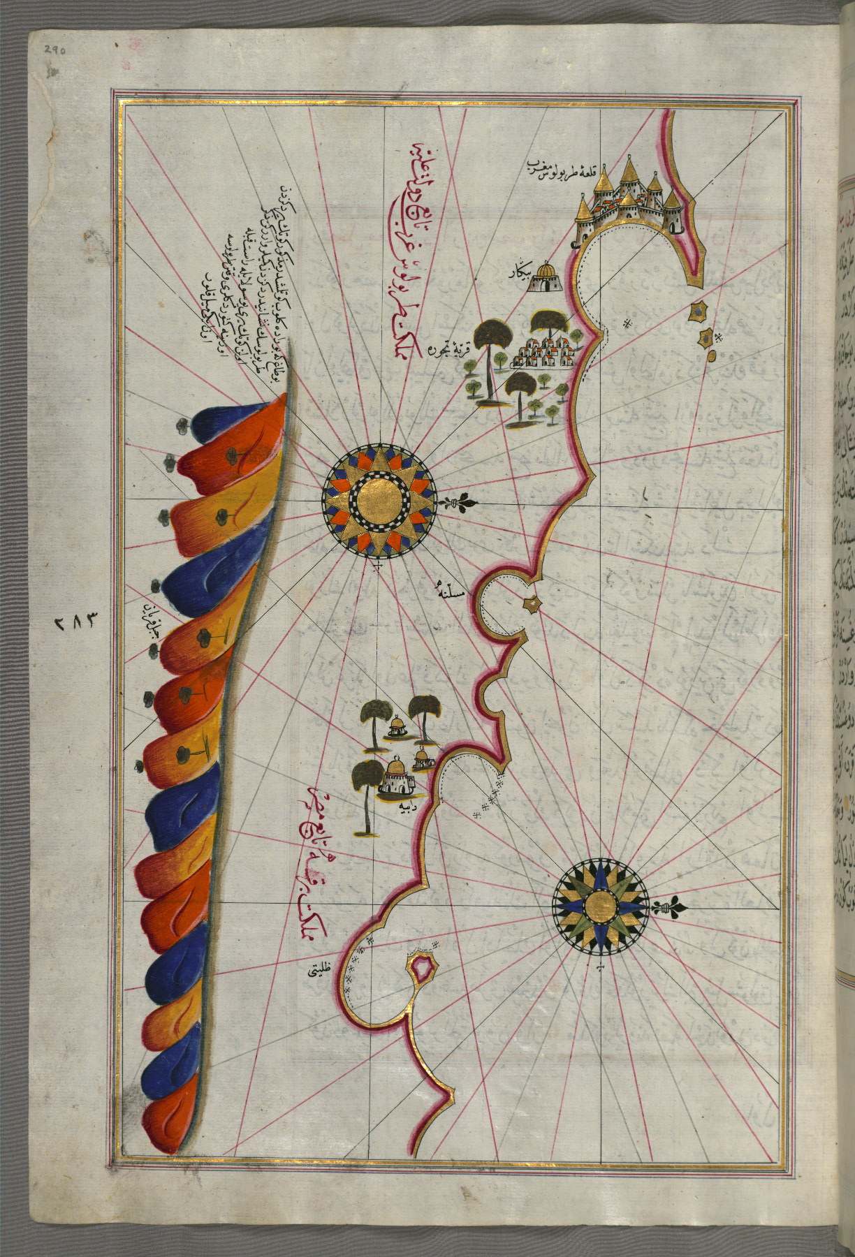
fol. 289a:
- Title: Fortress of Tripoli and surrounding area
- Form: Illustration
- Label: This map shows the fortress of Tripoli (Ṭarābulus-i Maghrib) and the surrounding area.

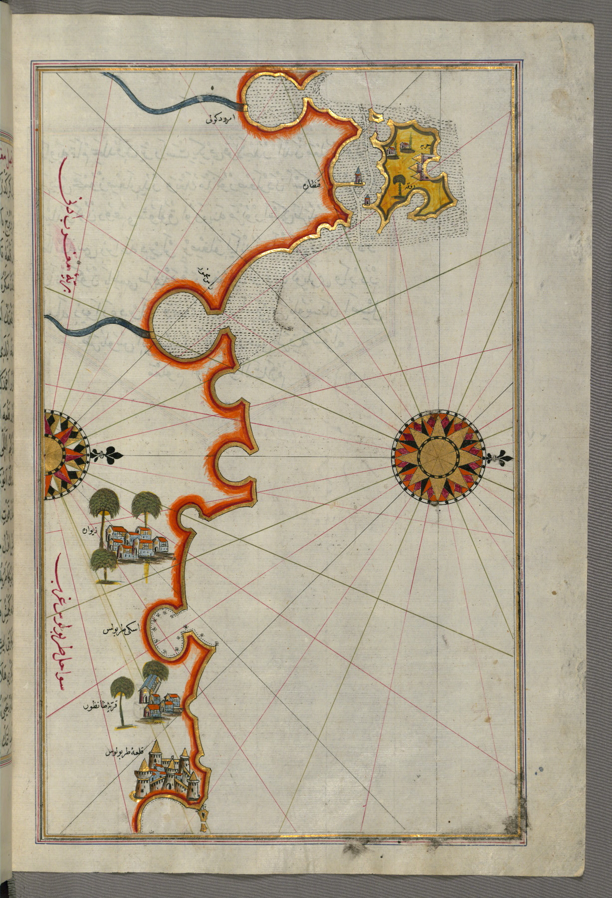
fol. 290a:
- Title: Libyan coastline from Tripoli east toward Egypt
- Form: Illustration
- Label: This map shows the Libyan coastline from Tripoli east toward Egypt.
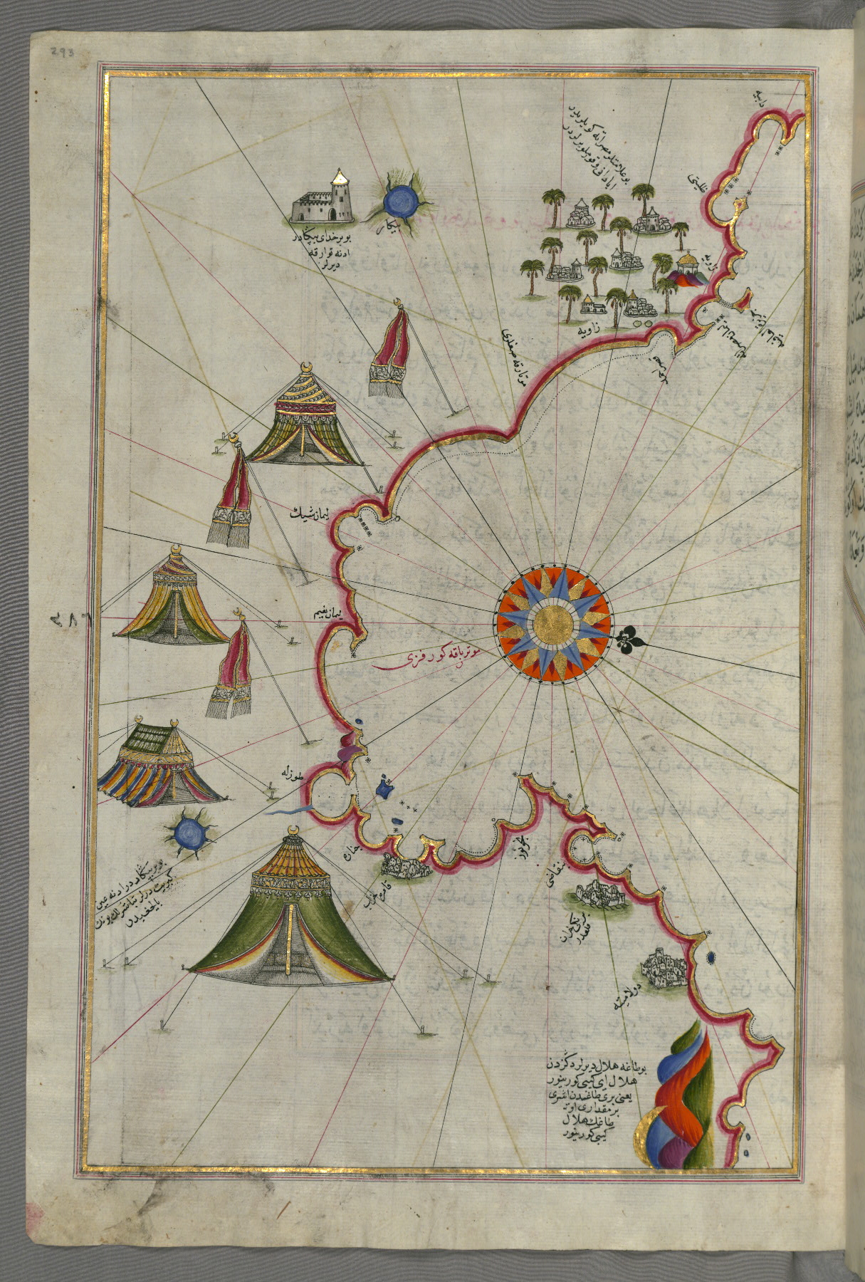
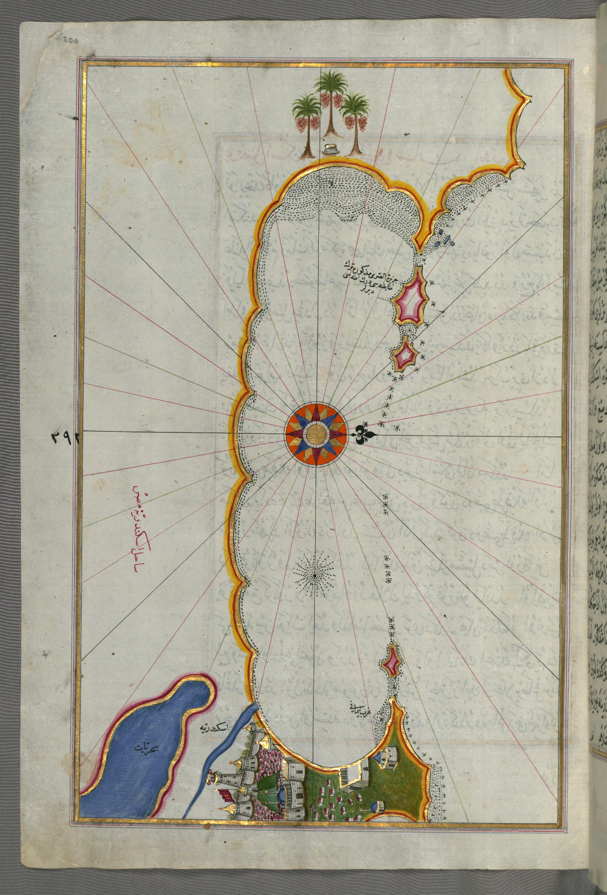
fol. 293a:
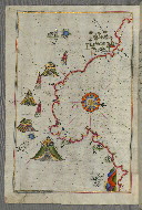
- Title: Libyan coastline as far as Benghazi
- Form: Illustration
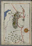
fol. 294b:
- Title: Libyan coastline toward the Egyptian border
- Form: Illustration

fol. 295b:
- Title: Libyan coastline toward the Egyptian border
- Form: Illustration
fol. 296b:
- Title: Libyan coastline as far as Salūm
- Form: Illustration
- Label: This map shows the Libyan coastline as far as Salūm.
fol. 297b:
- Title: Egyptian coastline from Salūm east
- Form: Illustration

fol. 298b:
- Title: Egyptian coastline from Matrūḥ east toward Alexandria
- Form: Illustration

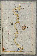
fol. 300a:
- Title: Coastline of Alexandria showing a portion of the town itself
- Form: Illustration
- Label: This map shows the coastline of Alexandria (Iskandarīyah) with a portion of the town itself.
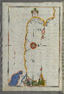
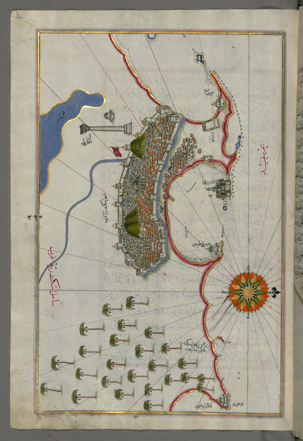
fol. 302a:
- Title: City of Alexandria
- Form: Illustration
- Label: This map shows the city of Alexandria (Iskandarīyah).
fol. 303b:
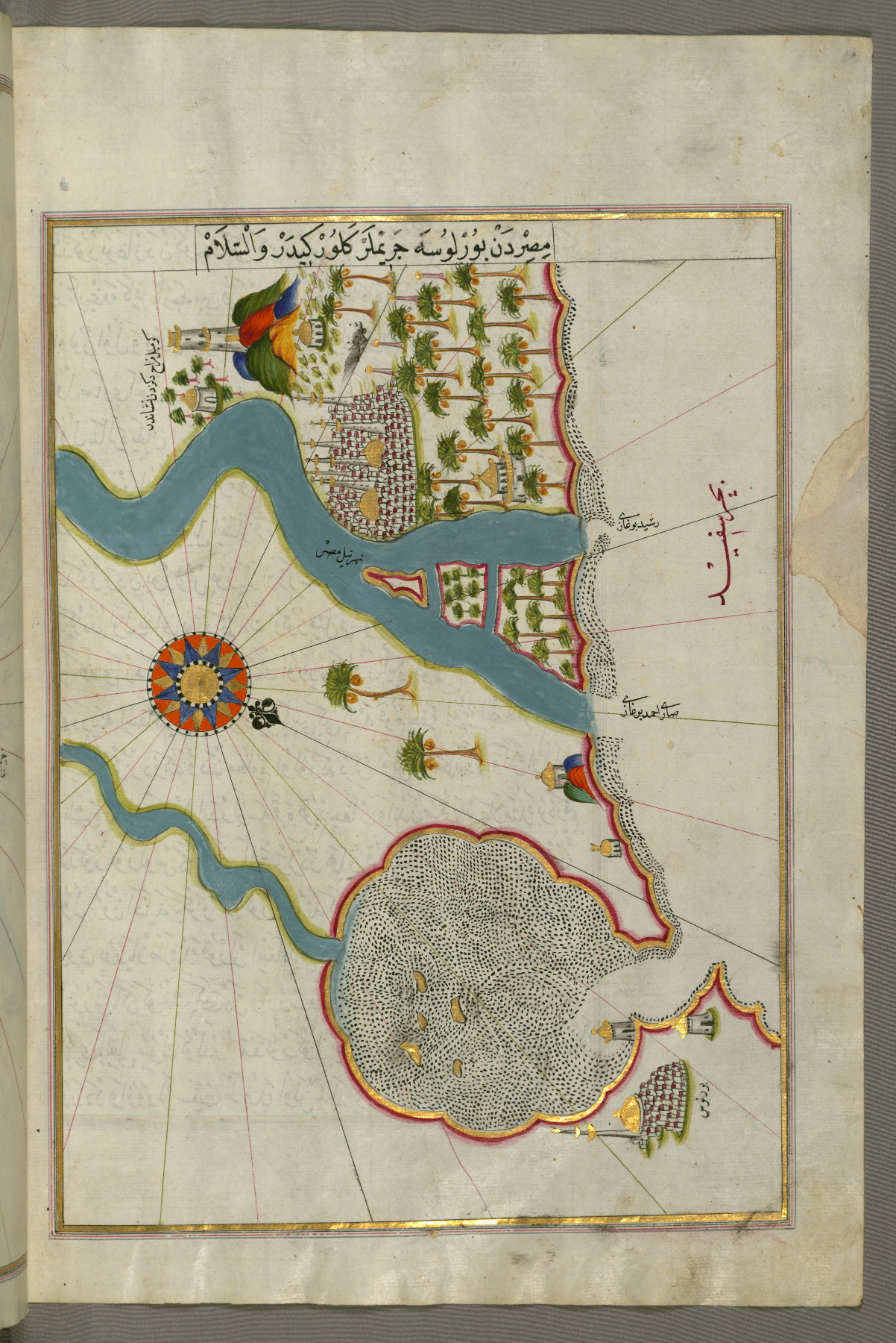
- Title: Egyptian coastline from Alexandria as far as the city of Rosetta
- Form: Illustration
- Label: This map shows the Egyptian coastline from Alexandria (Iskandarīyah) as far as the city of Rosetta (Rashīd).

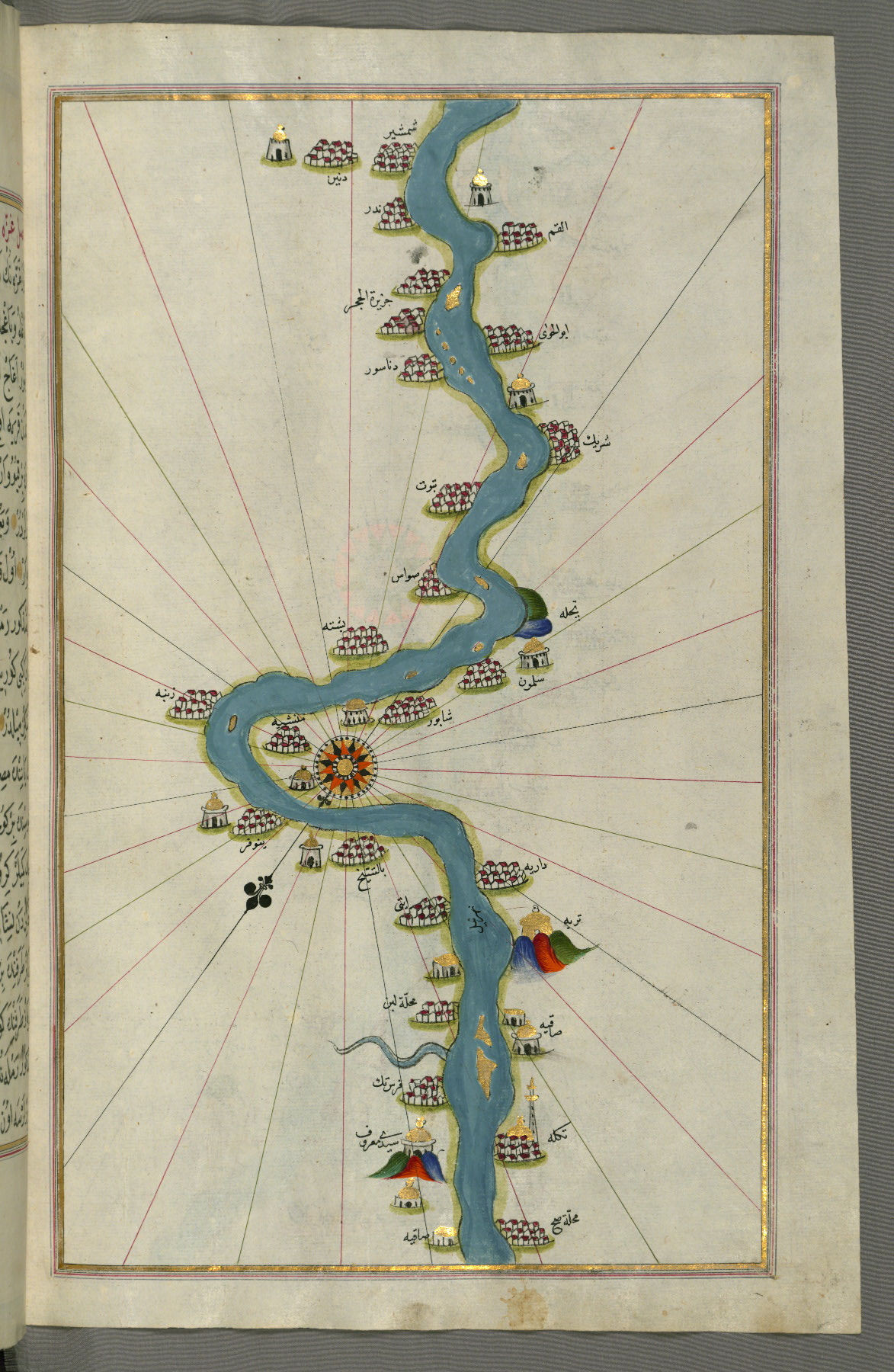
fol. 304b:
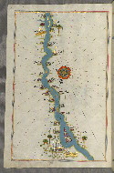
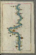
- Title: The Nile River from its estuary south
- Form: Illustration
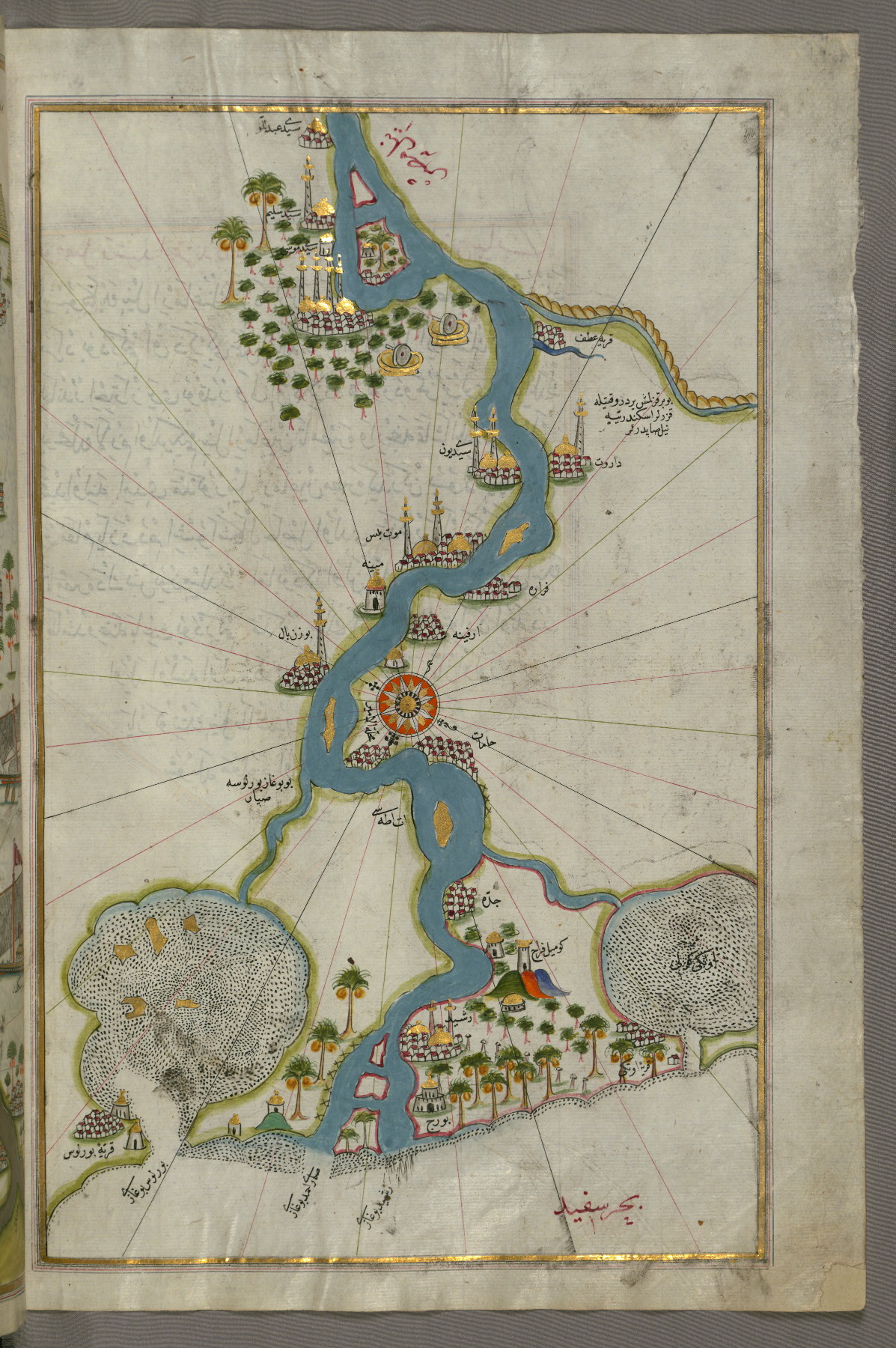
fol. 305a:
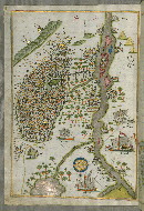
- Title: City of Cairo
- Form: Illustration
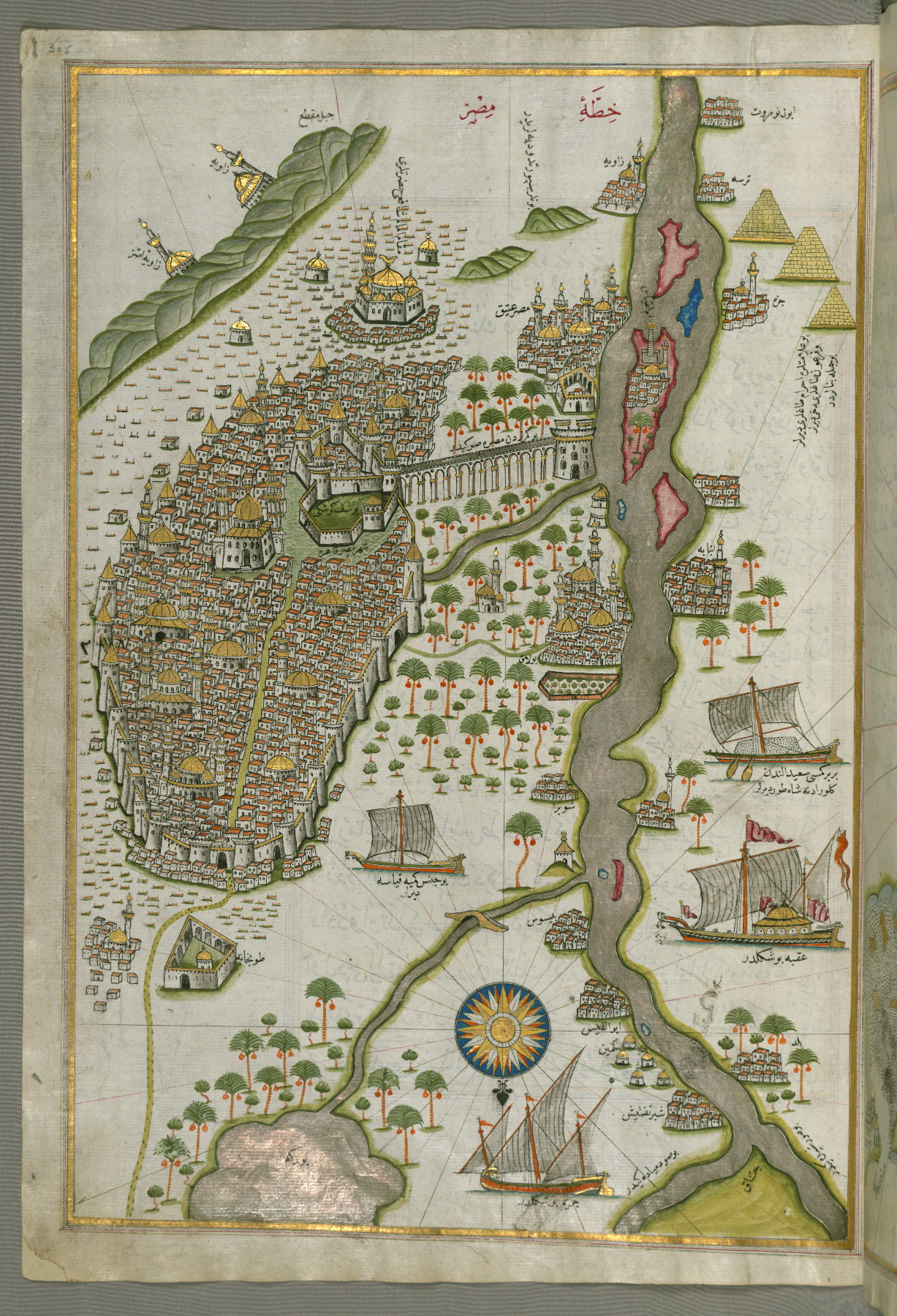
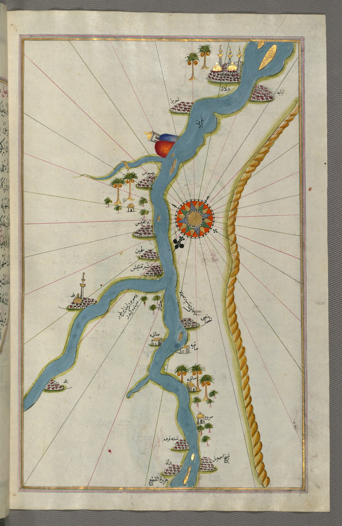
fol. 306b:
- Title: Nile River estuary with the cities of Rosetta and Būrullūs on either side
- Form: Illustration
- Label: This map shows the Nile River estuary with the cities of Rosetta (Rashid) and Būrullūs on either side.
fol. 307a:
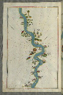
- Title: Nile River with various oases on either side
- Form: Illustration
fol. 307b:
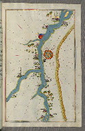
- Title: Towns and oases along the Nile River, beginning with Būlāq south of Cairo
- Form: Illustration
fol. 308b:
- Title: City of Damietta on the Egyptian coast
- Form: Illustration

fol. 309b:
- Title: Unmarked part of the Egyptian coastline
- Form: Illustration

fol. 310a:
- Title: Oases and villages along the Nile River as far as Sīdī Mūsá
- Form: Illustration

fol. 310b:
- Title: Nile River with various oases on either side as far as Sīdī Maʿrūf
- Form: Illustration
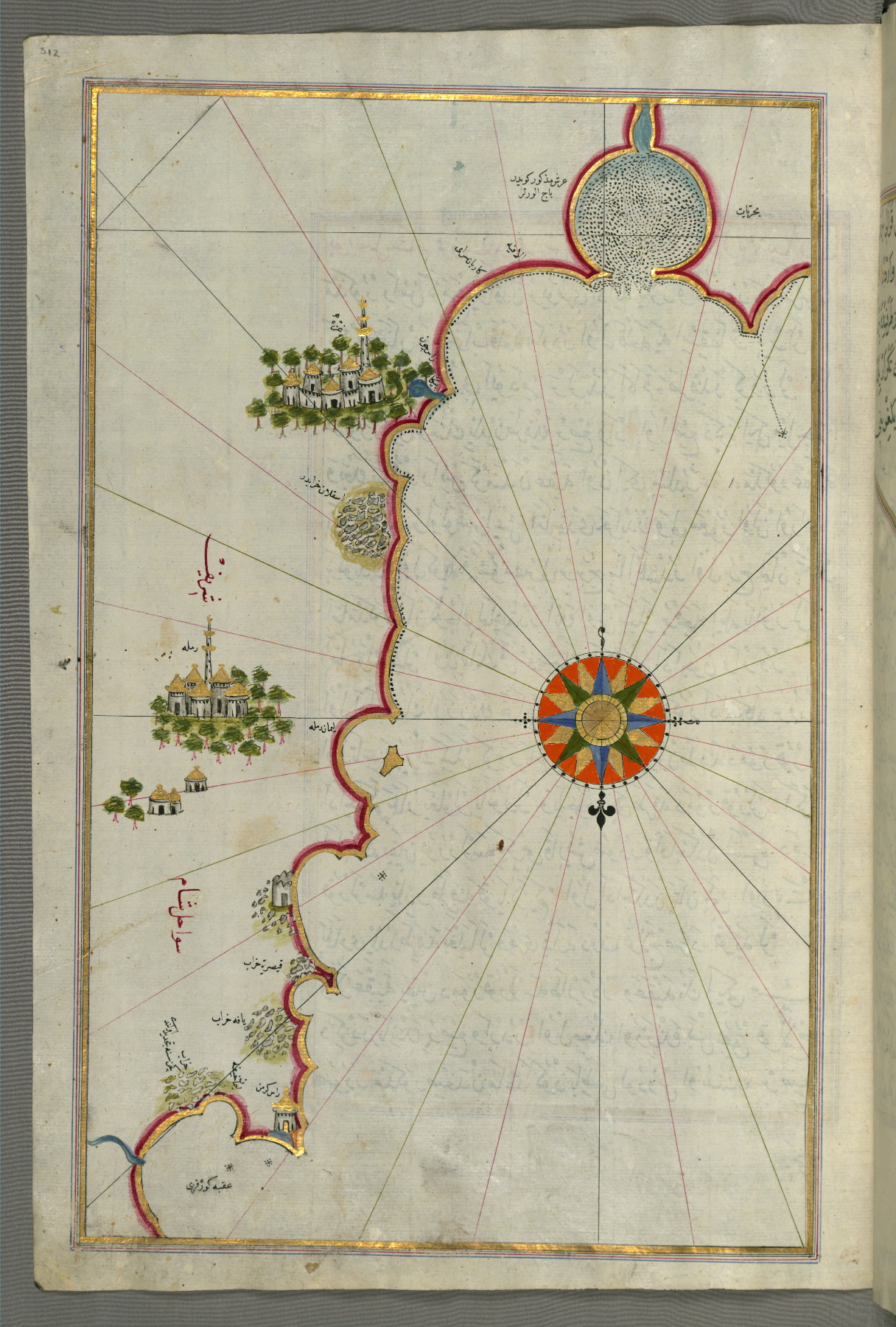
fol. 312a:
- Title: Syrian coastline and the cities of Gaza and Ramlah (present-day Gaza Strip)
- Form: Illustration
- Label: This map shows the Syrian coastline and the cities of Gaza (Ghazzah) and Ramlah (present-day Gaza Strip).
fol. 313b:
- Title: Eastern Mediterranean coastline (here marked as the Gulf of Aqaba) with the cities of Jaffa and Caesarea (present-day Israel)
- Form: Illustration

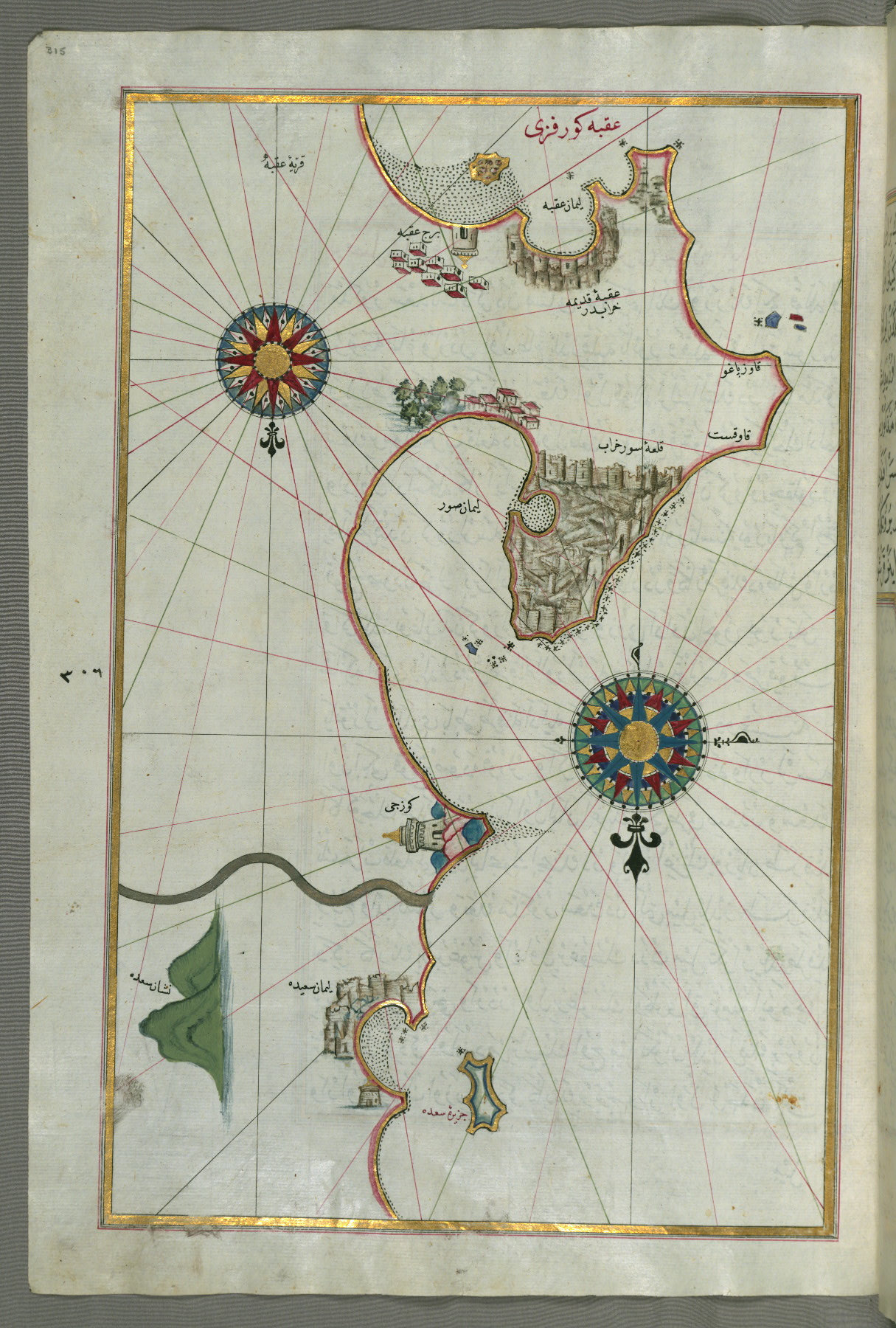
fol. 315a:
- Title: Eastern Mediterranean coastline with the city of Tyre
- Form: Illustration
- Label: This map shows the eastern Mediterranean coastline with the city of Tyre (Ṣūr).
fol. 316a:
- Title: Eastern Mediterranean coastline as far as the city of Beirut
- Form: Illustration

fol. 317b:
- Title: Eastern Mediterranean coastline and the city of Tripoli (Ṭarābulus–i Shām)
- Form: Illustration
- Label: This map shows the eastern Mediterranean coastline and the city of Tripoli (Ṭarābulus–i Shām).
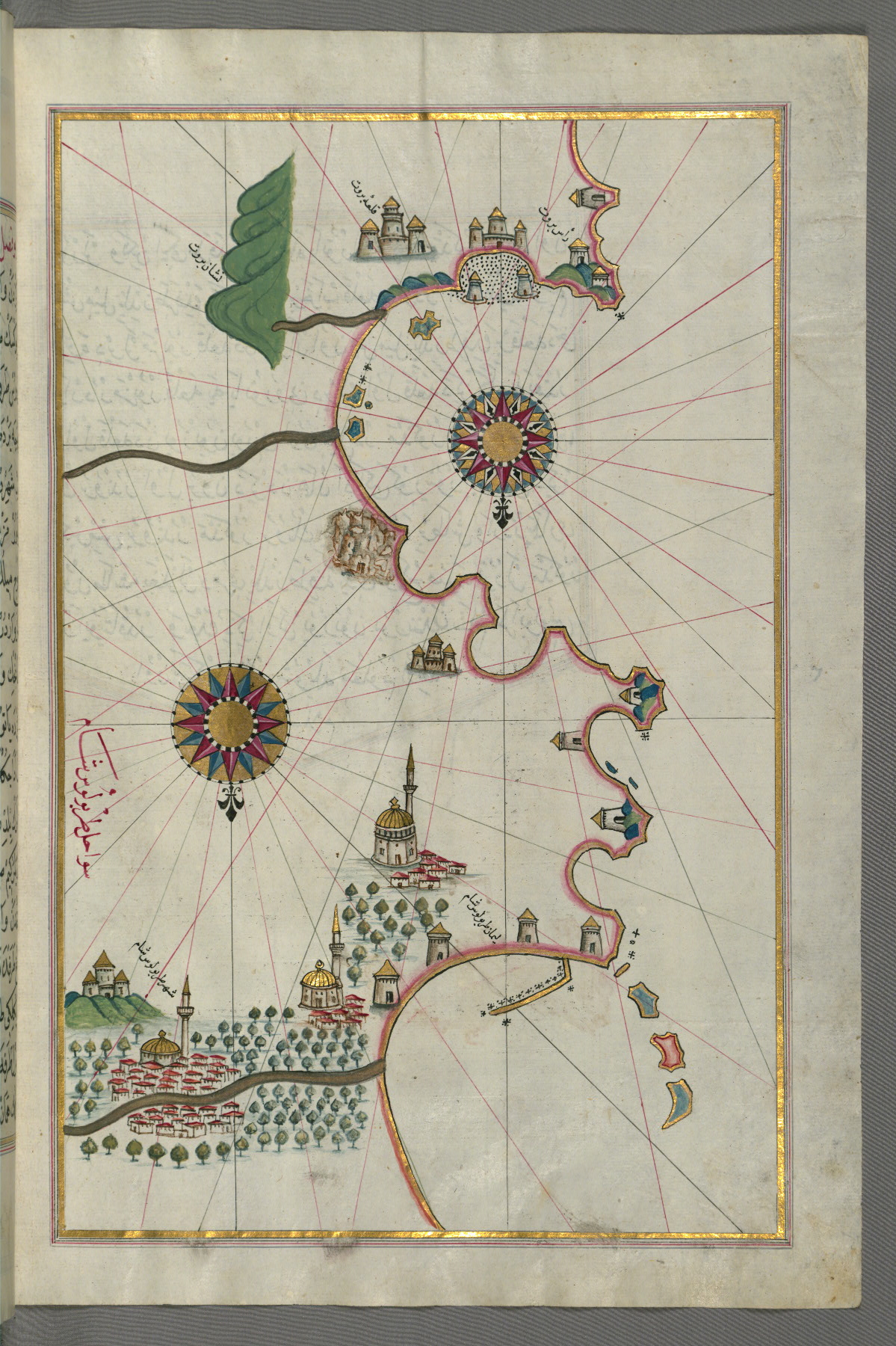
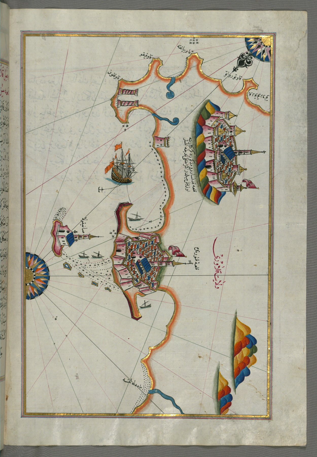
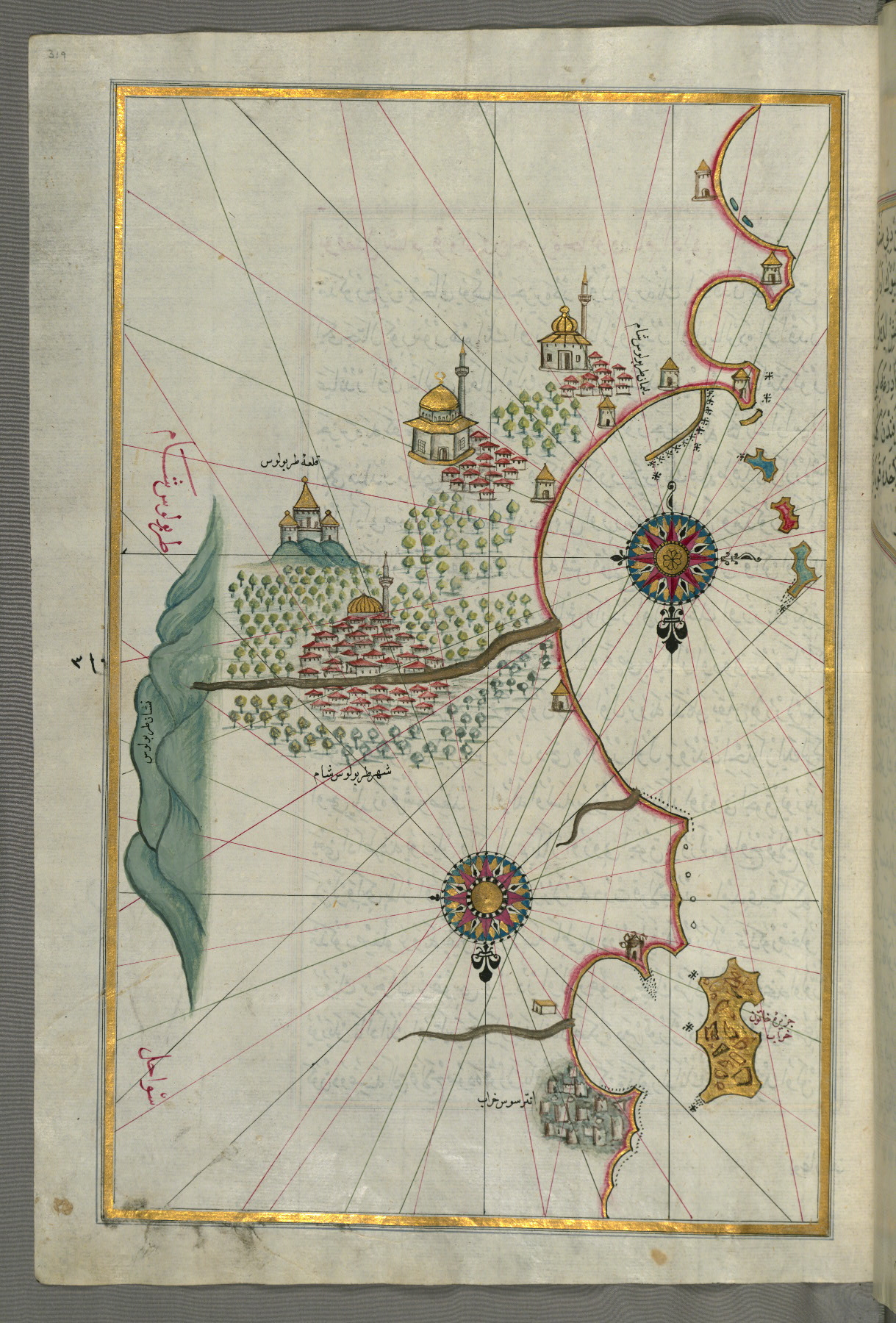
fol. 319a:
- Title: City of Tripoli (Ṭarābulus–i Shām)
- Form: Illustration
- Label: This map shows the city of Tripoli (Ṭarābulus–i Shām).
fol. 320b:
- Title: Eastern Mediterranean coastline from the island of Khātūn as far as Latakia (Lādhiqīyah)
- Form: Illustration
- Label: This map shows the eastern Mediterranean coastline from the island of Khātūn as far as Latakia (Lādhiqīyah).

fol. 322a:
- Title: Eastern Mediterranean coastline (marked here as the coast of İskenderun) and the cities of Latakia and Antakya
- Form: Illustration
- Label: This map shows the eastern Mediterranean coastline (marked here as the coast of İskenderun) and the cities of Latakia (Lādhiqīyah) and Antakya (ʿAnṭāqīyah).

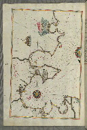
fol. 323a:
- Title: Anatolian coastline from the city of Alexandretta as far as the shores of Adana (Antioch in Cilicia)
- Form: Illustration
- Label: This map shows the Anatolian coastline from the city of Alexandretta (İskenderun) as far as the shores of Adana (Antioch in Cilicia).
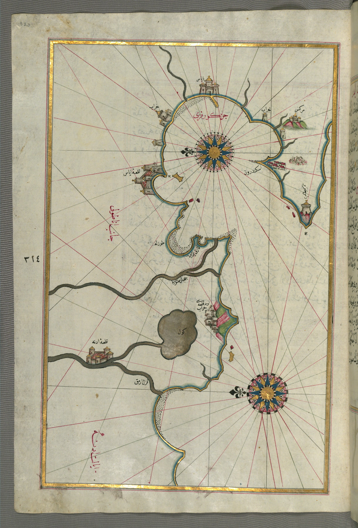
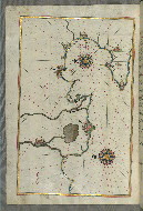
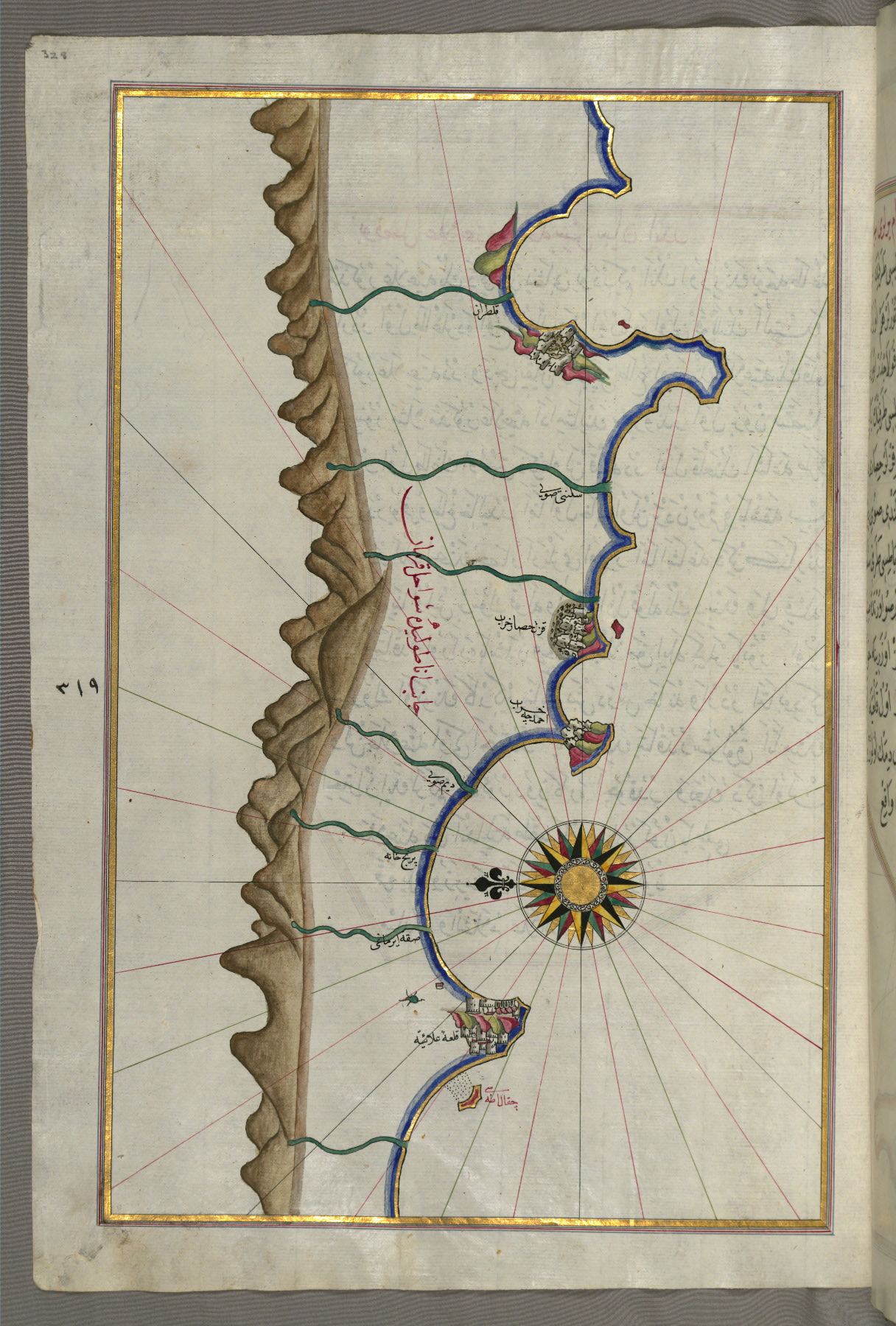
fol. 324a:
- Title: Anatolian coastline and the cities of Adana (Antioch in Cilicia) and Tarsus
- Form: Illustration
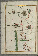
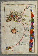
fol. 325a:
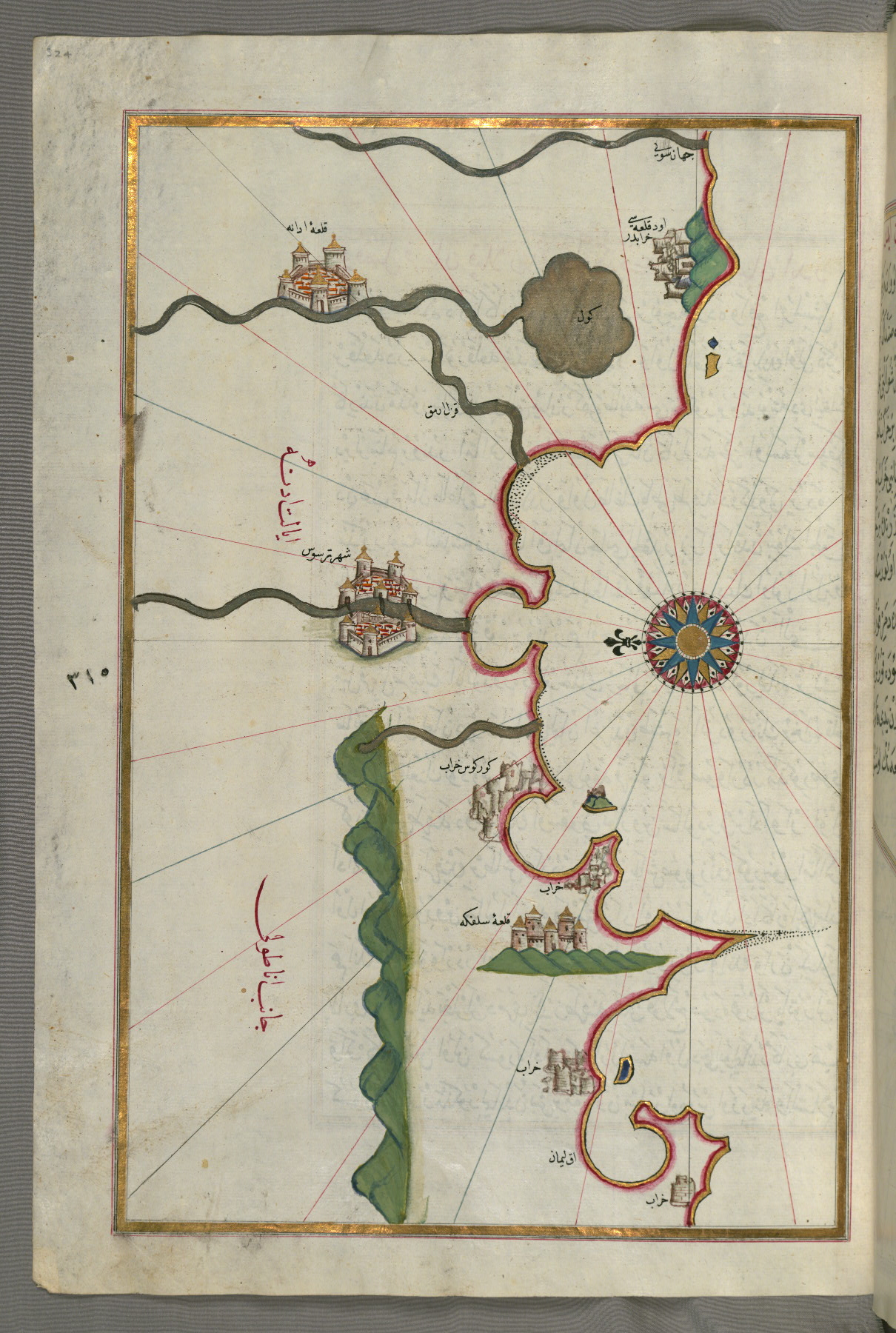
- Title: Anatolian coastline with the city of Silifke
- Form: Illustration

fol. 326a:
- Title: Anatolian coastline from Silfke to Anamur
- Form: Illustration
fol. 327a:
- Title: Anatolian coastline around Anamur
- Form: Illustration

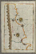
fol. 328a:
- Title: Anatolian coastline as far as Alanya
- Form: Illustration
- Label: This map shows the Anatolian coastline as far as Alanya (ʿAlāʾiye, Alaiye).
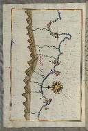
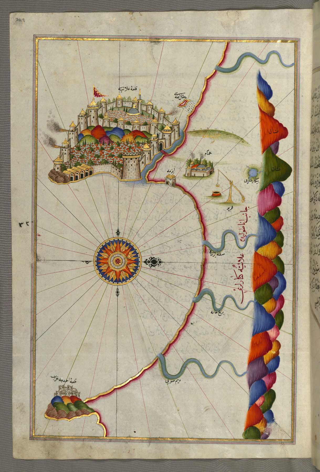
fol. 329a:
- Title: Fortress of Alanya
- Form: Illustration
- Label: This map shows the fortress of Alanya (ʿAlāʾiye, Alaiye).
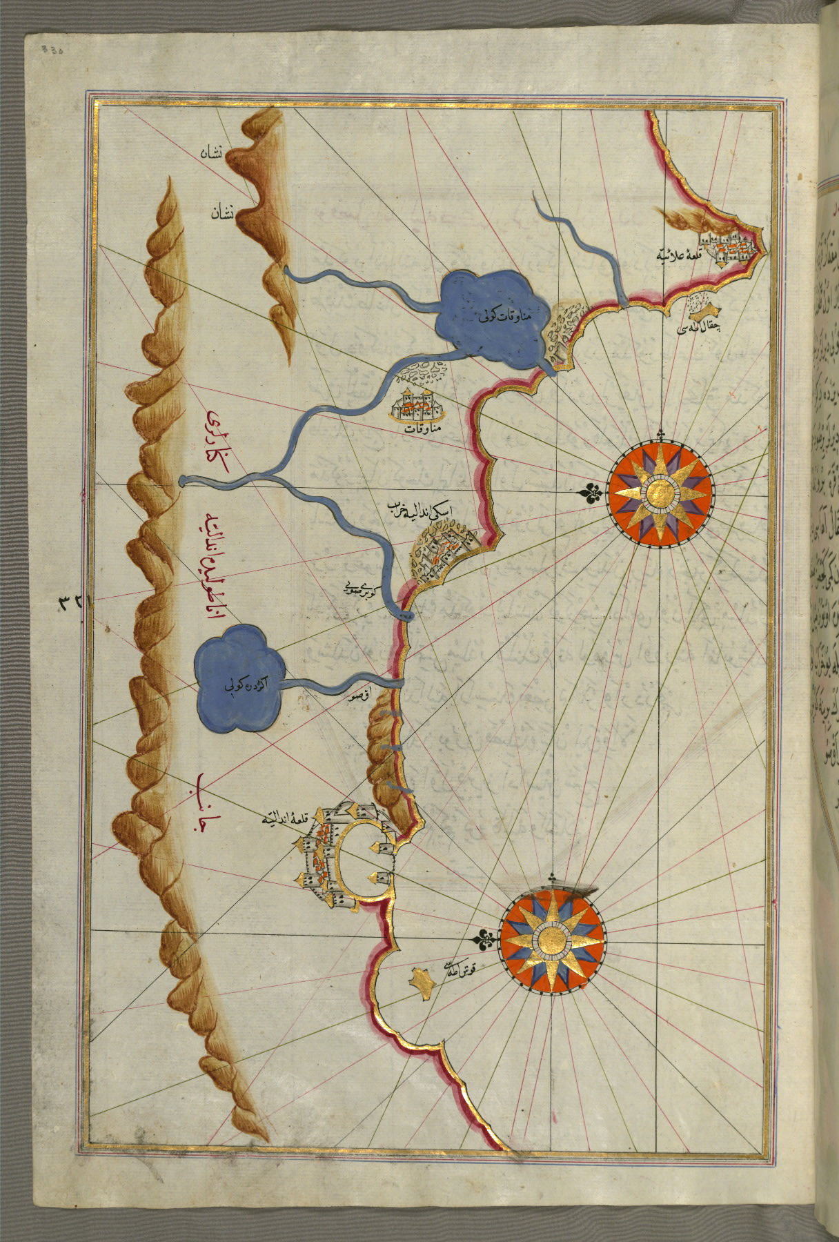
fol. 330a:
- Title: Anatolian coastline from Alanya to Andalye
- Form: Illustration
- Label: This map shows the Anatolian coastline from Alanya (ʿAlāʾiye, Alaiye) to Andalye (Antalya, formerly known as Adalia or Attalia).
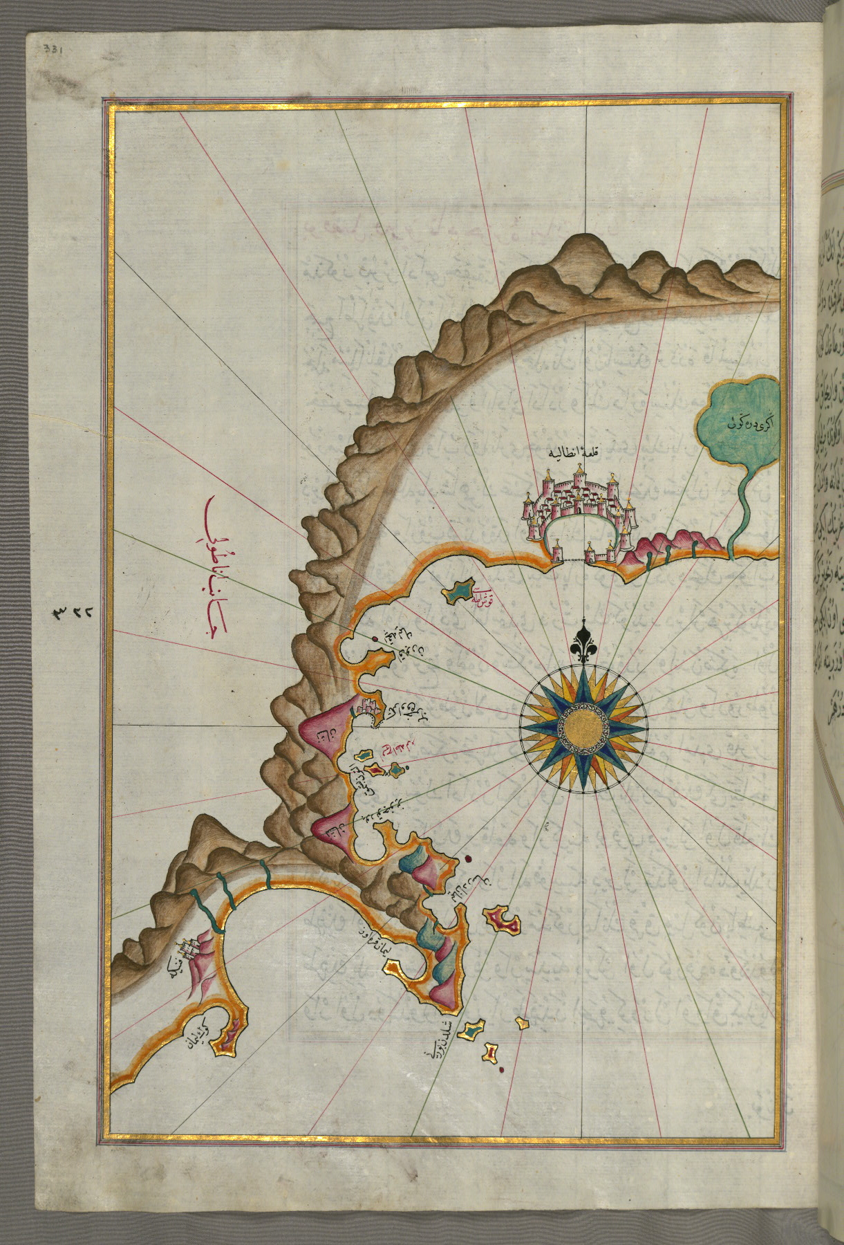
fol. 331a:
- Title: Anatolian coastline from Alanya to Andalye
- Form: Illustration
- Label: This map shows the Anatolian coastline from Alanya (ʿAlāʾiye, Alaiye) to Andalye (Antalya, formerly known as Adalia or Attalia).
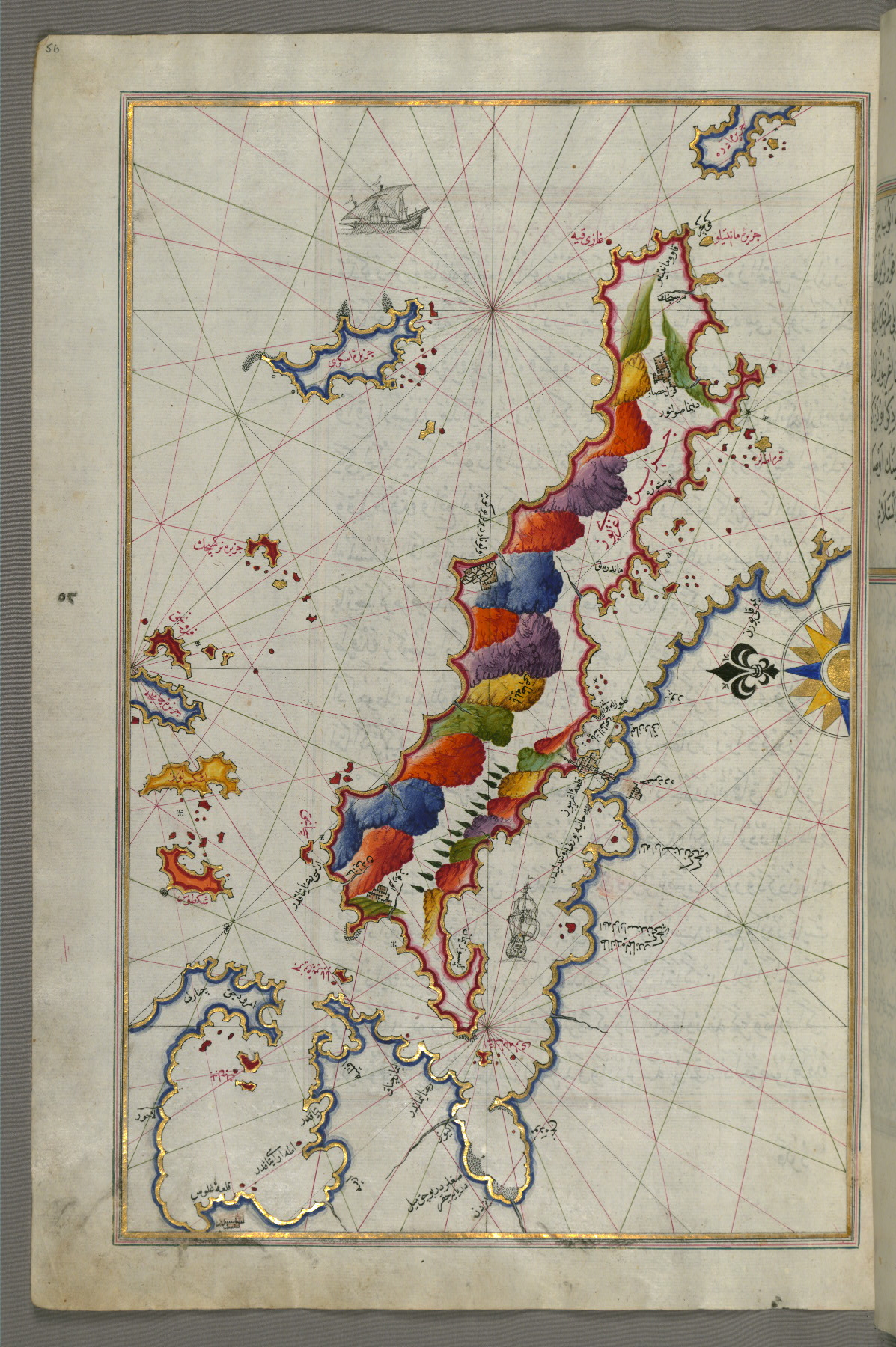
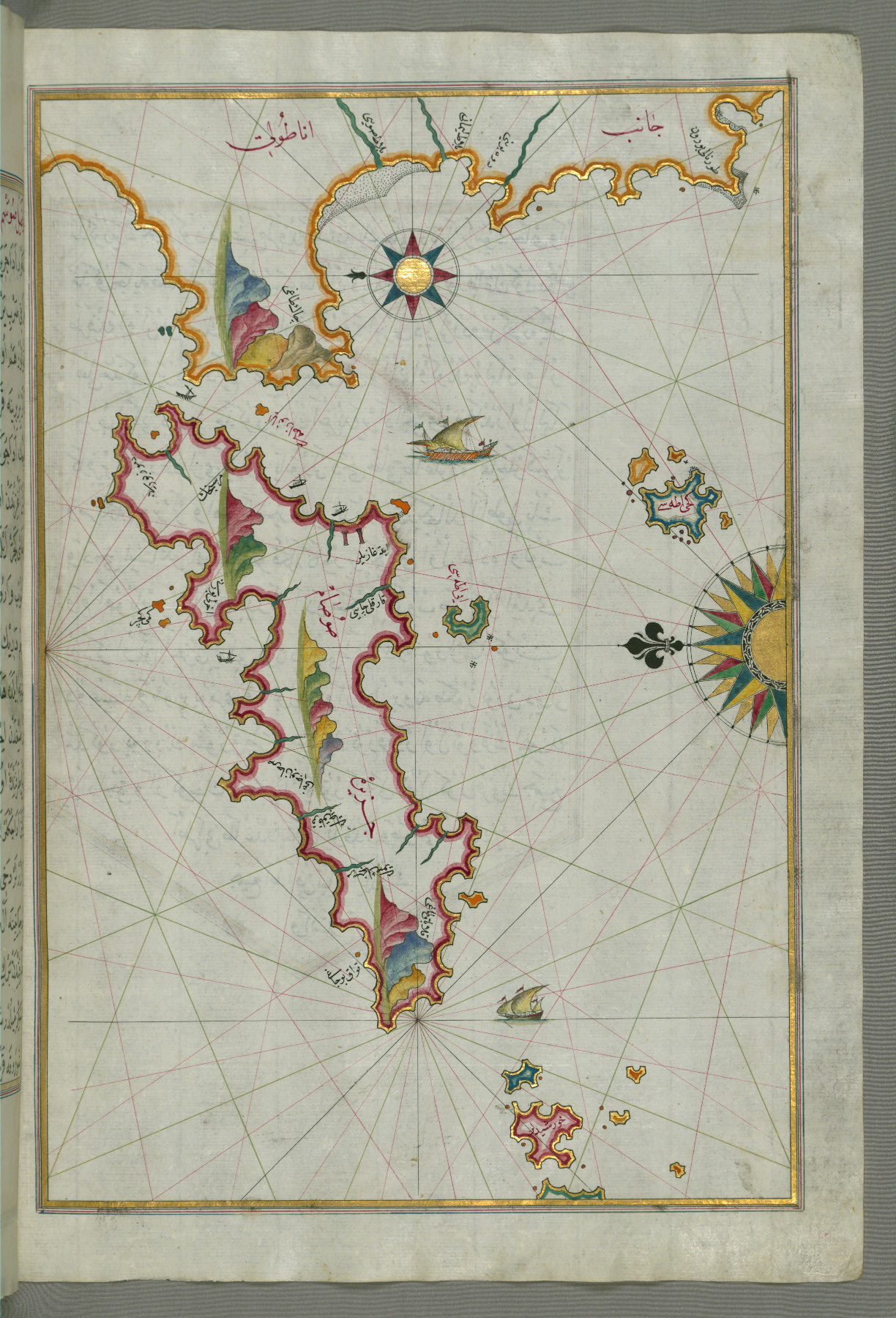
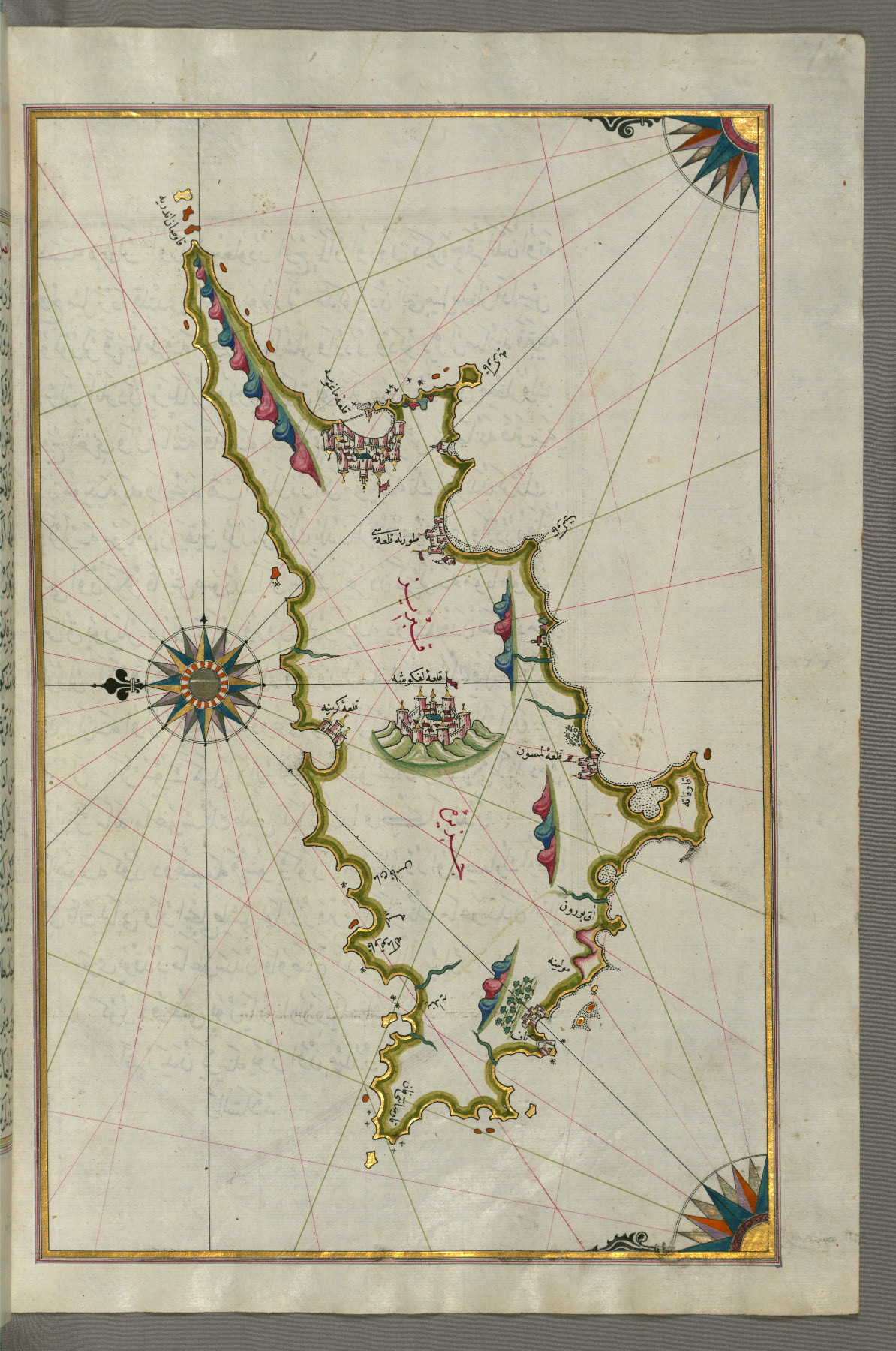
fol. 334b:
- Title: Island of Cyprus
- Form: Illustration
- Label: This map shows the island of Cyprus (Qibrīz, Kıbrıs).
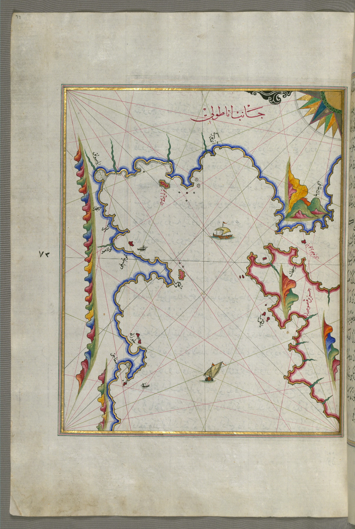
fol. 336b:
- Title: Anatolian coastline east of Finike
- Form: Illustration

fol. 337b:
- Title: Islands off the coast of Finike
- Form: Illustration
fol. 338b:
- Title: Unidentified islands off the southern Anatolian coast
- Form: Illustration
fol. 339b:
- Title: Unidentified islands off the southern Anatolian coast
- Form: Illustration
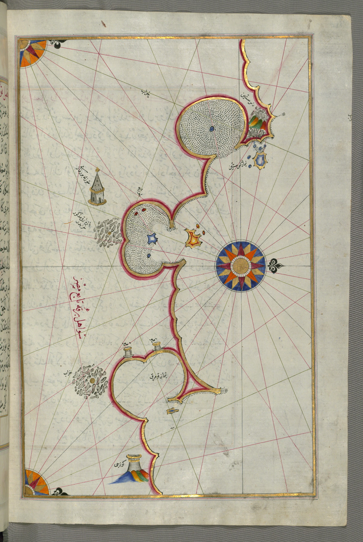
fol. 340b:
- Title: Unidentified islands off the southern Anatolian coast
- Form: Illustration
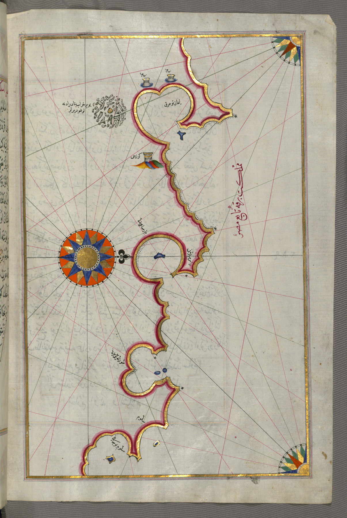
fol. 341b:
- Title: Unidentified islands off the southern Anatolian coast
- Form: Illustration
fol. 342b:
- Title: Unidentified islands off the southern Anatolian coast
- Form: Illustration
fol. 343b:
- Title: Unidentified islands off the southern Anatolian coast
- Form: Illustration

fol. 344b:
- Title: Istanbul island
- Form: Illustration
- Label: This map shows Istanbul island (Jazīrah-i Istānpūlīye).

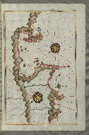
fol. 346a:
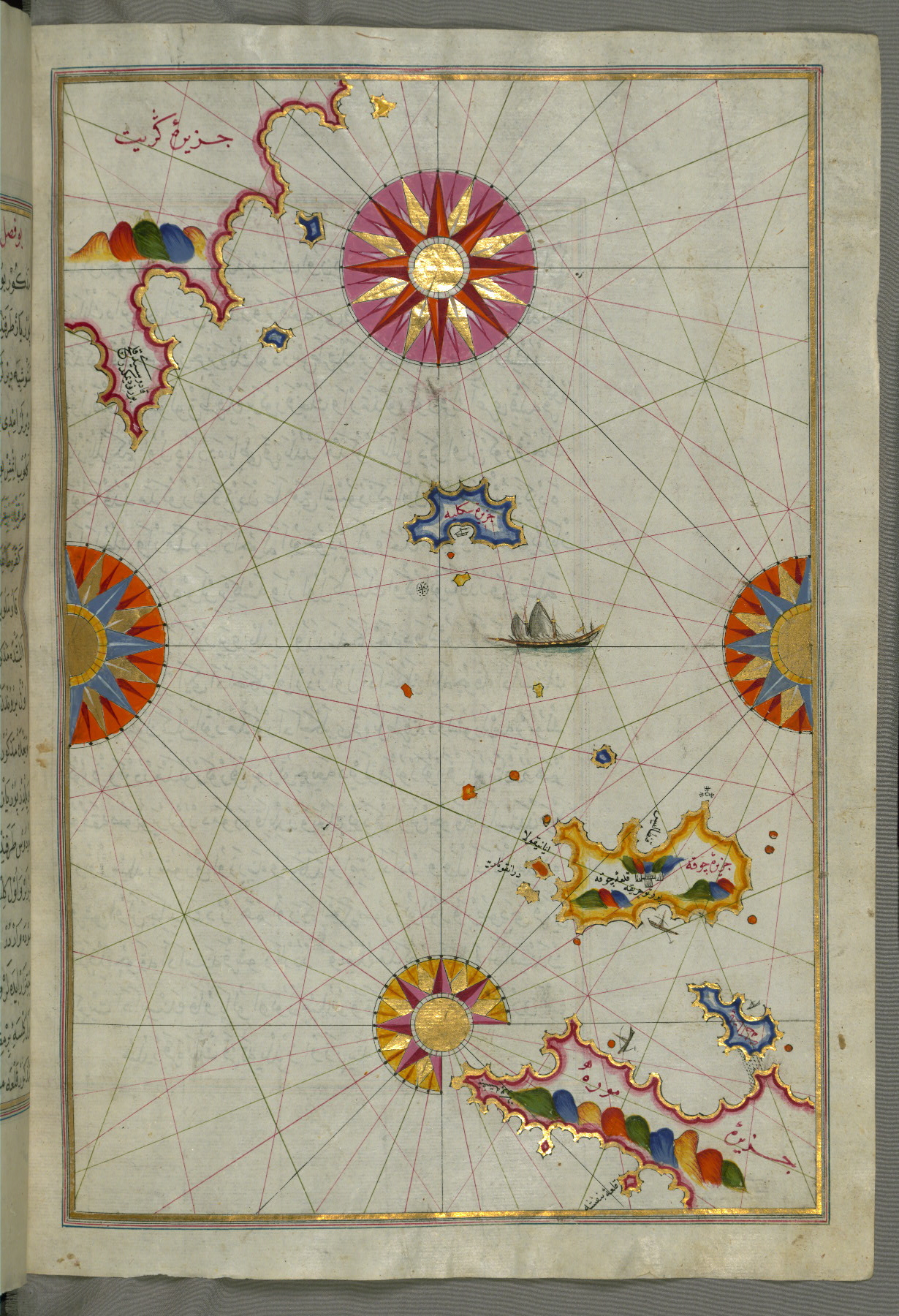
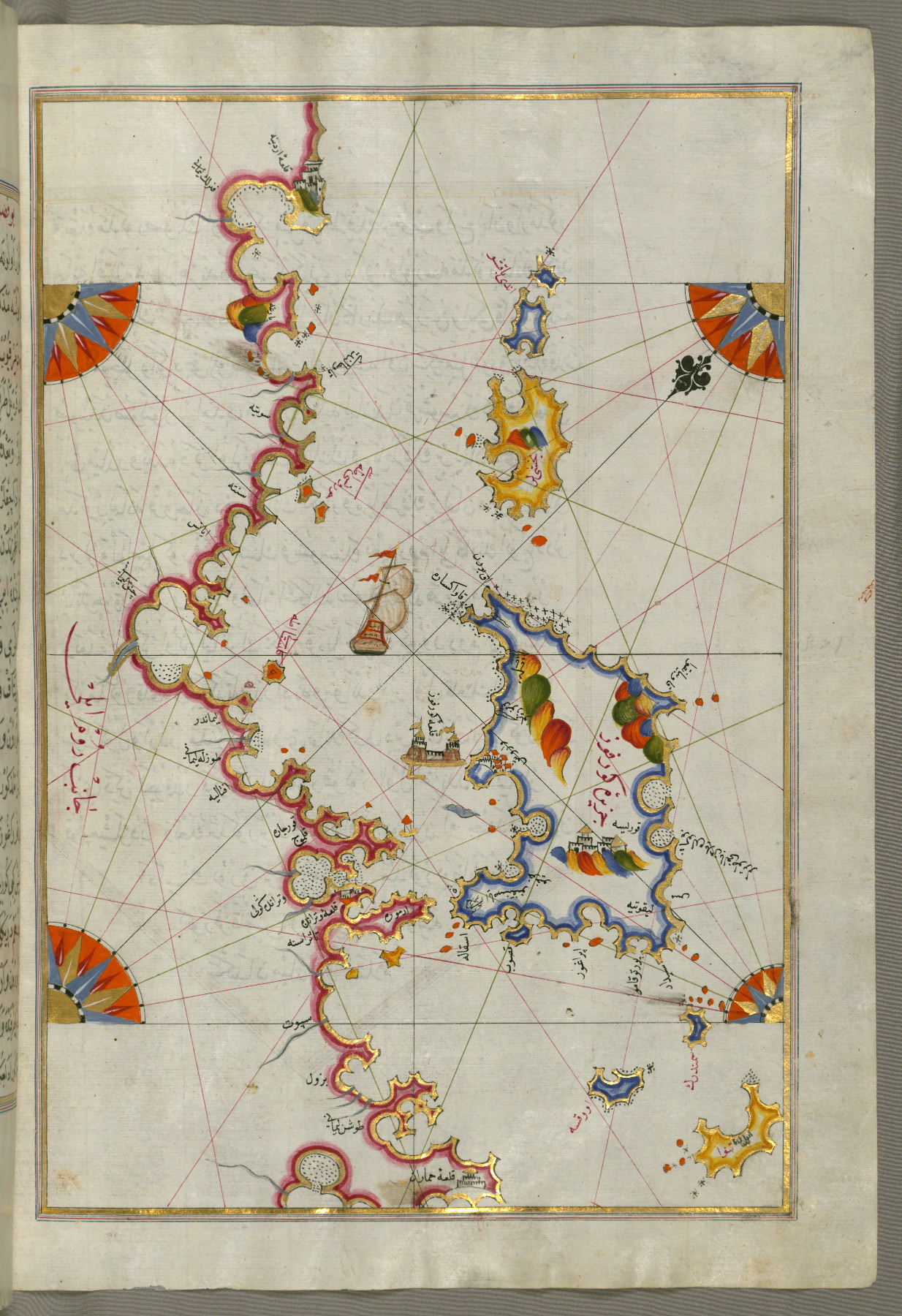
- Title: Islands of Karpathos and Kasos
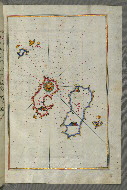
- Form: Illustration
- Label: This map shows the islands of Karpathos (Kerpe) and Kasos (Cūbān).
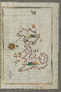
fol. 351b:
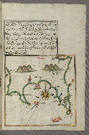
- Title: Fragment of the island of Crete
- Form: Illustration
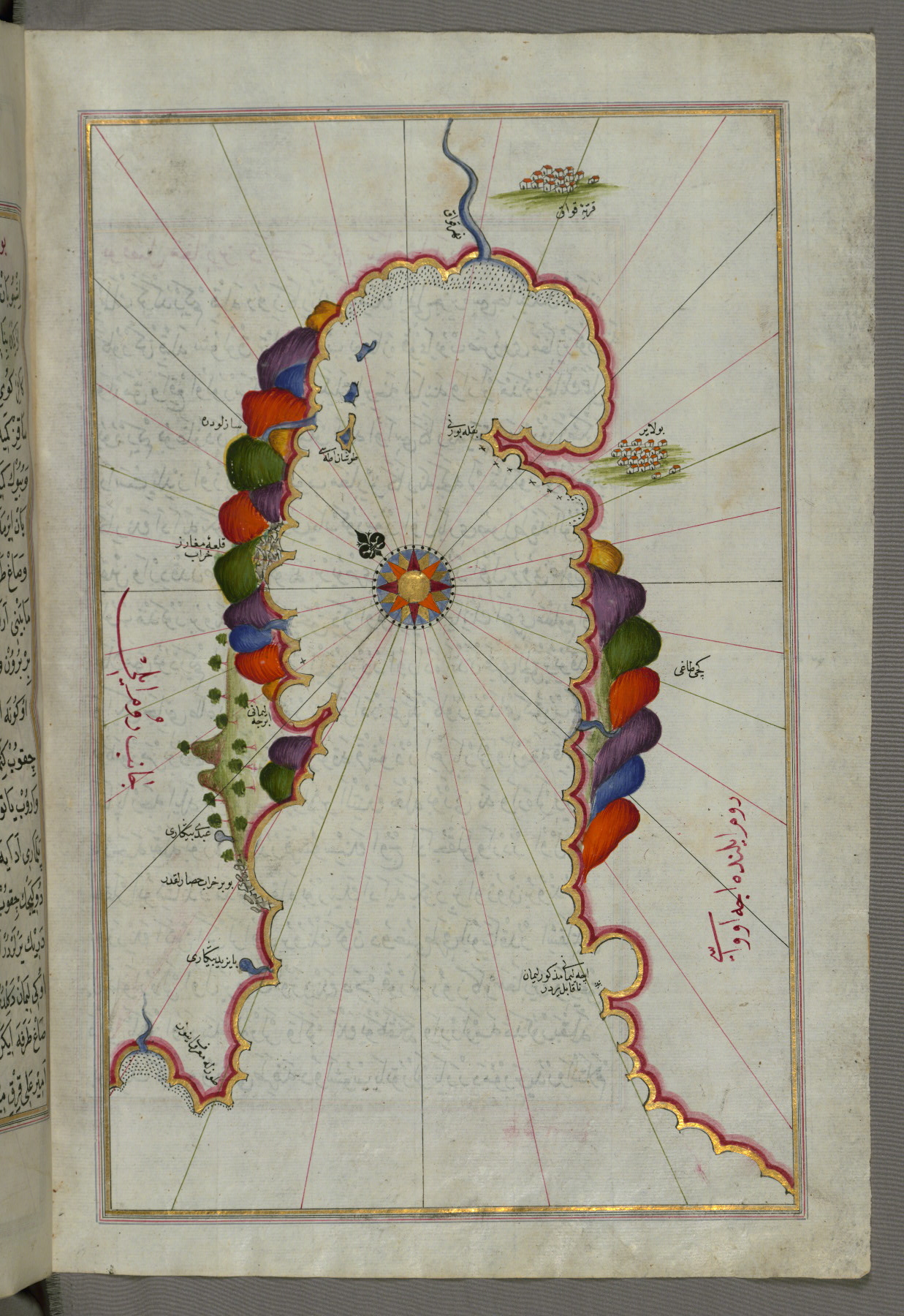
fol. 352a:
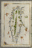
- Title: Island of Crete
- Form: Illustration
fol. 353a:
- Title: Island of Anafi east of Thera
- Form: Illustration
- Label: This map shows the island of Anafi (Anāfiyah) east of Thera (Thira).

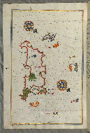
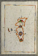
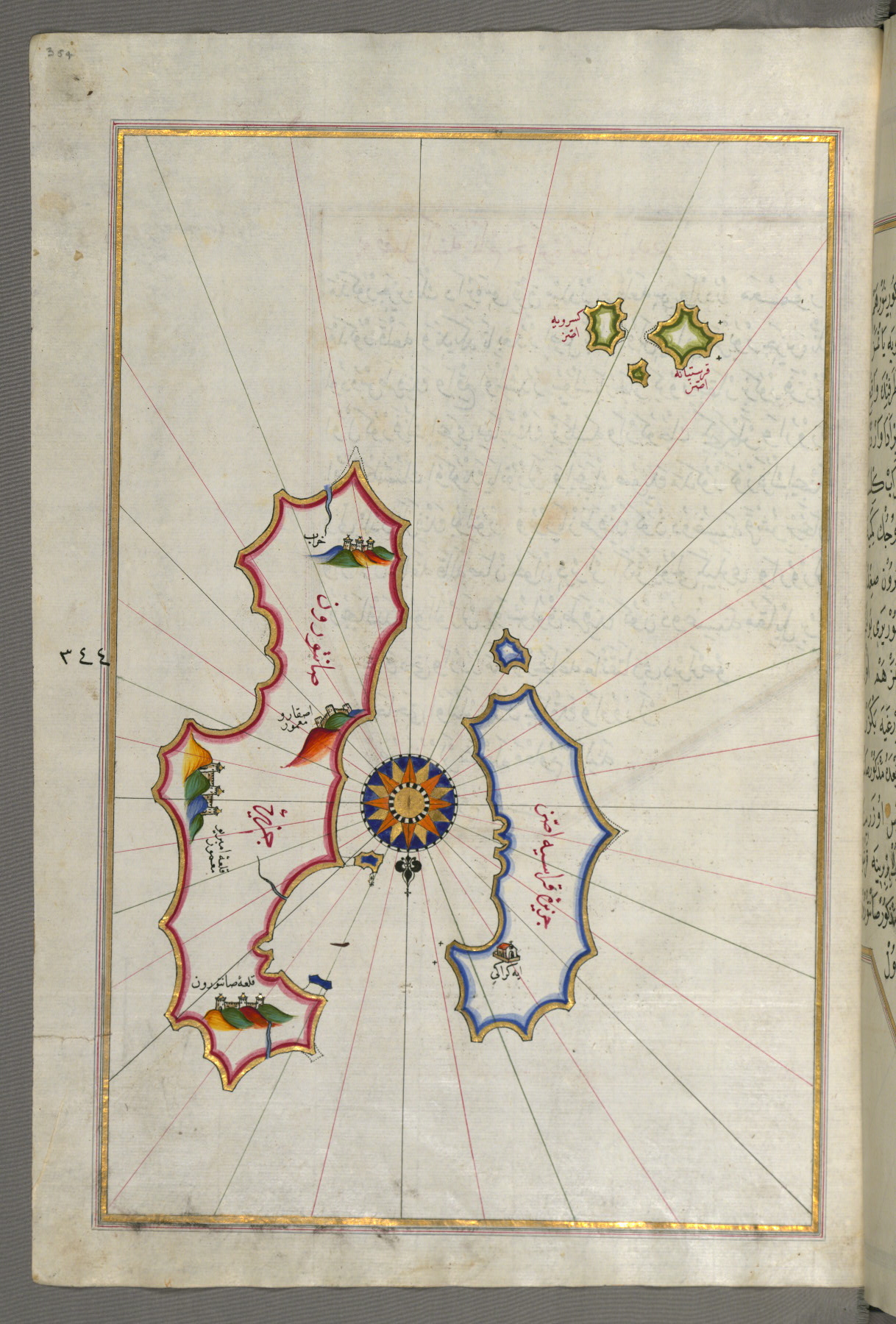
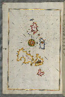
fol. 354a:
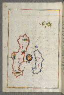
- Title: Islands of Santorini and Thera in the Aegean Sea north of Crete
- Form: Illustration
- Label: This map shows the islands of Santorini (Ṣāntūrūn) and Thera (Thira) in the Aegean Sea, north of Crete.
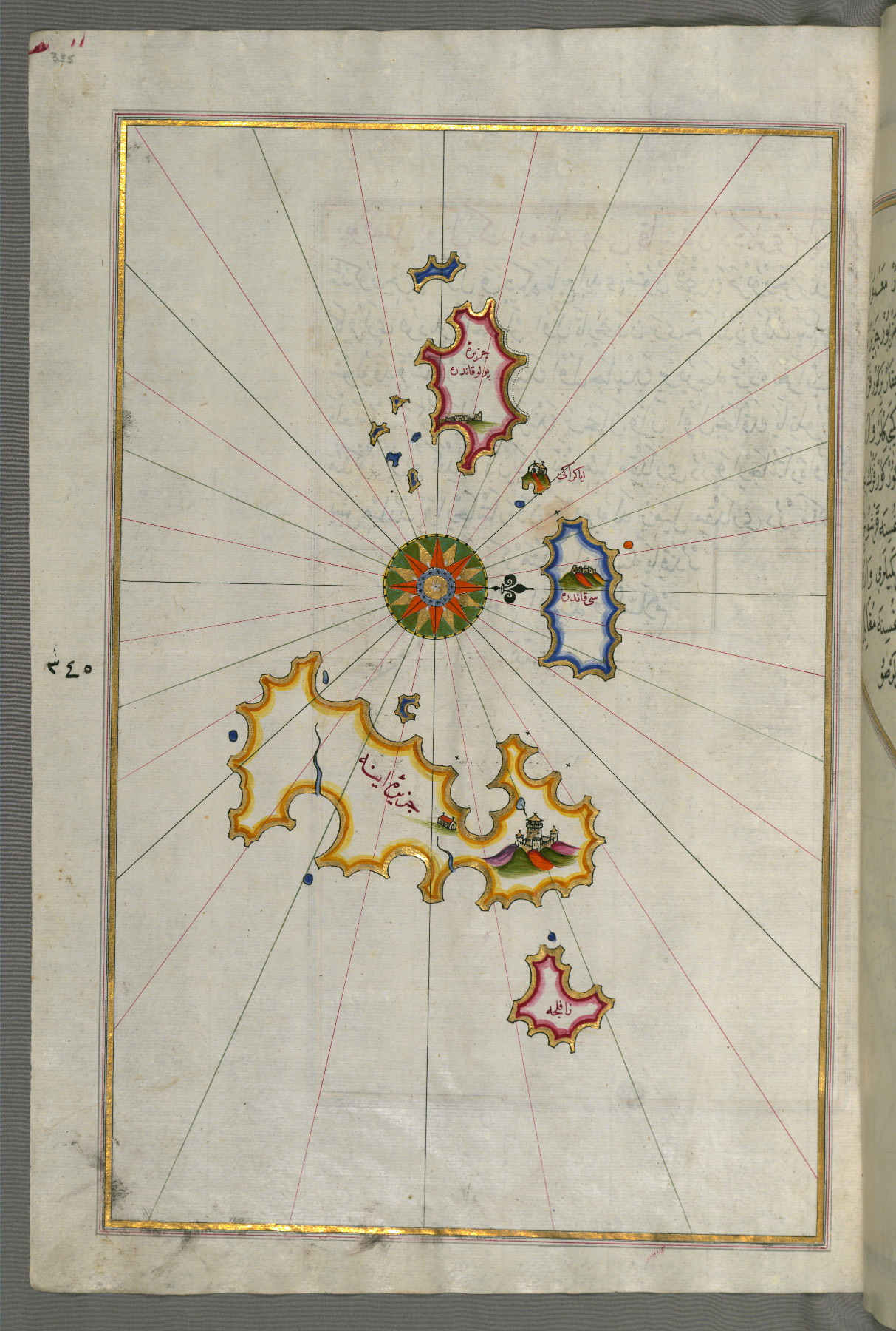
fol. 355a:
- Title: Islands of Foleġandros and Ios
- Form: Illustration
- Label: This map shows the islands of Foleġandros and Ios (İnyos, İnye).
fol. 356a:
- Title: Islands of Foleġandros and Melos
- Form: Illustration
- Label: This map shows the islands of Foleġandros and Melos (Deġirmenlik).

fol. 357b:
- Title: Island of Melos
- Form: Illustration
- Label: This map shows the island of Melos (Deġirmenlik).
fol. 359b:
- Title: Island of Serofos
- Form: Illustration
- Label: This map shows the island of Serofos (Ḳoyunluǧa).
fol. 360b:
- Title: Island of Kythnos
- Form: Illustration
- Label: This map shows the island of Kythnos (Termia).
fol. 361b:
- Title: Island of Keos
- Form: Illustration
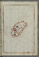
- Label: This map shows the island of Keos (Kea, Murtat, Mürted).
fol. 362b:
- Title: Island of Skyros
- Form: Illustration
- Label: This map shows the island of Skyros (İskire).
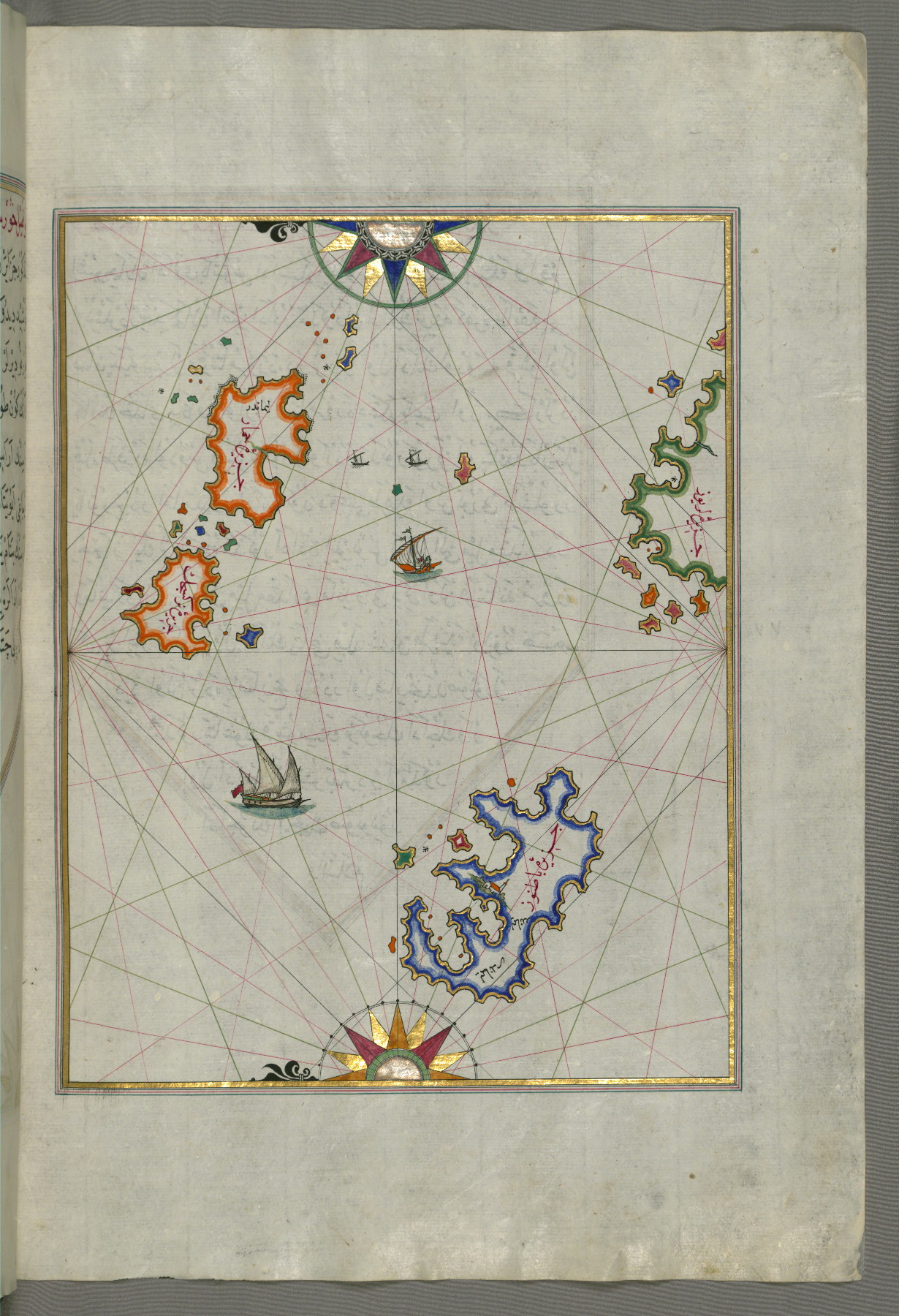
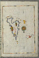
fol. 364b:
- Title: Aloneses and other islands
- Form: Illustration
- Label: This map shows the island of Aloneses (Čamlığa) and other islands.
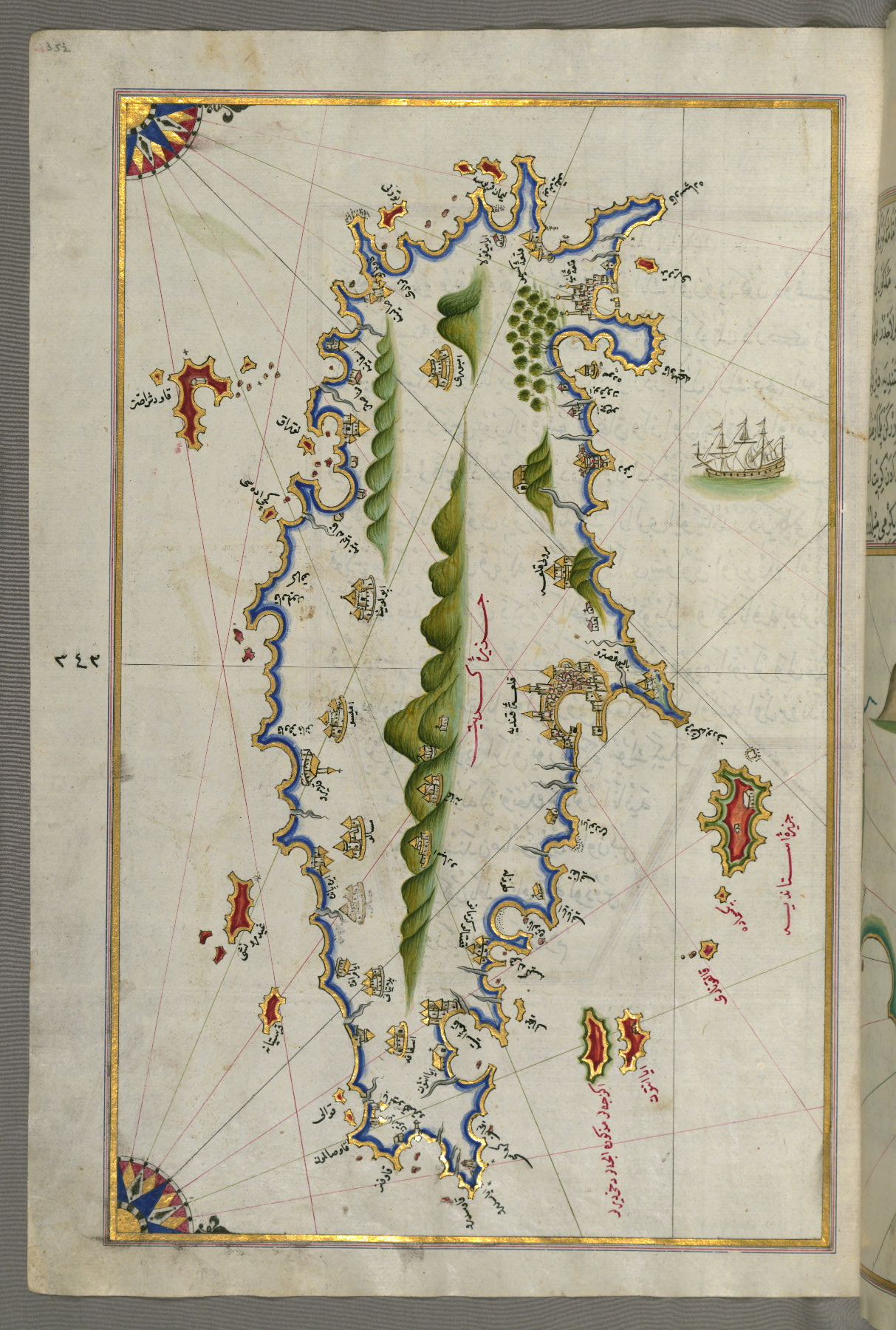
fol. 366b:
- Title: Part of the coastline of the Sea of Marmara with the town of Kavak
- Form: Illustration
- Label: This map shows part of the coastline of the Sea of Marmara with the town of Kavak (Qavāq).
fol. 368b:
- Title: Island of Marmara in the Sea of Marmara
- Form: Illustration

fol. 369b:
- Title: Island of Mīr ʿAlī
- Form: Illustration

fol. 370b:
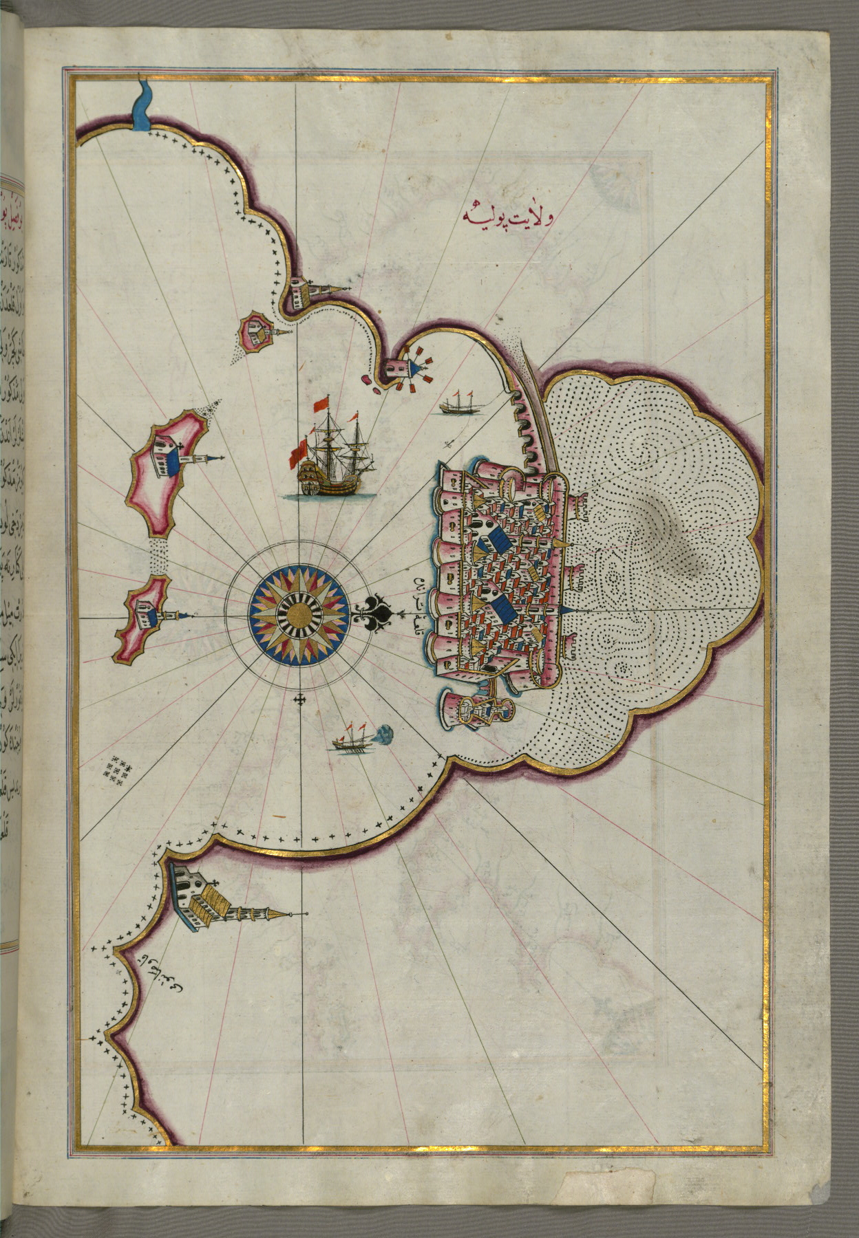
- Title: City of Constantinople
- Form: Illustration
- Label: This map shows the city of Constantinople (Qusṭanṭinīyah).

fol. 371a:

- Title: Coastline of the Black Sea from Istanbul to Geresun
- Form: Illustration
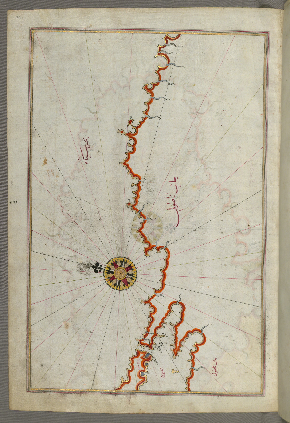
fol. 371b:
- Title: Coastline of the Black Sea
- Form: Illustration

fol. 372a:
- Title: Crimea, Sea of Azov, and mouth of the Dnieper River
- Form: Illustration
- Label: This map shows the Crimea (Qrīm), the Sea of Azov, and the mouth of the Dnieper River.

fol. 372b:
- Title: Sea of Marmara, Bosporus Strait, and the Black Sea
- Form: Illustration
fol. 373a:
- Title: Coastline of the Black Sea
- Form: Illustration
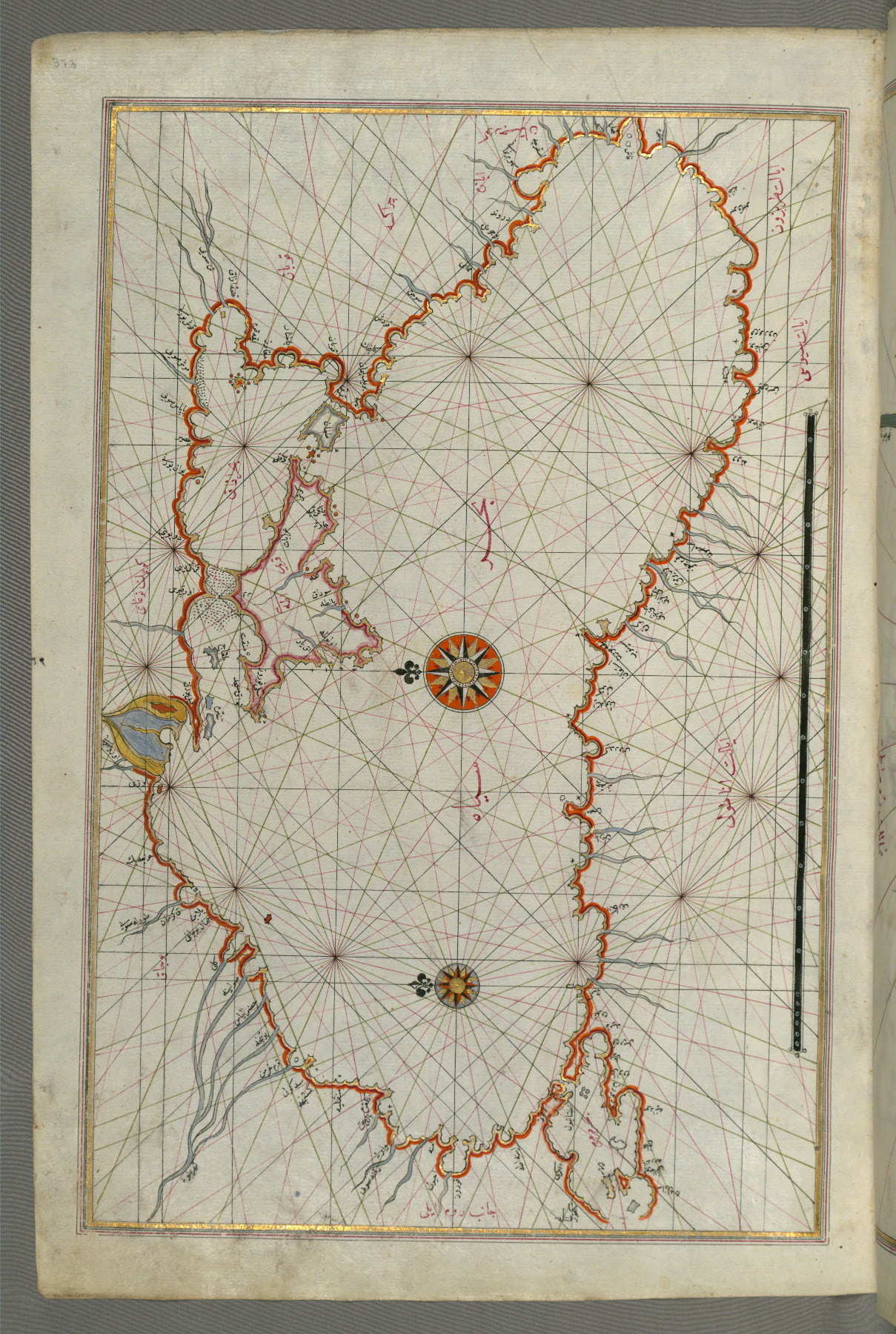
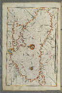
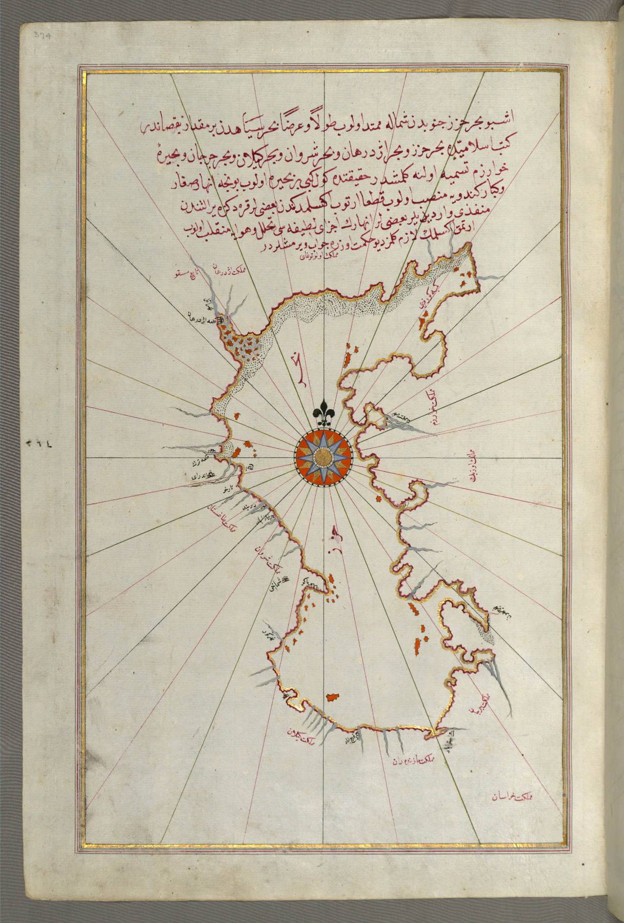
fol. 374a:
- Title: Caspian Sea
- Form: Illustration
- Label: This map shows the Caspian Sea (Baḥr-i Khazar).
The binding is not original.
Later binding, slightly too large for the textblock (with flap); central panel and side panels richly decorated and brushed with gold; dentelle-style doublures of red leather with a central lobed oval and cornerpieces with filigree work
Name: Aḥmad Afandī (fol. 4a)
Name: ʿAlī Afandī (fol. 4a)
Name: Sayyid ʿAlī Qapūdān (fol. 1a)
Bequest (waqf) seal of Sultan Maḥmūd Khān, followed by a bequest statement (now erased) and the seal of the inspector of wakfs, Muṣṭafá Ṭāhir (fol. 4a)
Walters Art Museum, 1931, by Henry Walters bequest
Goodrich, Thomas D. "Supplemental Maps in the Kitab-i Bahriye of Piri Reis." Archivum Ottomanicum 13 (1993-94): 117-141.
Soucek, Svatopluk. Piri Reis and Turkish Mapmaking after Columbus: The Khalili Portolan Atlas. London: Nour Foundation in association with Azimuth Editions and Oxford University Press, 1996.
Loupis, Dimitris. “Ottoman Adaptations of Early Italian Isolarii.” Journal of the International Map Collectors’ Society 80 (2000): 15-23.
Loupis, Dimitris. “Ottoman Nautical Charting and Miniature Painting: Technology and Aesthetics.” In M. Uğur Derman 65th Birthday Festschrift / 65 Yaş Armağanı, ed. İrvin Cemil Schick (İstanbul: Sabancı Üniversitesi, 2000), 369-397.
Loupis, Dimitris. “Piri Reis’s Book on Navigation as a Geography Handbook: Ottoman Efforts to Produce an Atlas during the Reign of Sultan Mehmed IV (1648-1687).” The Portolan: Journal of the Washington Map Society 52 (2001-2002): 11-17.
Hepworth, Paul. "Production and Date of the Walters' Kitab-i Bahriye." Journal of the Walters Art Museum 63 (2005): 73-80.
Principal cataloger: Gacek, Adam
Catalogers: Landau, Amy; Smith, Sita
Editor: Bockrath, Diane
Conservators: Jewell, Stephanie; Quandt, Abigail
Contributors: Barrera, Christina; Emery, Doug; Herbert, Lynley; Noel, William; Simpson, Shreve; Tabritha, Ariel; Toth, Michael B.; Valle, Chiara
The Walters Art Museum
Licensed for use under Creative Commons Attribution-NonCommercial-ShareAlike 3.0 Unported Access Rights, http://creativecommons.org/licenses/by-nc-sa/3.0/legalcode. It is requested that copies of any published articles based on the information in this data set be sent to the curator of manuscripts, The Walters Art Museum, 600 North Charles Street, Baltimore MD 21201.